world.wikisort.org - Nepal
Siddharthanagar (Nepali: सिद्धार्थनगर), formerly and colloquially still called Bhairahawa (Nepali: भैरहवा), is a municipality and the administrative headquarter of Rupandehi District in Lumbini Province of Nepal, 265 km (165 mi) west of Nepal's capital Kathmandu. It is the closest city to Lumbini, the birthplace of Gautama Buddha, which is located 25 km (16 mi) to the west. The city borders the Indian city of Sonauli in Maharajganj district of Uttar Pradesh.
This article needs additional citations for verification. (August 2022) |
Siddhārthanagar / Bhairahawa
सिद्धार्थनगर / भैरहवा | |
|---|---|
Municipality | |
 Lumbini Gate, Bhairahawa | |
| Nickname: Bhairahawa | |
 | |
 Siddhārthanagar / Bhairahawa Location in Nepal | |
| Coordinates: 27°30′N 83°27′E | |
| Country | |
| Province | Lumbini Province |
| District | Rupandehi District |
| Incorporated | 1967 |
| Government | |
| • Type | Mayor–council |
| • Mayor | Ishtiyak Ahmad Khan (NC) |
| • Deputy Mayor | Uma Adhikari (CPN (UML)) |
| Area | |
| • Total | 36.03 km2 (13.91 sq mi) |
| Population (2011) | |
| • Total | 63,483 |
| • Density | 1,800/km2 (4,600/sq mi) |
| Language | |
| • Official | Nepali[1] |
| • Additional official | Urdu[1] |
| • Regional language | Bhojpuri |
| Time zone | UTC+5:45 (NST) |
| Postal code | 32900 |
| Area code | 071 |
| Website | |
Although the current name was first used in 1977,[2] many still refer to it as Bhairahawa.[3]
History and etymology
The city was founded as Bhairahawa in 1967. The city's current name Siddharthanagar derives from Buddha's given name Siddhartha, as the birthplace of Buddha is located only 25 km (16 mi) to the west. The name was changed to Siddhartanagar in 1977[2] by poet Komal Dutta Tiwari.[citation needed]
Climate
The highest temperature ever recorded in Siddharthanagar was 44.8 °C (112.6 °F) on 7 June 1998, while the lowest temperature ever recorded was −1.1 °C (30.0 °F) on 20 January 1971.[4]
| Climate data for Siddharthanagar (Bhairahawa Airport) (1981-2010) | |||||||||||||
|---|---|---|---|---|---|---|---|---|---|---|---|---|---|
| Month | Jan | Feb | Mar | Apr | May | Jun | Jul | Aug | Sep | Oct | Nov | Dec | Year |
| Average high °C (°F) | 21.0 (69.8) |
25.4 (77.7) |
31.3 (88.3) |
36.1 (97.0) |
36.4 (97.5) |
35.5 (95.9) |
33.0 (91.4) |
33.4 (92.1) |
33.0 (91.4) |
32.2 (90.0) |
28.9 (84.0) |
24.1 (75.4) |
30.9 (87.6) |
| Daily mean °C (°F) | 14.9 (58.8) |
18.1 (64.6) |
23.0 (73.4) |
28.0 (82.4) |
30.0 (86.0) |
30.6 (87.1) |
29.5 (85.1) |
29.6 (85.3) |
28.8 (83.8) |
26.3 (79.3) |
21.7 (71.1) |
17.1 (62.8) |
24.8 (76.6) |
| Average low °C (°F) | 8.8 (47.8) |
10.7 (51.3) |
14.6 (58.3) |
19.9 (67.8) |
23.6 (74.5) |
25.7 (78.3) |
25.9 (78.6) |
25.9 (78.6) |
24.7 (76.5) |
20.3 (68.5) |
14.5 (58.1) |
10.2 (50.4) |
18.7 (65.7) |
| Average precipitation mm (inches) | 17.7 (0.70) |
19.2 (0.76) |
16.7 (0.66) |
26.4 (1.04) |
82.3 (3.24) |
269.4 (10.61) |
545.6 (21.48) |
395.5 (15.57) |
253.5 (9.98) |
77.5 (3.05) |
8.2 (0.32) |
13.3 (0.52) |
1,725.3 (67.93) |
| Source: Department Of Hydrology and Meteorology[5] | |||||||||||||
Demographics
The population of Siddarthanagar in 2001 was 63,528.[6] According to the 2011 census it was
Education

Rupandehi Lilaram Ma Vi, Bhairahawa Ma Vi, Paklihawa Ma Vi are old higher secondary schools.
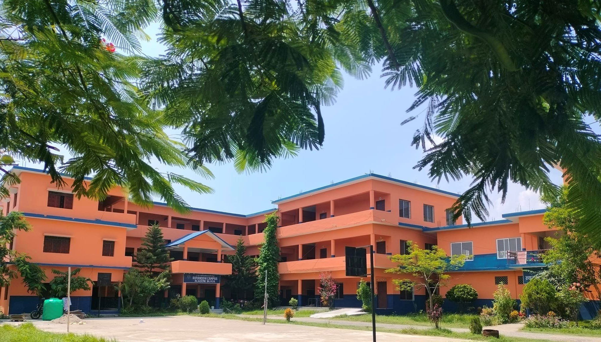
There are several higher education facilities in Siddharthanagar including Rupandehi Campus,[7][8] IAAS Paklihawa Campus, Universal College of Medical Sciences and Bhairahawa Namuna Campus.
See also
- Butwal
References
- "52nd REPORT OF THE COMMISSIONER FOR LINGUISTIC MINORITIES IN INDIA" (PDF). nclm.nic.in. Ministry of Minority Affairs. Archived from the original (PDF) on 25 May 2017. Retrieved 16 May 2019.
- "ब्रोसर २०१४". Siddharthanagar Municipality. Archived from the original on 19 June 2020. Retrieved 18 June 2020.
- Pant, Shashwat (23 January 2020). "New names for old places reflect the changing times, but not everyone is happy". The Kathmandu Post. Retrieved 18 June 2020.
- "Extreme Temperatures of Month January" (PDF). www.dhm.gov.np. Archived from the original (PDF) on 4 March 2016. Retrieved 27 February 2016.
- "Normals From 1981-2010" (PDF). Department Of Hydrology and Meteorology. Archived from the original (PDF) on 13 January 2014. Retrieved 26 September 2014.
- Nepal - City Population - Cities, Towns & Provinces - Tables & Maps
- "Home | Rupandehi Campus". www.rupandehicampus.edu.np. Retrieved 23 January 2019.
- "Rupandehi Campus granted QAA certificate". My Republica. Retrieved 23 January 2019.
https://siddharthanagarmun.gov.np/
Rupandehi District | ||||||
|---|---|---|---|---|---|---|
Headquarter: Siddharthanagar | ||||||
| Urban |
|  | ||||
| Rural municipality | ||||||
List of municipalities and rural municipalities of Nepal | ||||||
Authority control | |
|---|---|
| General |
|
| National libraries | |
На других языках
[de] Siddharthanagar
Siddharthanagar (früher Bhairahawa) ist eine Stadt (Munizipalität) im mittleren Terai Nepals an der Grenze zu Indien, ca. 256 km westlich von Kathmandu. Der Fluss Tinau fließt westlich an der Stadt vorbei.- [en] Siddharthanagar
[ru] Сиддхартханагар (Непал)
Сиддхартханагар (непальск. सिद्धार्थनगर), ранее был известен как Бхайрахава (непальск. भैरहवा) — город и муниципалитет на юге центральной части Непала, в районе Рупандехи зоны Лумбини Западного региона страны.Другой контент может иметь иную лицензию. Перед использованием материалов сайта WikiSort.org внимательно изучите правила лицензирования конкретных элементов наполнения сайта.
WikiSort.org - проект по пересортировке и дополнению контента Википедии