world.wikisort.org - Nepal
Sagarmāthā Zone (Nepali: सगरमाथा अञ्चल![]() Listen (help·info)) or Sagarmatha Anclal (Nepali: सगरमाथा अञ्चल
Listen (help·info)) or Sagarmatha Anclal (Nepali: सगरमाथा अञ्चल![]() Listen (help·info)) was one of the fourteen zones of Nepal until the restructuring of zones into provinces. The headquarters of Sagarmatha is Rajbiraj. Sagarmāthā is a Nepali word derived from सगर (sagar) meaning "sky" and माथा (māthā) meaning "head".[1]
Listen (help·info)) was one of the fourteen zones of Nepal until the restructuring of zones into provinces. The headquarters of Sagarmatha is Rajbiraj. Sagarmāthā is a Nepali word derived from सगर (sagar) meaning "sky" and माथा (māthā) meaning "head".[1]
Sagarmāthā Zone
सगरमाथा अञ्चल | |
|---|---|
Zone | |
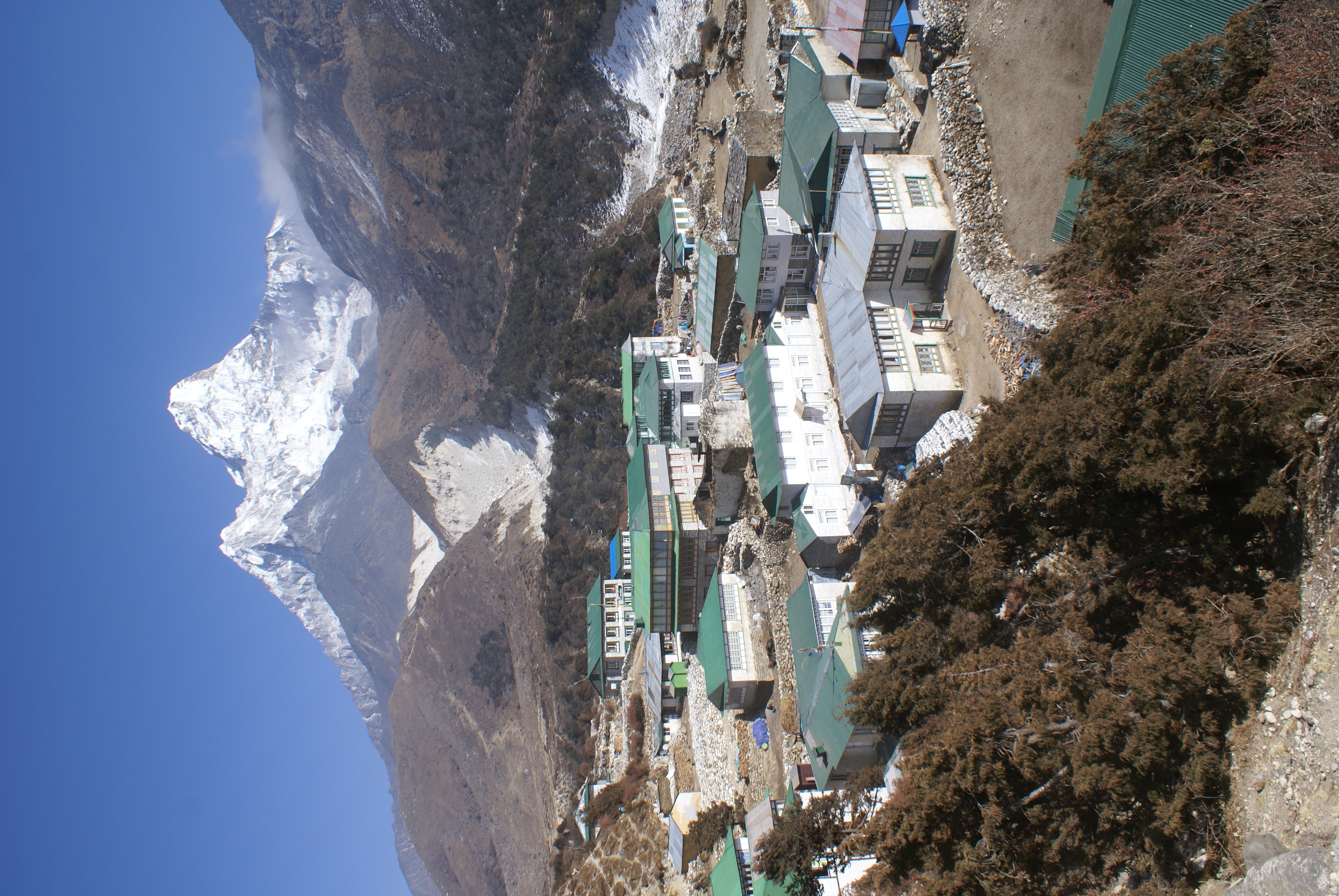 Lower Pangboche village in Khumbu, Nepal | |
 | |
| Country | |
| Time zone | UTC+5:45 (Nepal Time) |
It includes mountain districts of the Himalayas (including the world's highest peak Mount Everest)[2] in the north, hill districts in the center, and valley districts of the Terai in the south. It is bordered by China to the north, India to the south, the Koshi Zone to the east and the Janakpur Zone to the west.
Administrative subdivisions
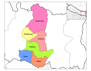
Sagarmāthā was divided into six districts; since 2015 the four northern districts have been redesignated as part of Province No. 1, while the two southernmost districts have been resigned as part of Province No. 2.
| District | Type | Headquarters | Since 2015 part of Province |
|---|---|---|---|
| Khotang | Hill | Diktel | Province No. 1 |
| Okhaldhunga | Hill | Okhaldhunga | |
| Solukhumbu | Mountain | Salleri | |
| Udayapur | Inner Terai | Triyuga | |
| Saptari | Outer Terai | Rajbiraj | Province No. 2 |
| Siraha | Outer Terai | Siraha |
The main city of the Sagarmāthā Zone was Rajbiraj which was also the headquarters. Other towns of the Sagarmāthā hill area were Katari, Okhaldhunga, Diktel, Salleri and Namche Bazaar; while Kathauna, Lahan, Fatepur, Rajbiraj and Siraha are in the outer Terai. Triyuga is an emerging city in the zone.[3]
Name origin
Sagarmāthā Zone took its name from "Sagarmāthā" which is the Nepalese name for Mount Everest (Sagarmāthā), which is located in the very north of the zone within the Sagarmatha National Park (1,148 km2) in the Solu Khumbu district of Nepal.
Sagarmāthā means "the Head in the Great Blue Sky"[4] derived from सगर (sagar) meaning "sky" and माथा (māthā) meaning "head" in the Nepali Language.
See also
- Province No. 1
- Development Regions of Nepal (Former)
- List of zones of Nepal (Former)
- List of districts of Nepal
- Sagarmatha National Park
References
- "Sacred Himalayan Landscape". 2013-06-12. Archived from the original on 2013-06-12. Retrieved 2018-09-03.
- yukesh0007 (2019-02-17). "Undisputed glory tales of Mt.Everest". SOUL OF HIMALAYAS. Retrieved 2020-01-28.
- "Triyuga Municipality proposes river land for Sagarmatha Airport". My Republica. Retrieved 2018-09-03.
- Exceed English Series 1, New Edition (2006), p. 48.
Former Development regions and zones of Nepal (1982–2015) | ||
|---|---|---|
| Eastern Region (Purwanchal) |
| |
| Central Region (Madhyamanchal) |
| |
| Western Region (Pashchimanchal) |
| |
| Mid-Western Region (Madhya Pashchimanchal) |
| |
| Far-Western Region (Sudur Pashchimanchal) |
| |
This Nepalese location article is a stub. You can help Wikipedia by expanding it. |
Другой контент может иметь иную лицензию. Перед использованием материалов сайта WikiSort.org внимательно изучите правила лицензирования конкретных элементов наполнения сайта.
WikiSort.org - проект по пересортировке и дополнению контента Википедии