world.wikisort.org - Nepal
Phakphokthum (Nepali: फाकफोकथुम) is a rural municipality (Nepali: गाउँपालिका; gaunpalika), one of six located in Ilam District of Province No. 1 of Nepal. A total of 10 municipalities are found in Ilam, of which 4 are urban and 6 are rural.
Phakphokthum
फाकफोकथुम गाउँपालिका | |
|---|---|
Rural Municipality | |
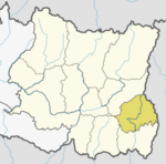
 Phakphokthum Location in Province No. 1  Phakphokthum Phakphokthum (Nepal) | |
| Coordinates: 26°59′5.81″N 87°43′10.2″E | |
| Province | Province No. 1 |
| District | Ilam |
| Wards | 7 |
| Established | 10 March 2017 |
| Seat | Phakphok |
| Government | |
| • Type | Village Council |
| • Chairperson | Mr. Ram Shrestha (NC) |
| • Vice-chairperson | Mrs. Saraswati Rai (NCP) |
| Area | |
| • Total | 108.79 km2 (42.00 sq mi) |
| Population (2011) | |
| • Total | 21,619 |
| • Density | 200/km2 (510/sq mi) |
| Time zone | UTC+5:45 (Nepal Standard Time) |
| Area code(s) | 027 |
| Website | official website |
According to Ministry of Federal Affairs and Local Development, Phakphokthum has an area of 108.79 square kilometres (42.00 sq mi) and the population of the municipality is 21,619 as of the 2011 Nepal census.[1][2]
It has 7 wards. Phakphok is the municipal headquarters.
History
Phakphokthum was a village development committee named Phakphok located in the Mechi Zone. Fulfilling the requirement of the new Constitution of Nepal 2015, Ministry of Federal Affairs and Local Development converted all VDCs and Municipalities into 753 new local level bodies. Phakphok turned into a rural municipality as Phakphokthum and the adjoining village development committees added to this. The adjoining VDCs added to this were: Amchok, Phuyatappa, Lumde, Ektappa and Chamaita.[1]
Economy
The major occupation of the people in this rural municipality is agriculture.
Governance
Phakphokthum lies in constituency number 2 of Ilam district. Subash Nemwang was elected as a member of parliament in the election of 2017. This is one of the most remote villages of the District.
Transport
The Damak-Rabi Phagunanda road connects the municipality through shortest way with the southern plains. The span of the highway is about 45 km.
See also
- Ilam District
External links
References
- "स्थानीय तहहरुको विवरण". www.mofald.gov.np/en. MoFALD. Archived from the original on 31 August 2018. Retrieved 13 April 2018.
- "CITY POPULATION – statistics, maps & charts". www.citypopulation.de. 8 October 2017. Retrieved 13 April 2018.
Ilam District | ||
|---|---|---|
Headquarter: Ilam | ||
| Rural Municipalities |
|  |
| Municipalities |
| |
This article about a location in Ilam District, Nepal is a stub. You can help Wikipedia by expanding it. |
Другой контент может иметь иную лицензию. Перед использованием материалов сайта WikiSort.org внимательно изучите правила лицензирования конкретных элементов наполнения сайта.
WikiSort.org - проект по пересортировке и дополнению контента Википедии