world.wikisort.org - Nepal
Mugum Karmarong (Nepali: मुगुम कार्मारोंग गाउँपालिका) is a rural municipality located in Mugu District of Karnali Province of Nepal.[1][2] The rural municipality spans 2,106.91 square kilometres (813.48 sq mi) of area, with a total population of 5,393 according to a 2011 Nepal census.[3][4] Mugum Karmarong is the second largest rural municipality of Nepal.
Mugum Karmarong
मुगूम कार्मारोङ गाउँपालिका | |
|---|---|
Rural Municipality | |
 Pulu village | |
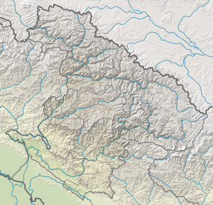 Mugum Karmarong Location of rural council  Mugum Karmarong Mugum Karmarong (Nepal) | |
| Coordinates: 29°35′0″N 82°23′30″E | |
| Country | |
| Province | Karnali Province |
| District | Mugu |
| Wards | 9 |
| Established | 10 March 2017 |
| Government | |
| • Type | Rural Council |
| • Chairperson | Mr. Tsiring Kyapne Lama |
| • Vice-chairperson | Mr. Tsiring Tamang |
| Area | |
| • Total | 2,106.91 km2 (813.48 sq mi) |
| • Rank | 2nd largest RM |
| Population (2011) | |
| • Total | 5,396 |
| • Density | 2.6/km2 (6.6/sq mi) |
| Time zone | UTC+5:45 (Nepal Standard Time) |
| Headquarter | Pulu |
| Website | mugumkarmarongmun |
On March 10, 2017, the Government of Nepal restructured the local level bodies into 753 new local level structures.[5][6]
The previous Dolphu, Mugu, Kimari, Pulu and Mangri VDCs were merged to form Mugum Karmarong Rural Municipality. Mugum Karmarong is divided into 9 wards, with Pulu declared the administrative center of the rural municipality.
References
- Malla, Suman. "Community hospital for locals of Mugum Karmarong". My Republica. Retrieved 26 December 2018.
- "Mugum Karmarong (Rural Municipality, Nepal) - Population Statistics, Charts, Map and Location". www.citypopulation.de. Retrieved 26 December 2018.
- "District Corrected Last for RAJAPATRA" (PDF). www.mofald.gov.np. Retrieved 17 July 2018.
- "स्थानीय तहहरुको विवरण" [Details of the local level bodies]. www.mofald.gov.np/en (in Nepali). Ministry of Federal Affairs and Local Development. Retrieved 17 July 2018.
- "New local level structure comes into effect from today". www.thehimalayantimes.com. The Himalayan Times. 10 March 2017. Retrieved 17 July 2018.
- "New local level units come into existence". www.kathmandupost.ekantipur.com. 11 March 2017. Retrieved 18 July 2018.
External links
Mugu District | ||
|---|---|---|
Headquarters: Gamgadhi (today part of Chhayanath Rara Municipality) | ||
| Municipalities |  | |
| Rural municipalities |
| |
| Former VDCs | ||
List of municipalities and rural municipalities of Nepal | ||
This article about a location in the Mugu District of Nepal is a stub. You can help Wikipedia by expanding it. |
Другой контент может иметь иную лицензию. Перед использованием материалов сайта WikiSort.org внимательно изучите правила лицензирования конкретных элементов наполнения сайта.
WikiSort.org - проект по пересортировке и дополнению контента Википедии