world.wikisort.org - Nepal
Suddhodhan Rural municipality (Kapilvastu)
Labani
लाबनी | |
|---|---|
Village development committee | |
 Al Shaikh Hospital in Labani village | |
 Labani Location in Nepal | |
| Coordinates: 27.51°N 83.21°E | |
| Country | |
| Zone | Lumbini Zone |
| District | Kapilvastu District |
| Government | |
| • Type | Nepal communist party |
| • Mayor | Kamlesh Choudhary |
| Population (2021) | |
| • Total | 45,201 |
| Time zone | UTC+5:45 (Nepal Time) |
| Area code | 32800 |
Labani is a village development committee in Kapilvastu District in the Lumbini Zone of southern Nepal. VDC (Ward) Name was Suddhodhan Rural municipality. They Total area (91.69 km). It is located on Taulihawa Road, 7 kilometres (4.3 mi) west of Lumbini. Current population of 45201 people in 2021 .[1]
References
- "Nepal Census 2001". Nepal's Village Development Committees. Digital Himalaya. Archived from the original on 12 October 2008. Retrieved 14 December 2008.
Kapilvastu District | ||
|---|---|---|
Headquarters: Kapilvastu Municipality | ||
| Municipalities | 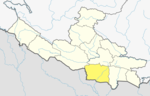 | |
| Rural municipalities | ||
| Former VDCs |
| |
List of municipalities and rural municipalities of Nepal | ||
This article about a location in Kapilvastu District, Nepal is a stub. You can help Wikipedia by expanding it. |
Текст в блоке "Читать" взят с сайта "Википедия" и доступен по лицензии Creative Commons Attribution-ShareAlike; в отдельных случаях могут действовать дополнительные условия.
Другой контент может иметь иную лицензию. Перед использованием материалов сайта WikiSort.org внимательно изучите правила лицензирования конкретных элементов наполнения сайта.
Другой контент может иметь иную лицензию. Перед использованием материалов сайта WikiSort.org внимательно изучите правила лицензирования конкретных элементов наполнения сайта.
2019-2026
WikiSort.org - проект по пересортировке и дополнению контента Википедии
WikiSort.org - проект по пересортировке и дополнению контента Википедии