world.wikisort.org - Nepal
Kimathanka is a Village (previously, a village development committee) in Bhotkhola rural municipality of Sankhuwasabha District of Province No. 1, Nepal and serves as the Nepalese counterpart of the Nepal-China (Tibet autonomous region) border at Zhentang (Chentang). At the time of the 1991 census, it had a population of 303 people living in 50 individual households.[1]
Kimathanka
किमाथांका | |
|---|---|
Village (ward) | |
Kimathanka
[Interactive fullscreen map]
Kimathanka
Map of the village development committees in Sankhuwasabha District | |
 Kimathanka Location in province  Kimathanka Kimathanka (Nepal) | |
| Coordinates: 27.8569°N 87.4181°E | |
| Country | |
| Province | Province No. 1 |
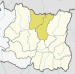
| District | Sankhuwasabha |
| Rural Municipality | Bhotkhola |
| Part of (ward) | Ward no. 1 |
| Area | |
| • Total | 13.37 km2 (5.16 sq mi) |
| Population (2011) | |
| • Total | 368 |
| • Density | 28/km2 (71/sq mi) |
| Time zone | UTC+5:45 (Nepal Time) |
Being among the most remote Himalayan villages of Nepal, Kimathanka is also the end point of the in-progress 362 kilometers long Biratnagar-Khandbari-Kimathanka road called Koshi Highway, which plans to connect the village with the provincial headquarter of Biratnagar and subsequently, with the Indian border town of Jogbani.[2][3] The Arun River runs through the valley below the village. In 2019, road embankment construction on the Chinese side led to fear of potential downstream flooding in Kimathanka.[4] In November 2020, Prime Minister of Nepal KP Sharma Oli visited Kimathanka inspecting the progress of Koshi Highway and other infrastructure projects in the area.[5][6]
Border
Kimathanka is near the border with Tibet. The border was part of brief dispute between China and Nepal before 1960.[7] The dispute was resolved in their 1961 border agreement.[8] The Chentang township in Tibet is on the other side of the valley. There has been local cross-border trade for decades. It has been sufficiently crucial for the local economy in recent years that in 2008 when Chinese tightened its border control during the Olympics, Kimathanka and the nearby villages faced food shortages due to disruption of the local trade.[9] A Chinese border checkpoint was set up in 2011 checking border crossing permits of Nepalese.[10] In 2015, there were recorded 7700 border crossings and the annual trade at this port was valued at CN¥ 18,650,000.[11]
Culture
Kimathanka was one of the areas of Nepal that had traditionally practiced polyandry, however that practice is fading.[12][13]
References
- "Nepal Census 2001". Nepal's Village Development Committees. Digital Himalaya. Archived from the original on 12 October 2008. Retrieved 19 November 2008.
- Rana, Pratik. "Nepal Army entrusted to build 14km road section of Khadbari-Kimathanka Highway linking China". My Republica. Retrieved 2020-01-22.
- "Road to connect China and India in Eastern region nears completion". kathmandupost.com. Retrieved 2020-01-22.
- Giri, Anil; Shakya, Dipendra (13 January 2019). "Chinese construction along the Nepal-Tibet border puts strategic land at risk". The Kathmandu Post. Retrieved 2 September 2019.
- "Koshi highway connecting Nepal, China and India soon: PM Oli". South Asian Monitor. November 12, 2020. Retrieved 22 November 2020.
Prime Minister KP Sharma Oli carried out an onsite visit of Kimathanka border point and North-South highway on Wednesday. On the occasion, he expressed his confidence that India and China would be connected with each other soon.
- "PM Oli to visit Kimathanka on Wednesday". Khabarhub. November 10, 2020. Retrieved 22 November 2020.
Prime Minister’s Press Adviser Surya Thapa said that Prime Minister Oli is visiting Kimathanka to inspect various projects including the Koshi Corridor.
- Office of the Geographer (1969-05-30). "International Boundary Study - China – Nepal Boundary" (PDF). Bureau of Intelligence and Research. Archived from the original (PDF) on 2012-05-03. Retrieved 2017-02-14.
- [China-Nepal Border Agreement] (in Chinese). 1961-10-05 – via Wikisource.
- Budhathoki, Kishor (2008-06-04). "China seals border, villages on Nepali side face starvation". The Himalayan Times. Retrieved 2017-02-13.
Starvation looms large in the northern parts of Sankhuwasabha district after China closed the Kimathanka check post
- "朋曲:寻访边境线" [Pum Qu River: Visiting the border]. Yuanfang De Jia. Season 江河万里行. Episode 136. 2014-11-05. China Central Television. Retrieved 2017-02-14.
- 周健伟; 林威; 汤阳 (2017-02-17). "藏在喜马拉雅山深处的"桃花源"". Xinhua Daily Telegraph (in Chinese). Retrieved 27 November 2019.
据统计,从2011年-2015年,陈塘通道承担的中尼进出口额由715万元增加到1865万元,贸易量由485吨增加到1265吨,出入境人员由2953人次增加到7700人次,均增长1.61倍。
- Wagle, Dinesh (October 12, 2002). "Nepal's Polyandry Tradition: Young Men Don't Want to Share Their Wife With Brothers in Kimathanka". Wagle Street Journal. Retrieved 2017-02-28.
- Gurung, Juddha Bahadur (2013-08-25). "Rapid Cultural Change: A Case Study of Polyandry Marriage System among the Gurung Community from Upper Mustang, Nepal". Dhaulagiri Journal of Sociology and Anthropology. 6: 75–106. doi:10.3126/dsaj.v6i0.8480. ISSN 1994-2672.
External links
Sankhuwasabha District | ||
|---|---|---|
Headquarters: Khandbari Municipality | ||
| Rural municipalities |
|  |
| Municipalities | ||
This article about a location in the Sankhuwasabha District of Nepal is a stub. You can help Wikipedia by expanding it. |
Другой контент может иметь иную лицензию. Перед использованием материалов сайта WikiSort.org внимательно изучите правила лицензирования конкретных элементов наполнения сайта.
WikiSort.org - проект по пересортировке и дополнению контента Википедии