world.wikisort.org - Nepal
Joshipur is Rural Municipality in Kailali District of Sudurpashchim Province established by merging Bauniya and Joshipur two existing village development committees.[1] Joshipur lies 75 km east of Dhangadhi and 61 3 km west of the capital, Kathmandu. It is surrounded by Lamki Chuha Municipality , Tikapur Municipality and Janaki Rural Municipality in the East , Ghodaghodi Municipality and Bhajani Municipality in the West , Bardagoriya Rural Municipality in the North and Bhajani Municipality in the South .
Joshipur Rural Municipality
जोशीपुर गाउँपालिका | |
|---|---|
Gaunpalika | |
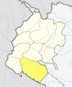
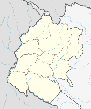 Joshipur Rural Municipality Location in Nepal  Joshipur Rural Municipality Joshipur Rural Municipality (Nepal) | |
| Coordinates: 28.5674°N 81.0147°E | |
| Country | |
| Province | Sudurpashchim Province |
| District | Kailali District |
| Government | |
| • Chairman | Chitra Bahadur Chaudhary (NUP) |
| • Vice-Chairman | Rekha Devi Kathariya (NUP) |
| Area | |
| • Total | 65.6 km2 (25.3 sq mi) |
| Population (2011) | |
| • Total | 36,459 |
| • Density | 560/km2 (1,400/sq mi) |
| Time zone | UTC+5:45 (NST) |
| Post code | 10900 |
| Area code(s) | 091 |
| Website | http://joshipurmun.gov.np |
Temples
- Ram Janaki Mandir, Jabahi
- Shree Someswarnath Mandir, Badhariya
- Shree Baneshwar baba sibha Mandir Dham, Bani
See also
- Sudurpashchim Province
- Kailali District
- Lamki Chuha Municipality
References
- "Nepal Census 2001". Nepal's Village Development Committees. Digital Himalaya. Archived from the original on 12 October 2008. Retrieved 15 November 2009..
External links
Kailali District | ||
|---|---|---|
Headquarters: Dhangadhi | ||
| Sub-metropolitan cities |
|  |
| Municipalities |
| |
| Rural municipalities | ||
| Former VDCs |
| |
List of municipalities and rural municipalities of Nepal | ||
This article about a location in the Kailali District of Nepal is a stub. You can help Wikipedia by expanding it. |
Текст в блоке "Читать" взят с сайта "Википедия" и доступен по лицензии Creative Commons Attribution-ShareAlike; в отдельных случаях могут действовать дополнительные условия.
Другой контент может иметь иную лицензию. Перед использованием материалов сайта WikiSort.org внимательно изучите правила лицензирования конкретных элементов наполнения сайта.
Другой контент может иметь иную лицензию. Перед использованием материалов сайта WikiSort.org внимательно изучите правила лицензирования конкретных элементов наполнения сайта.
2019-2026
WikiSort.org - проект по пересортировке и дополнению контента Википедии
WikiSort.org - проект по пересортировке и дополнению контента Википедии