world.wikisort.org - Nepal
Gandaki Province (Nepali: गण्डकी प्रदेश [ɡʌɳɖʌki]) ![]() Listen (help·info)), is one of the seven federal provinces established by the current constitution of Nepal which was promulgated on 20 September 2015.[1] Pokhara is the province's capital city. It borders the Tibet Autonomous Region of China to the north, Bagmati Province to the east, Karnali Province to the west, and Lumbini Province and Bihar of India to the south. The total area of the province is 21,504 km2 - about 14.57% of the country's total area. According to the latest census, the population of the province was 2,403,757.[2] The newly elected Provincial Assembly adopted Gandaki Province as the permanent name by replacing its initial name Province no. 4 in July 2018. Krishna Chandra Nepali is the present chief minister of Gandaki Province
Listen (help·info)), is one of the seven federal provinces established by the current constitution of Nepal which was promulgated on 20 September 2015.[1] Pokhara is the province's capital city. It borders the Tibet Autonomous Region of China to the north, Bagmati Province to the east, Karnali Province to the west, and Lumbini Province and Bihar of India to the south. The total area of the province is 21,504 km2 - about 14.57% of the country's total area. According to the latest census, the population of the province was 2,403,757.[2] The newly elected Provincial Assembly adopted Gandaki Province as the permanent name by replacing its initial name Province no. 4 in July 2018. Krishna Chandra Nepali is the present chief minister of Gandaki Province
Gandaki Province
गण्डकी प्रदेश Gandaki Province | |
|---|---|
Province | |
        From Top left to right Annapurna, Phewa Lake, Upper Mustang, Tilicho Lake, Manakamana Temple, Muktinath Temple, Machapuchare and Gorkha Durbar | |
|
Seal | |
 Location of Gandaki Province
 | |

Mustang
Myagdi
Baglung
Manang
Kaski
Parbat
Gorkha
Lamjung
Syangja
Tanahun
Nawalpur
China (Tibet)
Map of Gandaki Province, Nepal | |
| Coordinates: 28°12′34″N 83°59′29″E | |
| Country | |
| Formation | 20 September 2015 |
| Capital city | Pokhara |
| Largest city | Pokhara |
| Districts | 11 |
| Government | |
| • Type | Self governing province |
| • Body | Government of Gandaki Province |
| • Governor | Prithvi Man Singh Gurung |
| • Chief Minister | Krishna Chandra Nepali (NC) |
| • High Court | Pokhara High Court |
| • Provincial Assembly | Unicameral (60 seats) |
| • Parliamentary constituencies | 18 |
| Area | |
| • Total | 21,504 km2 (8,303 sq mi) |
| • Rank | 4th |
| Population (2021) | |
| • Total | 2,479,745 |
| • Rank | 6th |
| • Density | 120/km2 (300/sq mi) |
| • Rank | 6th |
| Time zone | UTC+5:45 (NST) |
| Geocode | NP-FO |
| Official language | Nepali/Khas kura |
| Other Official language(s) | 1.Gurung 2.Magar |
| HDI | |
| HDI rank | 2nd |
| Literacy | 74.81% |
| Sex ratio | 83.84 ♂ /100 ♀ (2011) |
| GDP | 3.12 billion USD |
| GDP rank | 5th |
| Website | gandaki |
Etymology
Gandaki Province was named after the river Gandaki. Gandaki is a major river in the province. This river has Important links with historical Hindu civilization.[citation needed] The Gandaki river is mentioned in the ancient Sanskrit epic Mahabharata.[citation needed] It has been said that Valmiki wrote the great epic Ramayana here.[citation needed] It is also believed to be the birthplace of Luv & Kush. Its evolution is described in Shiva Purana, Kumarakhand, in the chapter of the killing of Shankhachuda.
History
Gandaki province was once home to the Chaubisi Rajya, the 24 kings, of which Gorkha was one. From Gorkha, Prithvi Narayan Shah arose to unify all the kingdoms and expand to include all of present-day Nepal.[citation needed] Gandaki Province was known as "Gandak Kshetra" which was established in 1956. Gandak Kshetra was composed by grouping the then 4 districts. Those 4 districts are now divided into many districts. Gandak Kshetra had total area of 5,400 square miles (14,000 km2) and total population was 12 Lakhs.[3] The four districts were:
- Lumbini District (Rupandehi, Parasi, Palpa)
- Syangja District (Syangja, Nawalpur)
- Pokhara District (Tanahun, Kaski)
- Gorkha District (Gorkha, Lamjung, Manang)
In 1962, the administrative system was restructured again and the "Kshetras" system was canceled. The country was restructured into 75 development districts and those districts were grouped into zones.[4] In 1972 area of the Gandaki Province named Western Development Region. It had 3 zones and 16 districts.
Geography
The province has an area of 21,773 km2 which is about 14.66% of the total area of Nepal. The state extends between 27°-20' N ~ 29°-20' N latitude and 82° 52' E ~ 85°-12' E longitude. In terms of terrain, the province is spread over the Himalayan, Hilly and Terai region of Nepal; 5,919 km2 (26.8%) of the area falls under the Himalayan region, 14,604 km2 (67.2%) of the area falls under the Hilly region and 1,310 km2 (6%) of the area falls under the Terai region.[5]
| Location | August
(°F) |
August
(°C) |
January
(°F) |
January
(°C) |
Annual
Precipitation |
|---|---|---|---|---|---|
| Baglung | 72.1 | 22.3 | 47.5 | 8.6 | 1766.1/69.5 |
| Besishahar | 72.3 | 22.4 | 47.5 | 8.6 | 1639.6/64.6 |
| Chapakot | 60.2 | 20.4 | 46.5 | 9.6 | 1766.1/69.5 |
| Modi | 60.8 | 16 | 33.4 | 0.8 | 1094.7/43.1 |
| Pokhara | 74.8 | 23.8 | 50.4 | 10.2 | 2010.3/79.1 |
| Waling | 77.5 | 25.3 | 54.1 | 12.3 | 1962.7/84.5 |
Demographics
Religion in Gandaki Province
The province has a population of 2,403,016 which is just about 9.06% of the total population of Nepal.[citation needed] The population density is about 110 persons per square kilometre. The province has a population growth rate of -0.33%. The sex ratio is 89 males for 100 females, with a total of 948,028 males and 1,144,124 females recorded in 2011. The urban population of the region is 1,452,186 (60.5%) and the rural population is 943,652 (39.5%). About 50.1% of the population in the province are independent population.[citation needed]
Ethnicity
Caste/ethncities in Gandaki Province
Hill Brahmins are the largest community with 21.26% of the population. Other aboriginal Khas communities include Khas/Chhetri (13.13%), Kami (8.66%), Sarki (4.10%), Damai (3.84%), Thakuri (1.61%) and Kumal (1.49%). The Janajati groups are Magar (18.79%), Gurung (11.30%), Newar (4.23%), Tamang (2.03%), Tharu (1.68%) and Bhujel (1.27%).
Language
According to the 2011 Nepal census there are total 88 languages spoken in Gandaki Province. Nepali/Gorkhali/Khas Kura is the most-spoken language, by 72.67% of the population. 9.85% speak Kham Magar, 8.70% Gurung, 1.72% Newar, 1.48% Tharu and 1.42% Tamang.[7]
The Language Commission of Nepal has recommended Magar, Gurung and Bhojpuri as official language in the province. The commission has also recommended Tharu, Nepal Bhasa and Tamang to be additional official languages, for specific regions and purposes in the province.[8]
Administrative subdivisions
Gandaki province is divided into 11 districts, which are listed below. A district is administrated by the head of the District Coordination Committee and the District Administration Officer. The districts are further divided into municipalities or rural municipalities. The municipalities include one metropolitan city and 26 municipalities. There are 58 rural municipalities in the province.[9]
- Baglung District[10]
- Gorkha District
- Kaski District
- Lamjung District
- Manang District
- Mustang District
- Myagdi District
- Nawalpur District
- Parbat District
- Syangja District
- Tanahun District
| Rank | District | Pop. | Rank | District | Pop. | ||||
|---|---|---|---|---|---|---|---|---|---|
 Pokhara |
1 | Pokhara | Kaski | 414,141 | 11 | Putalibazar | Syangja | 44,876 | 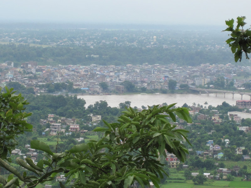 Gaindakot |
| 2 | Vyas | Tanahun | 70,335 | 12 | Devchuli | Nawalpur | 42,603 | ||
| 3 | Kawasoti | Nawalpur | 62,421 | 13 | Kushma | Parbat | 39,600 | ||
| 4 | Gaindakot | Nawalpur | 58,836 | 14 | Besishahar | Lamgunj | 39,356 | ||
| 5 | Baglung | Baglung | 57,823 | 15 | Palungtar | Gorkha | 38,174 | ||
| 6 | Madhyabindu | Nawalpur | 54,140 | 16 | Galyang | Syangja | 36,967 | ||
| 7 | Waling | Syangja | 51,143 | 17 | Beni | Myagdi | 33,498 | ||
| 8 | Gorkha | Gorkha | 49,272 | 18 | Galkot | Baglung | 33,097 | ||
| 9 | Shuklagandaki | Tanahun | 48,456 | 19 | Jaimini | Baglung | 31,430 | ||
| 10 | Bhanu | Tanahun | 45,792 | 20 | Bhimad | Tanahun | 31,362 | ||
Government and administration
The Governor acts as the head of the province while the Chief Minister is the head of the provincial government. The Chief Judge of the Pokhara High Court is the head of the judiciary.[11] The present Governor, Chief Minister and Chief Judge are Sita Kumari Poudel (governor), Krishna Chandra Nepali Pokharel (chief minister) and Purushottam Bhandari.[12][13] The province has 60 provincial assembly constituencies and 18 federal House of Representative constituencies.[14]
Gandaki Province has a unicameral legislature, like that of the other provinces in Nepal. The tenure of the provincial assembly is of five years. The Provincial Assembly of Gandaki Province is temporarily housed at the Urban Development Training Centre in Pokhara.[15]
Economy
The economy of the province is largely dependent on tourism.
Infrastructure
Roadways
9 out of 11 districts of Gandaki Province are connected via surfaced roads. Road connections to Mustang and Manang are unsurfaced and can be impassable during the rainy season. Siddhartha Highway connects Lumbini to Gandaki. The highway starts at the Nepal-India Border in Siddharthanagar and terminates at Prithivi chowk, Pokhara. The major settlements on the highway are Siddharthanagar, Butwal, Tansen, Waling, Putalibazar, Syangja, and Pokhara.
Airways
Pokhara Airport is a domestic airport which serves the province.
See also
- Provinces of Nepal
- List of districts in Nepal
References
- "Nepal Provinces". statoids.com. Retrieved 2016-03-21.
- "Gandaki Province in Nepal population". www.citypopulation.de. Retrieved 2018-06-04.
- नेपालको जिल्ला प्रशासन पुनर्गठनको रिपोर्ट, २०१३ (PDF). Nepal: Nepal Govt. pp. 38, 39, 40.
- "Memorial Step of King Mahendra in 1st Poush 2017 BS". reviewnepal.com. 13 December 2017. Retrieved 6 February 2018.
- "Province Profile" (PDF). nepalmap.org. Government of Province No. 4. Archived from the original (PDF) on 2018-04-28. Retrieved 2018-04-28.
- "Nepal Travel Weather Averages (Weatherbase)". Weatherbase. Retrieved 2018-04-28.
- "गण्डकी प्रदेशको भाषिक स्थिति" [Linguistic status of Gandaki Province]. www.annapurbapost.com (in Nepali). Annapurna Post. 7 December 2018. Retrieved 7 December 2018.
- "सरकारी कामकाजको भाषाका आधारहरूको निर्धारण तथा भाषासम्बन्धी सिफारिसहरू (पञ्चवर्षीय प्रतिवेदन- साराांश) २०७८" (PDF). Language Commission. Language Commission. Retrieved 28 October 2021.
- "स्थानिय तह". 103.69.124.141. Archived from the original on 2018-08-31. Retrieved 2018-04-27.
- "Constituent Assembly of Nepal". Archived from the original on 2016-11-17. Retrieved 2017-03-28.
- "High Courts get their chief judges". Retrieved 2018-04-27.
- "Prithvi Subba Gurung appointed as Province 4 CM - The Himalayan Times". The Himalayan Times. 2018-02-12. Retrieved 2018-04-27.
- "President of Nepal administers oath to Chiefs of seven provinces | DD News". ddnews.gov.in. Retrieved 2018-04-27.
- "CDC creates 495 constituencies". The Himalayan Times. 2017-08-31. Retrieved 2018-04-27.
- "First Provincial Assembly meeting of province 4 begins". Retrieved 2018-04-27.
Places adjacent to Gandaki Province | ||||||||||||||||
|---|---|---|---|---|---|---|---|---|---|---|---|---|---|---|---|---|
| ||||||||||||||||
Provinces of Nepal | ||
|---|---|---|
Provinces and Districts of Nepal | ||
|---|---|---|
| Province No. 1 |
| |
| Madhesh Province |
| |
| Bagmati Province |
| |
| Gandaki Province |
| |
| Lumbini Province |
| |
| Karnali Province |
| |
| Sudurpashchim Province |
| |
На других языках
[de] Provinz Gandaki
Die Provinz Gandaki (Nepali .mw-parser-output .Deva{font-size:120%}@media all and (min-width:800px){.mw-parser-output .Deva{font-size:calc(120% - ((100vw - 800px)/80))}}@media all and (min-width:1000px){.mw-parser-output .Deva{font-size:100%}}गण्डकी प्रदेश IAST .mw-parser-output .Latn{font-family:"Akzidenz Grotesk","Arial","Avant Garde Gothic","Calibri","Futura","Geneva","Gill Sans","Helvetica","Lucida Grande","Lucida Sans Unicode","Lucida Grande","Stone Sans","Tahoma","Trebuchet","Univers","Verdana"}Gaṇḍakī Pradeś) ist eine der sieben Provinzen in Nepal, die die Rolle der föderalen Glieder im Bundesstaat Nepal einnehmen. Die Provinz wurde durch die Verfassung vom 20. September 2015 geschaffen, die Nepal in einen Bundesstaat umwandelte.[1]- [en] Gandaki Province
Другой контент может иметь иную лицензию. Перед использованием материалов сайта WikiSort.org внимательно изучите правила лицензирования конкретных элементов наполнения сайта.
WikiSort.org - проект по пересортировке и дополнению контента Википедии