world.wikisort.org - Nepal
Kshetrapa (Nepali:क्षेत्रपा) is a village development committee in north-eastern Nepal. As per the 2011 National Population and Housing Census, Kshetrapa had 2,447 (1,116 male and 1,331 female) people living in 580 individual households.[1] Kshetrapa has one high school, Shree Kshetrawati Higher Secondary School, which is located at Peepal Daada, Majhgaun. Namdu Jugu Road, which runs through the village, is under construction as of 2020[update].
Kshetrapa
Chhetrapa | |
|---|---|
Village Development Committee | |
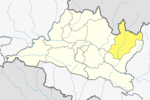
 Kshetrapa Location of Kshetrapa Village of Nepal. | |
| Coordinates: 27.67°N 86.15°E | |
| Country | |
| Zone | Janakpur Zone |
| District | Dolakha District |
| Population (2011) | |
| • Total | 2,447 |
| Time zone | UTC+5:45 (Nepal Time) |
A seasonal bus service is available from Kathmandu, around 170 km (approximately 105 miles) away. The majority of the native population are of Jirel, Chettris, and Newar ethnic groups.
The original trailhead of all early Everest expeditions began at Kathmandu and passed through Kshetrapa; this is an alternative to the other route, which connect at Yarsa, Kavre, through Kiratichhap and heads to Jiri.[2]
Villages
This section does not cite any sources. (September 2020) |
The following is a list of areas or sub-villages cities of Kshetrapa Village Development Committee:
- Bhaankharka
- Toriswaraa
- Yebbo
- Soluphuli
- Toridanda
- Thapagaun
- Daardok
- Dharmashala
- Byaarok
- Bagang
- Paattle
- Pipsul
- Pokhari Parri
- Majhgaun
- Tengithoke
- Pharthoke
- Waithoke
- Khulchi
- Peepal Danda
- Gechugaa
- Tiltapsha
- Gairaghar
- Pakhaghar
- Chhipigaun
- Kshetrapa
- Wollo Baseri
- Pallo Baseri
- Bethiswaraa
- Pukti
References
- "Archived copy" (PDF). Archived from the original (PDF) on 2013-01-24. Retrieved 2012-11-01.
{{cite web}}: CS1 maint: archived copy as title (link) - "Maps List | UN Nepal Information Platform" (PDF). un.org.np. Retrieved 2020-08-25.
External links
Dolakha District • (Hq :Charikot) | ||||||||
|---|---|---|---|---|---|---|---|---|
|  | |||||||
|
This article about a location in Bagmati Province of Nepal is a stub. You can help Wikipedia by expanding it. |
Другой контент может иметь иную лицензию. Перед использованием материалов сайта WikiSort.org внимательно изучите правила лицензирования конкретных элементов наполнения сайта.
WikiSort.org - проект по пересортировке и дополнению контента Википедии