world.wikisort.org - Nepal
Byas (Nepali: व्याँस, romanized: Vyans, also spelt Vyas, Vyans and Byans) is a rural municipality located in Darchula District of Sudurpashchim Province of Nepal.[1]
Byas
व्याँस | |
|---|---|
Rural municipality | |
 A river in Byas rural council | |
 Byans Rural Municipality
| |
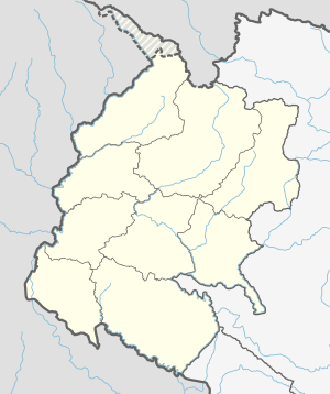 Byas Location in province  Byas Byas (Nepal) | |
| Coordinates: 29.92°N 80.69°E | |
| Country | |
| Province | Sudurpashchim Province |
| District | Darchula |
| No. of wards | 6 |
| Established | 10 March 2017 |
| Government | |
| • Type | Rural council |
| • Chairperson | Mr. Mangal Singh Dhami |
| • Vice-chairperson | Mr. Binod Singh Kunwar |
| Area | |
| • Total | 839.26 km2 (324.04 sq mi) |
| Population (2011) | |
| • Total | 10,347 |
| • Density | 12/km2 (32/sq mi) |
| Time zone | UTC+5:45 (NST) |
| Headquarters | Sunsera |
| Website | https://vyansmun.gov.np/ |
The total area of the rural municipality is 839.26 square kilometres (324.04 sq mi) and the total population of the rural municipality as of 2011 Nepal census is 10,347 individuals. The rural municipality is divided into total 6 wards.[2][3][4]
Byas (Nepali: व्याँस) is derived from Vyasa (Sanskrit: व्यास), the one who classified the Vedas. It is said that the Great Sage Vyasa meditated at this place, giving the region its name.
History
The rural municipality was established on 10 March 2017, fulfilling the requirement of the new constitution of Nepal in 2015, all old municipalities and villages (which were more than 3900 in number) were restructured into 753 new units, thus this RM came into existence.[5][6][7]
Byans, Rapla, Sunsera, Dhaulakot and Huti Village development committees were incorporated to form this new rural municipality. The headquarters of the municipality is situated at Sunsera[2]
Byas was a part of Doti Kingdom during the medieval era. The area between Seti River to Kali river was the Doti Kingdom. In 1790 Gorkha Kingdom (Name changed as "Nepal" in 1768) fought a war against Doti Kingdom and won the battle.[8] thus Doti Kingdom became part of Nepal.
Until 1962, Byas was a thum (county) of Baitadi-Dadeldhura district. Baitadi-Dadeldhura district was divided into two sub-districts. Baitadi and Dadeldhura. Byas was one of eight county (thum) of Baitadi sub-district.
It became part of Darchula District in 1962 when four counties of Baitadi sub-district separately formed a new district.
Ward Division
Byans RM is divided into 6 wards as below:
| Village | Ward No. | Area (KM2) | Population (2011) |
|---|---|---|---|
| Byans | 1 | 565.32 | 556 |
| Rapla | 2 | 179.31 | 1187 |
| Sina | 3 | 64.06 | 1349 |
| Sunsera | 4 | 13.72 | 2755 |
| Dhaulakot | 5 | 10.52 | 1906 |
| Huti | 6 | 6.32 | 2594 |
| Byas | 6 | 839.25 | 10347 |
Ward No.3 (Sina) was created taking some area from previous vdcs Sunsera and Dhaulakot
See also
- Apihimal
- Duhun
- Marma
- Naugad
References
- "स्थानीय तहहरुको विवरण" [Details of the local level bodies]. www.mofald.gov.np/en (in Nepali). Ministry of Federal Affairs and Local Development. Archived from the original on 31 August 2018. Retrieved 17 July 2018.
- District Corrected Last for RAJAPATRA (PDF). www.mofald.gov.np (Report) (in Nepali). Ministry of Federal Affairs and Local Development. p. 398. Retrieved 17 July 2018.
- "CITY POPULATION – statistics, maps & charts". www.citypopulation.de. 10 August 2017. Retrieved 16 August 2018.
- "Darchula district profile 2074" (PDF). www.cbs.gov.np (in Nepali). Central bureau of Statistics (Nepal). 2018. p. 8. Retrieved 9 February 2020.
- "New local level structure comes into effect from today". The Himalayan Times. 10 March 2017. Retrieved 17 July 2018.
- "Govt prepares to add 9 more local levels in Province 2". Kathmandu Post. 11 August 2017. Retrieved 16 November 2019.
- "New local level units come into existence". Kathmandu Post. 11 March 2017. Retrieved 18 July 2018.
- "History of Nepal". T.R.Vaidya Publications. Archived from the original on 2005-02-09. Retrieved 2008-01-31.
External links
Places adjacent to Byans Rural Municipality | ||||||||||||||||
|---|---|---|---|---|---|---|---|---|---|---|---|---|---|---|---|---|
| ||||||||||||||||
Darchula District | ||
|---|---|---|
Headquarters: Khalanga | ||
| Municipalities |
|  |
| Rural municipalities | ||
| Former VDCs |
| |
List of municipalities and rural municipalities of Nepal | ||
Другой контент может иметь иную лицензию. Перед использованием материалов сайта WikiSort.org внимательно изучите правила лицензирования конкретных элементов наполнения сайта.
WikiSort.org - проект по пересортировке и дополнению контента Википедии