world.wikisort.org - Nepal
Bhausabari Bajar (Nepali: भौसाबरी) is a village in the Kanepokhari Rural Municipality in the Morang District of Province No. 1, south-eastern Nepal. It is the center of Kanepokhari Ward 5, which had a population of 6,776 in 2011.
Bhausabari
भौसाबरी | |
|---|---|
Village | |
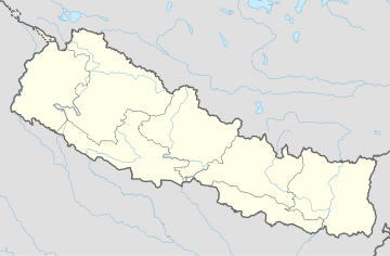
 Bhausabari Location in Nepal | |
| Coordinates: 26.602854°N 87.495241°E | |
| Country | |
| Province | Province No. 1 |
| District | Morang District |
| Gaunpalika | Kanepokhari |
| Time zone | UTC+5:45 (Nepal Time) |
Location
Bhausabari Bajar is in Nepal, Province 1, Morang, Kanepokhari. It is about 111 metres (364 ft) above sea level.[1] The Köppen climate classification is Cwa: Monsoon-influenced humid subtropical climate.[2]
Population
In 2068 BS (2011 CE) Kanepokhari Ward 5 had 1,558 households with a total population of 6,776 of which 3,107 were male and 3,669 were female. The ward was previously Keroun Wards 1, 2 and 5.[3]
Facilities
The Shree Secondary School, Bhausabari Keraun-1 has 90 students. It is under the Public S.S Banigama.[4]
Communications
Bhausabari lies along and to the west of Kanepokhari-Rangeli Road, south of Ramailo and north of Dhikuadagi.[5] The Kanepokhari – Jahada – Bhausabari road leads north to Jahada, Kanepokhari from the west side of the village. It is graveled along its 6.55 kilometres (4.07 mi) length.[6]
References
- "Bhausabari Bajar", GeoNames, retrieved 2020-06-11
- "Bhausabari Bajar, Keroun, Morang, Kosī Zone, Purwanchal, Nepal", Mindat, retrieved 2020-06-11
- Unit-9: Kanepokhari Gaunpalika (PDF), District Coordination Committee Office : Morang, Nepal, p. 10, retrieved 2020-06-11
- MORANG sup73 (schoolwise data) (PDF), Education Development And Coordination Unit, Morang, retrieved 2020-06-11
- "Bhausabari", Google Maps, retrieved 2020-06-11
- "Table A4.1 Overall Road Inventory", District Transport Master Plan (DTMP) (PDF), District Development Committee, Morang, February 2013, p. 45, retrieved 2020-06-11
Другой контент может иметь иную лицензию. Перед использованием материалов сайта WikiSort.org внимательно изучите правила лицензирования конкретных элементов наполнения сайта.
WikiSort.org - проект по пересортировке и дополнению контента Википедии
