world.wikisort.org - Nepal
Babai Rural Municipality (Nepali :बबई गाउँपालिका) is a Gaunpalika in Dang District in Lumbini Province of Nepal. On 12 March 2017, the government of Nepal implemented a new local administrative structure, with the implementation of the new local administrative structure, VDCs have been replaced with municipal and Village Councils. Babai is one of these 753 local units.[1][2] Babai Rural Municipality has area of 257.48 km2.[3] Babai RM is surrounded by Shantinagar Rural Municipality and Dangisharan Rural Municipality in the east, Banke district in the west, Salyan district in the north and in south there is Dangisharan Rural Municipality and Banke district.
Babai Rural Municipality
बबई गाउँपालिका | |
|---|---|
Gaunpalika | |
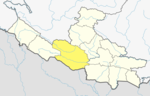
 Babai Rural Municipality Location in Nepal | |
| Coordinates: 28.351851°N 81.718791°E | |
| Country | |
| Province | Lumbini Province |
| District | Dang District |
| Area | |
| • Total | 257.48 km2 (99.41 sq mi) |
| Elevation | 520 m (1,710 ft) |
| Population | |
| • Total | 27,469 |
| • Density | 110/km2 (280/sq mi) |
| Time zone | UTC+5:45 (Nepal Time) |
| Website | http://babaimun.gov.np/ |
References
- "Babai" (PDF). Archived (PDF) from the original on 2020-07-08.
- "बबई गाउँपालिका | प्रदेश नं ५". babaimun.gov.np. Retrieved 2020-07-08.
- "बबई गाउँपालिकाको श्रोत नक्सा | बबई गाउँपालिका". babaimun.gov.np. Retrieved 2020-09-11.
Dang District | ||
|---|---|---|
Headquarters: Ghorahi | ||
| Sub-metropolitan cities |
|  |
| Municipalities |
| |
| Rural municipalities |
| |
| Former VDCs |
| |
List of municipalities and rural municipalities of Nepal | ||
This article about a location in the Dang District of Nepal is a stub. You can help Wikipedia by expanding it. |
Другой контент может иметь иную лицензию. Перед использованием материалов сайта WikiSort.org внимательно изучите правила лицензирования конкретных элементов наполнения сайта.
WikiSort.org - проект по пересортировке и дополнению контента Википедии