world.wikisort.org - Nepal
Aaptar was a village development committee in Udayapur District in the Sagarmatha Zone of Eastern Development Region of Nepal. It became part of Rautamai Rural Municipality after reconstruction of administration in Nepal.
Aaptar
आँपटार | |
|---|---|
Neighborhood | |
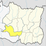
 Aaptar Location in Nepal  Aaptar Aaptar (Nepal) 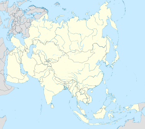 Aaptar Aaptar (Asia) | |
| Coordinates: 26.97°N 86.74°E | |
| Country | |
| Province | Province No. 1 |
| District | Udayapur District |
| Rural Municipality | Rautamai |
| Population (2011) | |
| • Total | 4,494 |
| Time zone | UTC+5:45 (Nepal Time) |
Fulfilling the requirement of the new constitution of Nepal in 2015, all old municipalities and villages (which were more than 3900 in number) were restructured into 753 new units.[1][2]
At the time of the 2011 Nepal census it had a population of 4494 people living in 862 individual households.[3]
References
- "New local level structure comes into effect from today". www.thehimalayantimes.com. The Himalayan Times. 10 March 2017. Retrieved 17 July 2018.
- "Govt prepares to add 9 more local levels in Province 2". www.kathmandupost.ekantipur.com. Kantipur Publication. 11 August 2017. Retrieved 15 August 2018.
- "National Population and Housing Census 2011(Village Development Committee/Municipality)" (PDF). Government of Nepal. National Planning Commission. November 2012. Archived from the original (PDF) on 2016-12-21. Retrieved 2017-01-22.
External links
Udayapur District | ||
|---|---|---|
Headquarter: Gaighat | ||
| Municipality |
|  |
| Rural Municipality |
| |
This article about a location in the Udayapur District of Nepal is a stub. You can help Wikipedia by expanding it. |
Текст в блоке "Читать" взят с сайта "Википедия" и доступен по лицензии Creative Commons Attribution-ShareAlike; в отдельных случаях могут действовать дополнительные условия.
Другой контент может иметь иную лицензию. Перед использованием материалов сайта WikiSort.org внимательно изучите правила лицензирования конкретных элементов наполнения сайта.
Другой контент может иметь иную лицензию. Перед использованием материалов сайта WikiSort.org внимательно изучите правила лицензирования конкретных элементов наполнения сайта.
2019-2026
WikiSort.org - проект по пересортировке и дополнению контента Википедии
WikiSort.org - проект по пересортировке и дополнению контента Википедии