world.wikisort.org - Nepal
Aalitaal (Nepali: आलिताल) is a Gaupalika in Dadeldhura District in the Sudurpashchim Province of far-western Nepal.[1]
Aalitaal Rural Municipality
आलिताल गाउँपालिका | |
|---|---|
Rural Municipality | |
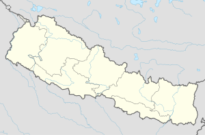  Aalitaal Rural Municipality नेपालको नक्शामा आलिताल गाउँपालिका | |
| Coordinates: 29.1351°N 80.5124°E | |
| Country |  Nepal Nepal |
| Government | |
| • Type | Local government |
| • Chairperson | Bal B. Gurung |
| • Administrative Head | Ganesh datt Bhatt |
| • Engineer | Aakash Joshi |
| Area | |
| • Total | 292.87 km2 (113.08 sq mi) |
| Population (2011 census) | |
| • Total | 18,531 |
| • Density | 63/km2 (160/sq mi) |
| Time zone | UTC+05:45 (Nepal Standard Time) |
| Website | http://aalitalmun.gov.np/ |
Aalitaal has a population of 18531.The land area is 292.87 km2.[2]

References
- "Ministry of Federal Affairs". Retrieved 6 July 2020.
- "National Population and Housing Census 2011(National Report)" (PDF). Central Bureau of Statistics. Government of Nepal. 2012. Archived from the original (PDF) on 2013-04-19. Retrieved 2012-01-01.
Dadeldhura District | ||
|---|---|---|
Headquarters: Amargadhi | ||
| Municipalities |
| 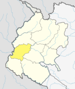 |
| Rural municipalities |
| |
| Former VDCs |
| |
List of municipalities and rural municipalities of Nepal | ||
 | This article about a location in the Dadeldhura District of Nepal is a stub. You can help Wikipedia by expanding it. |
Текст в блоке "Читать" взят с сайта "Википедия" и доступен по лицензии Creative Commons Attribution-ShareAlike; в отдельных случаях могут действовать дополнительные условия.
Другой контент может иметь иную лицензию. Перед использованием материалов сайта WikiSort.org внимательно изучите правила лицензирования конкретных элементов наполнения сайта.
Другой контент может иметь иную лицензию. Перед использованием материалов сайта WikiSort.org внимательно изучите правила лицензирования конкретных элементов наполнения сайта.
2019-2026
WikiSort.org - проект по пересортировке и дополнению контента Википедии
WikiSort.org - проект по пересортировке и дополнению контента Википедии