world.wikisort.org - Nepal
Ngawal (Nepali न्यावल) ist ein Dorf und ein Village Development Committee im Distrikt Manang in Nordzentral-Nepal.
| Ngawal न्यावल | |||
|---|---|---|---|
| |||
| Koordinaten | 28° 39′ N, 84° 6′ O | ||
| Basisdaten | |||
| Staat | Nepal | ||
|
Provinz |
Gandaki | ||
| Zone | Gandaki | ||
| ISO 3166-2 | NP-P4 | ||
| Distrikt | Manang | ||
| Höhe | 3660 m | ||
| Einwohner | 274 (2011) | ||
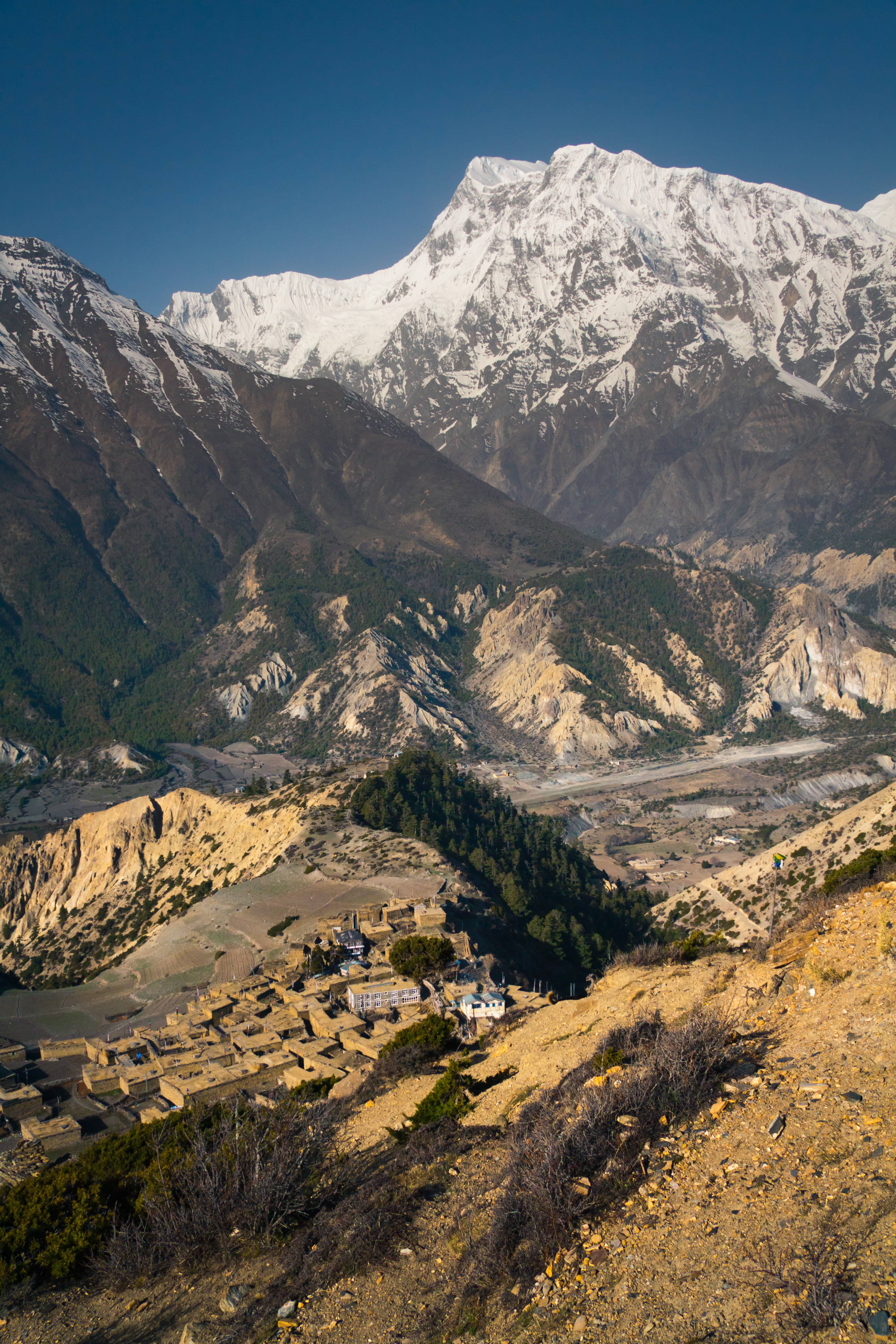 | |||

Ngawal liegt im oberen Manang-Tal zwischen Manang und Pisang an der Trekkingroute Annapurna Circuit. Die Ortschaft liegt oberhalb des nördlichen Flussufers des Marsyangdi auf einer Höhe von 3660 m.
Einwohner
Im Jahr 2001 betrug die Einwohnerzahl von Ngawal 516. Bei der Volkszählung 2011 hatte Ngawal 274 Einwohner (davon 151 männlich) in 73 Haushalten.[1]
Weblinks
Commons: Ngawal – Sammlung von Bildern, Videos und Audiodateien
Einzelnachweise
- National Population and Housing Census 2011 (PDF) Central Bureau of Statistics. Archiviert vom Original am 31. Juli 2013.
На других языках
- [de] Ngawal
[en] Nyawal
Ngawal (Nawal) is a village development committee in Manang District in the Gandaki Zone of northern Nepal. At the time of the 2011 Nepal census it had a population of 274. Ngawal VDC is one of the Seven Village Development Committee in Upper Manang. One of the main attraction of this village is a centuries-old cave of Guru Rinpoche that is on the hills overlooking Ngawal village. The local people believes the cave leads to Mustang. And a monastery in Tibetan Nyingma pa sect which is called Portoche Monastery. 16[citation needed]Текст в блоке "Читать" взят с сайта "Википедия" и доступен по лицензии Creative Commons Attribution-ShareAlike; в отдельных случаях могут действовать дополнительные условия.
Другой контент может иметь иную лицензию. Перед использованием материалов сайта WikiSort.org внимательно изучите правила лицензирования конкретных элементов наполнения сайта.
Другой контент может иметь иную лицензию. Перед использованием материалов сайта WikiSort.org внимательно изучите правила лицензирования конкретных элементов наполнения сайта.
2019-2026
WikiSort.org - проект по пересортировке и дополнению контента Википедии
WikiSort.org - проект по пересортировке и дополнению контента Википедии