world.wikisort.org - Morocco
Foum Zguid (Arabic: فم زڭيد, lit. 'mouth of the Zguid river') is a town in Tata Province, Souss-Massa, southeastern Morocco. According to the 2004 census it had a population of 9,630, the second-highest in the province after the capital Tata.[1]
Foum Zguid
فم زڭيد | |
|---|---|
Town | |
 Foum Zguid City Center. | |
 Foum Zguid | |
| Coordinates: 30°05′07″N 6°52′25″W | |
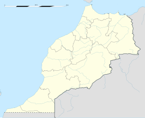
| Country | |
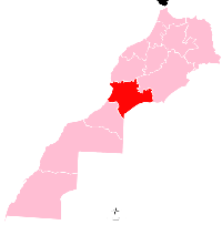
| Region | Souss-Massa |
| Province | Tata Province |
| Population (2004) | |
| • Total | 9,630 |
| Time zone | UTC+0 (WET) |
| • Summer (DST) | UTC+1 (WEST) |
| Postal code | 84150 |
Foum Zguid is on the N12 highway to the northeast of Tata. Iriqui National Park is to the south of Foum Zguid, as is the border with Algeria, but no roads lead to either.
References
- Maaroufi, Youssef. "Recensement général de la population et de l'habitat 2004".
External links
![]() Media related to Foum Zguid at Wikimedia Commons
Media related to Foum Zguid at Wikimedia Commons
Capital: Agadir | ||
| Provinces and prefectures |
|  |
| Cities |
| |
На других языках
[de] Foum Zguid
Foum Zguid (arabisch فم زكيد, Taschelhit ⵉⵎⵉ ⵥⴰⴳⴳⵉⴷ) ist eine Oasenstadt mit etwa 9.000 Einwohnern in der Provinz Tata in der Region Souss-Massa im Süden Marokkos.- [en] Foum Zguid
Текст в блоке "Читать" взят с сайта "Википедия" и доступен по лицензии Creative Commons Attribution-ShareAlike; в отдельных случаях могут действовать дополнительные условия.
Другой контент может иметь иную лицензию. Перед использованием материалов сайта WikiSort.org внимательно изучите правила лицензирования конкретных элементов наполнения сайта.
Другой контент может иметь иную лицензию. Перед использованием материалов сайта WikiSort.org внимательно изучите правила лицензирования конкретных элементов наполнения сайта.
2019-2026
WikiSort.org - проект по пересортировке и дополнению контента Википедии
WikiSort.org - проект по пересортировке и дополнению контента Википедии