world.wikisort.org - Morocco
Errachidia (Arabic: الرشيدية, Berber: ⵉⵎⴻⵜⵖⴰⵔⵏ Imetɣaren) is a city in Morocco, located in the Errachidia Province, and is the capital of the Drâa-Tafilalet region.
This article relies largely or entirely on a single source. (December 2015) |
Errashidia
Imetɣaren قصر السوق Iɣrem ‘N Welzuz | |
|---|---|
City | |
| Eṛṛacidiya / الرشيدية Imetɣaren / ⵉⵎⴻⵜⵖⴰⵔⵏ | |
 Main road in Er Rashidia | |
 Coat of arms | |
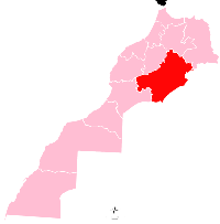
 Errashidia location of Errachidia in Morocco  Errashidia Errashidia (Africa) | |
| Coordinates: 31°55′55″N 4°25′28″W | |
| Country | |
| Region | Drâa-Tafilalet |
| Province | Errachidia |
| Elevation | 1,009 m (3,310 ft) |
| Population (2014)[1] | |
| • Total | 92,374 |
The city's residents speak Berber and Moroccan Arabic.
Toponymy
Formerly known as "Ksar Es Souk" (Berber languages: ⵉⵖⵔⴻⵎ ⵏ ⵓⵍⵣⵓⵣ, Ighrem n Ulzuz), the city was renamed Errachidia around 1975 in honor of the second son of Hassan II, Moulay Rachid.
Culture
The city was part of the route of the 2006 and 2007 Dakar Rally.
Climate
Errachidia has a hot desert climate (Köppen climate classification BWh). The highest temperature ever registered in Errachidia was 43.9 °C (111.0 °F), on July 17, 2021.[2]
| Climate data for Errachidia (1981–2010) | |||||||||||||
|---|---|---|---|---|---|---|---|---|---|---|---|---|---|
| Month | Jan | Feb | Mar | Apr | May | Jun | Jul | Aug | Sep | Oct | Nov | Dec | Year |
| Average high °C (°F) | 15.2 (59.4) |
17.8 (64.0) |
21.7 (71.1) |
25.3 (77.5) |
29.3 (84.7) |
34.8 (94.6) |
38.7 (101.7) |
37.6 (99.7) |
32.6 (90.7) |
26.1 (79.0) |
20.1 (68.2) |
16.1 (61.0) |
26.3 (79.3) |
| Daily mean °C (°F) | 8.4 (47.1) |
11.2 (52.2) |
15.4 (59.7) |
18.8 (65.8) |
22.9 (73.2) |
28.1 (82.6) |
31.9 (89.4) |
30.9 (87.6) |
26.0 (78.8) |
19.8 (67.6) |
13.7 (56.7) |
9.6 (49.3) |
19.7 (67.5) |
| Average low °C (°F) | 1.7 (35.1) |
4.6 (40.3) |
9.0 (48.2) |
12.3 (54.1) |
16.4 (61.5) |
21.5 (70.7) |
25.1 (77.2) |
24.1 (75.4) |
19.5 (67.1) |
13.5 (56.3) |
7.4 (45.3) |
3.0 (37.4) |
13.2 (55.8) |
| Average precipitation mm (inches) | 9.8 (0.39) |
14.8 (0.58) |
8.3 (0.33) |
8.9 (0.35) |
9.9 (0.39) |
5.8 (0.23) |
2.7 (0.11) |
3.9 (0.15) |
11.8 (0.46) |
22.5 (0.89) |
14.8 (0.58) |
10.2 (0.40) |
123.6 (4.87) |
| Mean monthly sunshine hours | 252.3 | 242.6 | 277.1 | 294.5 | 317.0 | 315.8 | 310.1 | 293.8 | 267.0 | 262.3 | 246.7 | 242.3 | 3,321.5 |
| Source: World Meteorological Organization[3] | |||||||||||||
Notable people
- Abdalaati Iguider - 1500m runner
- Rachid Neqrouz - Former footballer
- Mohamed Ounajem - professional footballer
References
- "POPULATION LÉGALE DES RÉGIONS, PROVINCES, PRÉFECTURES, MUNICIPALITÉS, ARRONDISSEMENTS ET COMMUNES DU ROYAUME D'APRÈS LES RÉSULTATS DU RGPH 2014" (in Arabic and French). High Commission for Planning, Morocco. 8 April 2015. Retrieved 29 September 2017.
- "60210: Errachidia (Morocco)". ogimet.com. OGIMET. 17 July 2021. Retrieved 18 July 2021.
- "World Meteorological Organization Climate Normals for 1981–2010". World Meteorological Organization. Retrieved 10 November 2021.
External links
 Media related to Errachidia at Wikimedia Commons
 Errachidia travel guide from Wikivoyage
Capital: Errachidia | ||
| Provinces |
|  |
| Cities | ||
Authority control | |
|---|---|
| General |
|
| National libraries | |
На других языках
- [en] Errachidia
[ru] Эр-Рашидия
Эр-Рашидия (араб. الراشيدي) — марокканский город, расположенный в области Драа — Тафилалет, находится на востоке Марокко. Город находится в провинции с одноимённым названием. Ранее была известна как N Ighram Ksar Es Souk Souk.Текст в блоке "Читать" взят с сайта "Википедия" и доступен по лицензии Creative Commons Attribution-ShareAlike; в отдельных случаях могут действовать дополнительные условия.
Другой контент может иметь иную лицензию. Перед использованием материалов сайта WikiSort.org внимательно изучите правила лицензирования конкретных элементов наполнения сайта.
Другой контент может иметь иную лицензию. Перед использованием материалов сайта WikiSort.org внимательно изучите правила лицензирования конкретных элементов наполнения сайта.
2019-2026
WikiSort.org - проект по пересортировке и дополнению контента Википедии
WikiSort.org - проект по пересортировке и дополнению контента Википедии