world.wikisort.org - Morocco
Beni Mellal (Arabic: بني ملال, Berber languages: ⴰⵢⵜ ⵎⵍⵍⴰⵍ, romanized: Ayt Mellal) is a city in north-central Morocco. It is the capital of the Béni Mellal-Khénifra Region and has a population of 192,676 (2014 census).[1] It sits at the foot of Jbel Tassemit (2247 m), and next to the plains of Beni Amir.
Beni Mellal
| |
|---|---|
  | |
 Beni Mellal Location in Morocco  Beni Mellal Beni Mellal (Africa) | |
| Coordinates: 32°20′22″N 6°21′39″W | |
| Country | |
| Region | Béni Mellal-Khénifra |
| Province | Beni Mellal |
| Elevation | 620 m (2,030 ft) |
| Population (2020) | |
| • City | 209.676 |
| • Rank | 17th in Morocco |
| • Metro | 447,330 |
| Time zone | UTC+1 (CET) |
| Postal code | 23000 |
The walls of the city go back to Moulay Ismail, in 1688, as well as the Kasbah Bel-Kush but most of the city is quite modern and forms an important economic centre for the region particularly in the areas of petrochemical production as well as textile manufacturing which forms the backbone of the wider community. Local agricultural products as oranges, olives, figs etc. find their way to the market via Beni Mellal.[citation needed]
The city has good connections via the road to Casablanca to the East and lies on the ancient route - now a national road - from Fez to Marrakech. The national rail-operator ONCF is also extending the railtrack from Casablanca to (nearby) Oued Zem to the city.
History
The city was first called Ismali back in 1688, since Moulay Ismail, the second ruler of the Moroccan Alaouite Dynasty, built the fortresses of Tadla (remains still visible today). The ruler also constructed the well known Kasba Ras el Ain of this area, which overlooks the whole city along with the agricultural surroundings. It is made from stone and is close to the spring of Ain Asserdoun. The Kasbah was believed to have been built in order to protect this spring and to protect the surrounding area. The spring of Ain Asserdoun is a Berber name means the source of the mule or the eye of the mule. In the area of Soumaa a zaouia exists dated back to the 16th century, which is still used for religious purposes. It was the meeting of these two cities, Tadla and Soumaa, which formed the Berber name Beni Mellal which translated means children of the white.
Climate
Beni Mellal has a hot semi-arid climate (Köppen climate classification BSh) with very hot summers and cool winters. As the city lies quite far inland and is shielded by the Middle Atlas mountains, the climate is highly continental. Because of these factors the overall climate can be considered in a fluctuative state generally moderating between two larger extremes in temperature and climate. Rainfall can reach up to 500 mm (20 in) per year, snow can also fall in winter.
| Climate data for Beni Mellal | |||||||||||||
|---|---|---|---|---|---|---|---|---|---|---|---|---|---|
| Month | Jan | Feb | Mar | Apr | May | Jun | Jul | Aug | Sep | Oct | Nov | Dec | Year |
| Average high °C (°F) | 17.8 (64.0) |
19.6 (67.3) |
23.3 (73.9) |
24.6 (76.3) |
28.8 (83.8) |
34.2 (93.6) |
39.5 (103.1) |
40.8 (105.4) |
32.2 (90.0) |
28.1 (82.6) |
22.0 (71.6) |
18.9 (66.0) |
27.5 (81.5) |
| Average low °C (°F) | 3.3 (37.9) |
5.1 (41.2) |
7.8 (46.0) |
10.3 (50.5) |
13.5 (56.3) |
17.8 (64.0) |
24.2 (75.6) |
25.1 (77.2) |
18.0 (64.4) |
14.0 (57.2) |
8.6 (47.5) |
5.0 (41.0) |
12.7 (54.9) |
| Average rainfall mm (inches) | 33.9 (1.33) |
34.2 (1.35) |
43.0 (1.69) |
36.7 (1.44) |
20.0 (0.79) |
3.5 (0.14) |
1.6 (0.06) |
1.2 (0.05) |
7.2 (0.28) |
35.6 (1.40) |
53.4 (2.10) |
40.0 (1.57) |
310.3 (12.2) |
| Source: BBC Weather (records)[2] | |||||||||||||
Transport
Beni Mellal is served by Beni Mellal Airport.
Education
In Beni Mellal is located Sultan Moulay Slimane University.
Notable people
- Mohamed El Badraoui - Former footballer
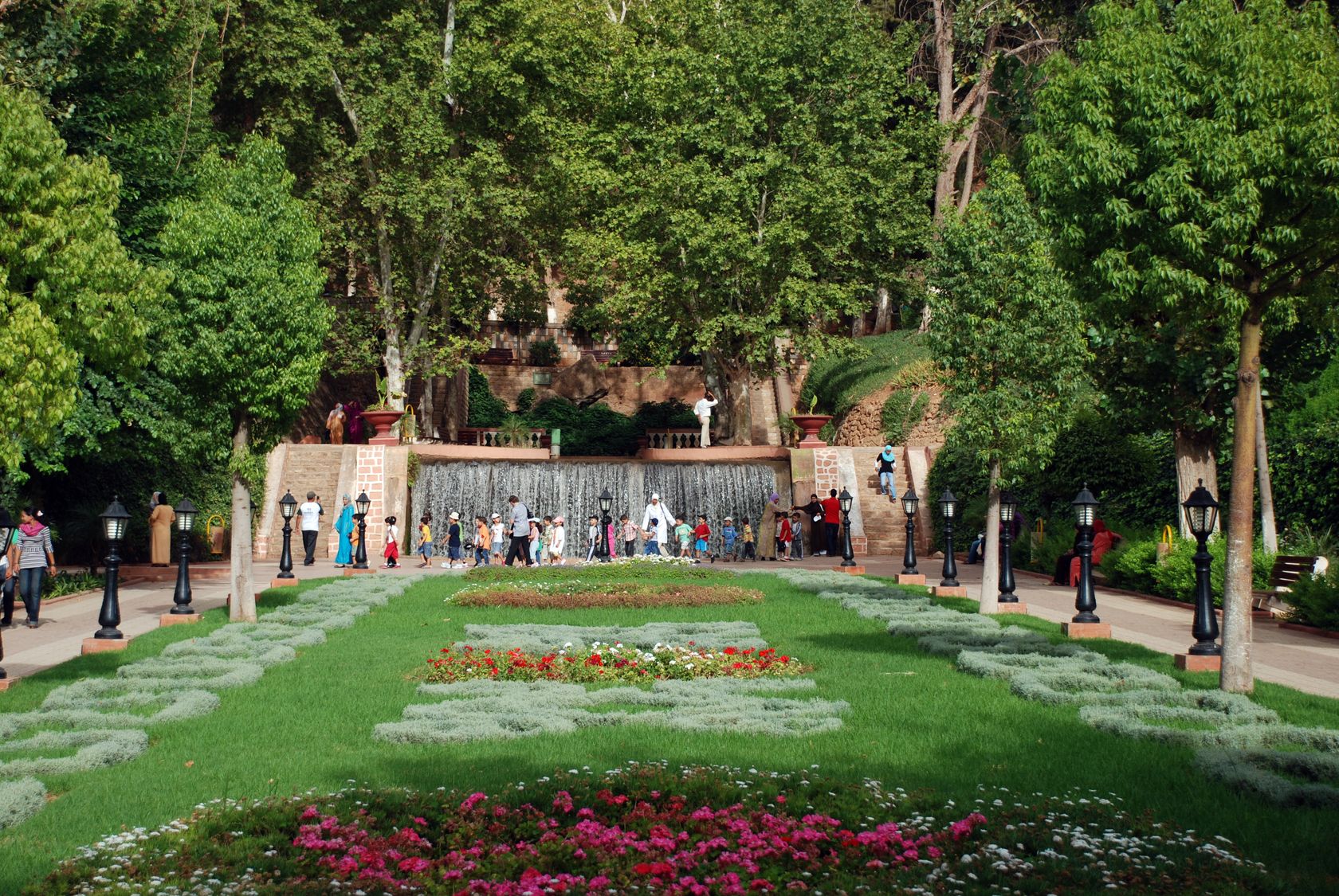
Gallery

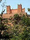 El Kasbah Ain Asserdoun Beni Mellal
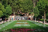
 Sultan Moulay Slimane University


References
- "POPULATION LÉGALE DES RÉGIONS, PROVINCES, PRÉFECTURES, MUNICIPALITÉS, ARRONDISSEMENTS ET COMMUNES DU ROYAUME D'APRÈS LES RÉSULTATS DU RGPH 2014" (in Arabic and French). High Commission for Planning, Morocco. 8 April 2015. Retrieved 29 September 2017.
- "Average Conditions tetoaun, Morocco". BBC Weather. Retrieved August 17, 2009.
External links
- Lexicorient Archived 2016-03-03 at the Wayback Machine
- Monographie de la Ville de Beni Mellal (in French)
Béni-Mellal Province | ||
|---|---|---|
Capital: Beni Mellal | ||
| Municipalities | ||
| Rural communes | ||
Authority control | |
|---|---|
| General |
|
| National libraries | |
На других языках
[de] Beni Mellal
Beni Mellal (arabisch بني ملال, DMG Banī Mallāl, Zentralatlas-Tamazight ⴰⵢⵜ ⵎⵍⵍⴰⵍ .mw-parser-output .Latn{font-family:"Akzidenz Grotesk","Arial","Avant Garde Gothic","Calibri","Futura","Geneva","Gill Sans","Helvetica","Lucida Grande","Lucida Sans Unicode","Lucida Grande","Stone Sans","Tahoma","Trebuchet","Univers","Verdana"}Ayt Mellal) ist die Hauptstadt der Region Béni Mellal-Khénifra in der Landesmitte von Marokko mit etwa 200.000 Einwohnern.- [en] Beni Mellal
[es] Beni Melal
Beni Melal (en árabe, بني ملال) es una ciudad de Marruecos, capital de la provincia homónima y de la región de Beni Melal-Jenifra. Está situada entre el Atlas Medio y la llanura de Tadla, en el centro del país. Su población en 2021 era de 209 676 habitantes.[ru] Бени-Меллаль
Бе́ни-Мелла́ль (араб. بني ملال) — марокканский город, расположенный 160 км южнее Касабланки. Это столица области Тадла-Азилал, с населением 928 000 человек (согласно переписи 2010). Находится у подножия горы Тассемит (2247 м) и на равнинах Бени Амир.Другой контент может иметь иную лицензию. Перед использованием материалов сайта WikiSort.org внимательно изучите правила лицензирования конкретных элементов наполнения сайта.
WikiSort.org - проект по пересортировке и дополнению контента Википедии