world.wikisort.org - Mexico
Tekax, sometimes spelled Tecax (in full, Tekax de Álvaro Obregón), is a small city in the Mexican state of Yucatán, located at 20°12′07″N 89°17′17″W in the southernmost part of the state. Tekax (pronounced [teˈkɑʃ]) means "Place of the Forests" in the Yucatec Maya language. Tekax was briefly declared the capital of Yucatán in 1845. Tekax is also the name of the surrounding municipality of which the city of Tekax serves as municipal seat of government.

Tekax | |
|---|---|
City | |
 | |
 Flag Coat of arms | |
| Nickname(s): La Sultana de la Sierra | |
 Location of Tekax in Yucatan | |
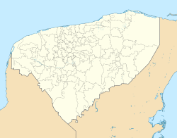 Tekax Tekax | |
| Coordinates: 20°12′07″N 89°17′17″W | |
| Country | Mexico |
| State | Yucatán |
| Municipality | Tecax Municipality |
| Seat | Tecax |
| Government | |
| • Municipal president | Fernando Romero Ávila[1] (PRI) |
| Elevation | 20 m (70 ft) |
| Population (2010)[2] | |
| • Total | 25 751 |
| Demonym(s) | Tecaxican |
| Postal Code | 97970[3] |
| Prefix | 997[4] |
| Website | tecax |
In the census of 2005 Tekax had a population of 23,524. The municipality of Tekax reported a population of 37,454. It has an area of 3,819.61 km² (1,474.76 sq mi) and is the second-largest municipality in geographical area in the state, after Tizimín. The majority of the population in the municipality have Mayan ancestry.
Climate
| Climate data for Tekax | |||||||||||||
|---|---|---|---|---|---|---|---|---|---|---|---|---|---|
| Month | Jan | Feb | Mar | Apr | May | Jun | Jul | Aug | Sep | Oct | Nov | Dec | Year |
| Average high °C (°F) | 29.8 (85.6) |
31.2 (88.2) |
33.7 (92.7) |
35.4 (95.7) |
36.0 (96.8) |
35 (95) |
34.4 (93.9) |
34.6 (94.3) |
34.0 (93.2) |
32.7 (90.9) |
31.3 (88.3) |
29.8 (85.6) |
33.2 (91.8) |
| Average low °C (°F) | 15.9 (60.6) |
16.3 (61.3) |
18.2 (64.8) |
19.9 (67.8) |
21.3 (70.3) |
21.6 (70.9) |
21.0 (69.8) |
21 (70) |
21.3 (70.3) |
20.2 (68.4) |
18.2 (64.8) |
16.3 (61.3) |
19.3 (66.7) |
| Average precipitation mm (inches) | 28 (1.1) |
28 (1.1) |
41 (1.6) |
36 (1.4) |
100 (4) |
160 (6.2) |
140 (5.5) |
140 (5.5) |
180 (7.2) |
140 (5.7) |
48 (1.9) |
48 (1.9) |
1,090 (42.9) |
| Source: Weatherbase [5] | |||||||||||||
References
- Link to tables of population data from Census of 2005 INEGI: Instituto Nacional de Estadística, Geografía e Informática
- Yucatán Enciclopedia de los Municipios de México
- IPEPAC. "Directorio de alcaldes electos" (PDF). Archived from the original (PDF) on September 16, 2011. Retrieved October 15, 2011.
- Instituto Nacional de Estadística y Geografía (2010). "Principales resultados por localidad 2010 (ITER)".
- Servicio Postal Mexicano. "Consulta Códigos Postales". Archived from the original on July 28, 2011. Retrieved August 2, 2011.
- Telmex. "Claves LADA". Archived from the original on April 14, 2010. Retrieved August 2, 2011.
- "Weatherbase: Historical Weather for Tekax, Yucatán". Weatherbase. 2011. Retrieved on November 24, 2011.
External links
Mérida (capital) | |||||||||||||||
| Topics |
|  | |||||||||||||
| Metros |
| ||||||||||||||
| Larger cities | |||||||||||||||
| Smaller cities |
| ||||||||||||||
| Municipalities |
| ||||||||||||||
На других языках
- [en] Tekax
[es] Tekax
Tekax (en maya: Kʼáax), oficialmente Tekax de Álvaro Obregón[7] es una ciudad cabecera del municipio del mismo nombre, ubicada en el estado mexicano de Yucatán.[8] Tiene una altura promedio de 37 m s. n. m. y se localiza a una distancia de 115 km de la capital del estado, la ciudad de Mérida, a 10 km de Akil, a 18 km de Oxkutzcab y a 34 km de Ticul.[ru] Текаш
Текаш, полное наименование Текаш-де-Альваро-Обрегон (исп. Tekax de Álvaro Obregón) — город в Мексике, штат Юкатан, административный центр муниципалитета Текаш. Численность населения, по данным переписи 2010 года, составила 25 751 человек[1].Другой контент может иметь иную лицензию. Перед использованием материалов сайта WikiSort.org внимательно изучите правила лицензирования конкретных элементов наполнения сайта.
WikiSort.org - проект по пересортировке и дополнению контента Википедии