world.wikisort.org - Mexico
Jesús María is a city in the Mexican state of Aguascalientes. It stands at 21°58′N 102°21′W and serves as the municipal seat of the surrounding municipality of Jesús María.
Jesús María | |
|---|---|
City | |
 | |
 Coat of arms | |
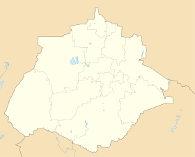 Jesús María Location in Mexico Jesús María Jesús María (Mexico) | |
| Coordinates: 21°58′N 102°21′W | |
| Country | Mexico |
| State | Aguascalientes |
| Municipality | Jesús María |
| Area | |
| • Total | 499 km2 (193 sq mi) |
| Population (2010) | |
| • Total | 43,012 |
As of 2010, the city of Jesús María had a population of 43,012, making it the second largest city in the state.[1] It is located so close to the state capital city of Aguascalientes, Aguascalientes, that it has been swallowed by it, rendering it part of the Aguascalientes metropolitan area (pop. 805,666 in 2005), with the function of a suburban area.
It is also the sister city of Queen Creek, Arizona, United States
Climate
| Climate data for Jesús María (1951–2010) | |||||||||||||
|---|---|---|---|---|---|---|---|---|---|---|---|---|---|
| Month | Jan | Feb | Mar | Apr | May | Jun | Jul | Aug | Sep | Oct | Nov | Dec | Year |
| Record high °C (°F) | 33.0 (91.4) |
35.0 (95.0) |
38.0 (100.4) |
37.0 (98.6) |
39.5 (103.1) |
37.0 (98.6) |
34.0 (93.2) |
35.0 (95.0) |
40.0 (104.0) |
37.0 (98.6) |
35.5 (95.9) |
32.0 (89.6) |
40.0 (104.0) |
| Average high °C (°F) | 22.8 (73.0) |
24.5 (76.1) |
27.4 (81.3) |
29.6 (85.3) |
31.0 (87.8) |
29.5 (85.1) |
27.1 (80.8) |
27.3 (81.1) |
26.9 (80.4) |
26.0 (78.8) |
25.3 (77.5) |
22.8 (73.0) |
26.7 (80.1) |
| Daily mean °C (°F) | 12.9 (55.2) |
14.1 (57.4) |
17.0 (62.6) |
19.4 (66.9) |
21.5 (70.7) |
21.8 (71.2) |
20.4 (68.7) |
20.3 (68.5) |
19.8 (67.6) |
17.8 (64.0) |
15.5 (59.9) |
13.5 (56.3) |
17.8 (64.0) |
| Average low °C (°F) | 2.9 (37.2) |
3.7 (38.7) |
6.5 (43.7) |
9.2 (48.6) |
11.9 (53.4) |
14.2 (57.6) |
13.7 (56.7) |
13.3 (55.9) |
12.6 (54.7) |
9.5 (49.1) |
5.6 (42.1) |
4.1 (39.4) |
8.9 (48.0) |
| Record low °C (°F) | −7.0 (19.4) |
−5.0 (23.0) |
−3.0 (26.6) |
−0.1 (31.8) |
4.5 (40.1) |
6.9 (44.4) |
7.8 (46.0) |
5.0 (41.0) |
2.9 (37.2) |
1.5 (34.7) |
−4.0 (24.8) |
−6.0 (21.2) |
−7.0 (19.4) |
| Average precipitation mm (inches) | 13.1 (0.52) |
6.1 (0.24) |
5.6 (0.22) |
7.6 (0.30) |
17.4 (0.69) |
72.6 (2.86) |
103.7 (4.08) |
105.2 (4.14) |
67.3 (2.65) |
30.0 (1.18) |
13.7 (0.54) |
15.2 (0.60) |
457.5 (18.01) |
| Average precipitation days (≥ 0.1 mm) | 2.0 | 1.2 | 0.5 | 1.2 | 2.5 | 7.8 | 10.3 | 10.1 | 7.5 | 3.7 | 1.3 | 2.2 | 50.3 |
| Source: Servicio Meteorologico Nacional[2][3] | |||||||||||||
References
- "Jesús María". Catálogo de Localidades. Secretaría de Desarrollo Social (SEDESOL). Retrieved 23 April 2014.
- "Estado de Aguascalientes-Estacion: Jesus Maria (SMN)". Normales Climatologicas 1951–2010 (in Spanish). Servicio Meteorologico Nacional. Archived from the original on 3 March 2016. Retrieved 8 May 2015.
- "Extreme Temperatures and Precipitation for Jesus Maria (SMN) 1944–1988" (in Spanish). Servicio Meteorológico Nacional. Archived from the original on 18 May 2015. Retrieved 8 May 2015.
- Link to tables of population data from Census of 2005 Instituto Nacional de Estadística, Geografía e Informática (INEGI)
- Aguascalientes Enciclopedia de los Municipios de México
External links
Wikimedia Commons has media related to Jesús María, Aguascalientes.
- Municipio de Jesús María Official website
- Gobierno del Estado de Aguascalientes Official website of state of Aguascalientes
Aguascalientes City (capital) | ||
| Municipalities (and municipal seats) |
|  |
| ||
Authority control | |
|---|---|
| General | |
| National libraries | |
На других языках
- [en] Jesús María, Aguascalientes
[ru] Хесус-Мария (Агуаскальентес)
Хесус-Мария (исп. Jesús María) — город и административный центр одноимённого муниципалитета в мексиканском штате Агуаскальентес. Численность населения, по данным переписи 2010 года, составила 43 012 человек.Текст в блоке "Читать" взят с сайта "Википедия" и доступен по лицензии Creative Commons Attribution-ShareAlike; в отдельных случаях могут действовать дополнительные условия.
Другой контент может иметь иную лицензию. Перед использованием материалов сайта WikiSort.org внимательно изучите правила лицензирования конкретных элементов наполнения сайта.
Другой контент может иметь иную лицензию. Перед использованием материалов сайта WikiSort.org внимательно изучите правила лицензирования конкретных элементов наполнения сайта.
2019-2026
WikiSort.org - проект по пересортировке и дополнению контента Википедии
WikiSort.org - проект по пересортировке и дополнению контента Википедии