world.wikisort.org - Malaysia
Bukit Payong (est. pop. 2010 census: 26790)[1] is a town Marang District, Terengganu, Malaysia.
Bukit Payong | |
|---|---|
 Bukit Payong Mosque, a landmark at the centre of Bukit Payong | |
 Flag | |
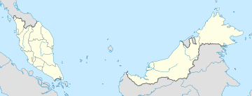 Bukit Payong Location in Malaysia | |
| Coordinates: 4°15′N 103°25′E | |
| Country | |
| State | Terengganu |
| District | Marang |
| Population (2010) | |
| • Total | 26,790 |
| • Ethnicities | 95.8% Malays 4% Chinese 0.15 others |
| Time zone | UTC+8 (Malaysian Standard Time) |
| Postcode | 21400 |
The population comprises 95.85% Malays, 4% Chinese and 0.15% of other races. The town borders with the district of Kuala Terengganu. It houses several government departments such as Jabatan Pertanian, Jabatan Haiwan, Peladang, and Pejabat Pos. There are several shopping centres; Pasaraya Seri Intan, Kedai Wahab and Xiri Mart. There are also many bundle shops in the town as well as facilities such as banks, a futsal hall, police station, civic hall, clinics, health centres and schools. The East Coast Expressway interchange also exits here. It is also the seat of the state constituency of the same name. Currently, the seat is held by Pan-Malaysian Islamic Party or PAS after 2013 Malaysia General Election[2]
Gallery

References
- "Archived copy" (PDF). Archived from the original (PDF) on 2012-11-14. Retrieved 2012-07-12.
{{cite web}}: CS1 maint: archived copy as title (link) - "1". Archived from the original on 2018-08-09. Retrieved 2020-07-09.
This article needs additional citations for verification. (September 2008) |
State of Terengganu | |||||||||||
|---|---|---|---|---|---|---|---|---|---|---|---|
Capital: Kuala Terengganu | |||||||||||
| Topics |
| ||||||||||
| Society |
| ||||||||||
| Administrative divisions |
| ||||||||||
| |||||||||||
This article about a location in the Sultanate of Terengganu is a stub. You can help Wikipedia by expanding it. |
Другой контент может иметь иную лицензию. Перед использованием материалов сайта WikiSort.org внимательно изучите правила лицензирования конкретных элементов наполнения сайта.
WikiSort.org - проект по пересортировке и дополнению контента Википедии