world.wikisort.org - Malaysia
Asajaya (Chinese: 雅沙再也) is a small town located in Samarahan Division, Sarawak, Malaysia.
Asajaya | |
|---|---|
 | |
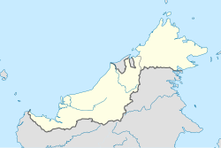 Asajaya | |
| Coordinates: 1°34′42″N 110°34′52″E | |
| Country | |
| State | |
History
Asajaya was formerly known as Nonok, and it is a sub-district under Kuching Division since 1970. From 1993 it was transferred to the newly formed Samarahan Division, and since then it was renamed as Asajaya. Asajaya was upgraded into a district on 31 December 1999.[1]
Demographics
| Ethnicity | 2010 | |
|---|---|---|
| Pop. | % | |
| Malays | 26032 | 83.46% |
| Iban | 2593 | 8.31% |
| Bidayuh | 177 | 0.57% |
| Melanau | 63 | 0.2% |
| Other Bumiputeras | 48 | 0.15% |
| Chinese | 2038 | 6.53% |
| Indians | 18 | 0.06% |
| Others | 17 | 0.05% |
| Malaysian total | 30986 | 99.35% |
| Non-Malaysian | 204 | 0.65% |
| Total | 31190 | 100.00% |
| Year | Pop. | ±% |
|---|---|---|
| 2000 | 28,513 | — |
| 2010 | 31,190 | +9.4% |
| 2020 | 33,606 | +7.7% |
| Figures for 1991 was included under Samarahan District. Source: [2] | ||
Transportation
Local Bus
| Route No. | Operating Route | Operator |
|---|---|---|
| K12 | Kuching-Kota Samarahan-Asajaya-Sadong Jaya | CPL |
Climate
Asajaya has a tropical rainforest climate (Af) with heavy to very heavy rainfall year-round.
| Climate data for Asajaya | |||||||||||||
|---|---|---|---|---|---|---|---|---|---|---|---|---|---|
| Month | Jan | Feb | Mar | Apr | May | Jun | Jul | Aug | Sep | Oct | Nov | Dec | Year |
| Average high °C (°F) | 29.8 (85.6) |
30.0 (86.0) |
31.0 (87.8) |
32.0 (89.6) |
32.5 (90.5) |
32.2 (90.0) |
32.2 (90.0) |
32.0 (89.6) |
31.7 (89.1) |
31.6 (88.9) |
31.3 (88.3) |
30.6 (87.1) |
31.4 (88.5) |
| Daily mean °C (°F) | 26.1 (79.0) |
26.2 (79.2) |
26.9 (80.4) |
27.4 (81.3) |
27.8 (82.0) |
27.5 (81.5) |
27.4 (81.3) |
27.2 (81.0) |
27.1 (80.8) |
27.1 (80.8) |
26.9 (80.4) |
26.6 (79.9) |
27.0 (80.6) |
| Average low °C (°F) | 22.5 (72.5) |
22.5 (72.5) |
22.8 (73.0) |
22.9 (73.2) |
23.2 (73.8) |
22.9 (73.2) |
22.6 (72.7) |
22.5 (72.5) |
22.6 (72.7) |
22.7 (72.9) |
22.6 (72.7) |
22.6 (72.7) |
22.7 (72.9) |
| Average rainfall mm (inches) | 555 (21.9) |
421 (16.6) |
304 (12.0) |
269 (10.6) |
242 (9.5) |
191 (7.5) |
186 (7.3) |
243 (9.6) |
263 (10.4) |
309 (12.2) |
344 (13.5) |
471 (18.5) |
3,798 (149.6) |
| Source: Climate-Data.org[3] | |||||||||||||
References
- "Sejarah". Pusat Ekonomi Digital Pekan Asajaya.
- "TABURAN PENDUDUK MENGIKUT PBT & MUKIM 2010". Department of Statistics, Malaysia. Retrieved 15 December 2017.
- "Climate: Asajaya". Climate-Data.org. Retrieved 29 October 2020.
External links
Wikimedia Commons has media related to Asajaya District.
State of Sarawak | |||||||||||
|---|---|---|---|---|---|---|---|---|---|---|---|
Capital: Kuching | |||||||||||
| History |
| ||||||||||
| Topics |
| ||||||||||
| Society |
| ||||||||||
| Administrative divisions |
| ||||||||||
| |||||||||||
This Sarawak location article is a stub. You can help Wikipedia by expanding it. |
Текст в блоке "Читать" взят с сайта "Википедия" и доступен по лицензии Creative Commons Attribution-ShareAlike; в отдельных случаях могут действовать дополнительные условия.
Другой контент может иметь иную лицензию. Перед использованием материалов сайта WikiSort.org внимательно изучите правила лицензирования конкретных элементов наполнения сайта.
Другой контент может иметь иную лицензию. Перед использованием материалов сайта WikiSort.org внимательно изучите правила лицензирования конкретных элементов наполнения сайта.
2019-2025
WikiSort.org - проект по пересортировке и дополнению контента Википедии
WikiSort.org - проект по пересортировке и дополнению контента Википедии