world.wikisort.org - Luxembourg
Tandel is a commune and village in eastern Luxembourg, in the canton of Vianden. It lies close to the border with Germany. As of 2001[update], the village of Tandel, which lies in the centre of the commune, has a population of 87.
Tandel
Tandel | |
|---|---|
Commune | |
 | |
 Coat of arms | |
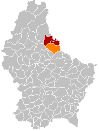 Map of Luxembourg with Tandel highlighted in orange, and the canton in dark red | |
| Coordinates: 49.897°N 6.182°E | |
| Country | |
| Canton | Vianden |
| Area | |
| • Total | 41.72 km2 (16.11 sq mi) |
| • Rank | 11th of 102 |
| Highest elevation | 537 m (1,762 ft) |
| • Rank | 7th of 102 |
| Lowest elevation | 190 m (620 ft) |
| • Rank | 21st of 102 |
| Population (2018) | |
| • Total | 2,048 |
| • Rank | 72nd of 102 |
| • Density | 49/km2 (130/sq mi) |
| • Rank | 95th of 102 |
| Time zone | UTC+1 (CET) |
| • Summer (DST) | UTC+2 (CEST) |
| LAU 2 | LU0000901 |
| Website | tandel.lu |
The commune of Tandel was formed on 1 January 2006 from the former communes of Bastendorf (in the canton of Diekirch) and Fouhren (in the canton of Vianden). The law creating Tandel was passed on 21 December 2004.[1]
Populated places
The commune consists of the following villages:
|
|
Population
References
- "Mémorial A, 2004, No. 216" (PDF) (in French). Service central de législation. Retrieved 2006-08-15.
- "Population par canton et commune". statistiques.public.lu. Retrieved 11 January 2022.
{{cite web}}: CS1 maint: url-status (link)
External links
 Media related to Tandel at Wikimedia Commons
Places adjacent to Tandel | ||||||||||||||||
|---|---|---|---|---|---|---|---|---|---|---|---|---|---|---|---|---|
| ||||||||||||||||

This article related to the geography of Vianden canton is a stub. You can help Wikipedia by expanding it. |
На других языках
- [en] Tandel
[ru] Тандель
Тандель (люксемб. Tandel, фр. Tandel) — коммуна в Люксембурге, располагается в округе Дикирх. Коммуна Тандель является частью кантона Вьянден. В коммуне находится одноимённый населённый пункт.Текст в блоке "Читать" взят с сайта "Википедия" и доступен по лицензии Creative Commons Attribution-ShareAlike; в отдельных случаях могут действовать дополнительные условия.
Другой контент может иметь иную лицензию. Перед использованием материалов сайта WikiSort.org внимательно изучите правила лицензирования конкретных элементов наполнения сайта.
Другой контент может иметь иную лицензию. Перед использованием материалов сайта WikiSort.org внимательно изучите правила лицензирования конкретных элементов наполнения сайта.
2019-2026
WikiSort.org - проект по пересортировке и дополнению контента Википедии
WikiSort.org - проект по пересортировке и дополнению контента Википедии