world.wikisort.org - Luxembourg
Erpeldange-sur-Sûre (Luxembourgish: Ierpeldeng op der Sauer [ˈiːɐ̯pəldeŋ op dɐ ˈzɑʊɐ], German: Erpeldingen an der Sauer [ˈɛʁpl̩dɪŋən ʔan deːɐ̯ ˈzaʊɐ]) is a commune and small town in north-eastern Luxembourg. It lies along the river Sûre, between Ettelbruck and Diekirch. It is part of the canton of Diekirch.
Erpeldange
Ierpeldeng | |
|---|---|
Commune | |
 | |
 Coat of arms | |
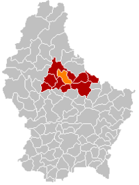 Map of Luxembourg with Erpeldange highlighted in orange, and the canton in dark red | |
| Coordinates: 49.85°N 6.1°E | |
| Country | |
| Canton | Diekirch |
| Area | |
| • Total | 17.97 km2 (6.94 sq mi) |
| • Rank | 64th of 102 |
| Highest elevation | 459 m (1,506 ft) |
| • Rank | 24th of 102 |
| Lowest elevation | 190 m (620 ft) |
| • Rank | 21st of 102 |
| Population (2018) | |
| • Total | 2,339 |
| • Rank | 63rd of 102 |
| • Density | 130/km2 (340/sq mi) |
| • Rank | 56th of 102 |
| Time zone | UTC+1 (CET) |
| • Summer (DST) | UTC+2 (CEST) |
| LAU 2 | LU0000604 |
| Website | erpeldange.lu |
As of 2001[update], the town of Erpeldange, which lies in the centre of the commune, has a population of 818. Other towns within the commune include Burden and Ingeldorf
Erpeldange-sur-Sûre was formed on 1 July 1850, when it was detached from the commune of Ettelbruck, along with the commune of Schieren. The law forming Erpeldange-sur-Sûre was passed on the 22 January 1850.[1]
Erpeldange Castle now houses the commune's administrative offices. It has a history dating from the 13th century.[2]
Population


References
- {{fr icon"Mémorial A, 1850, No. 18" (PDF) (in German). Service central de législation. Retrieved 2006-08-15.
- "Histoire" Archived 2009-12-01 at the Wayback Machine, Commune d'Erpeldange. (in French) Retrieved 26 March 2011.
- "Population par canton et commune". statistiques.public.lu. Retrieved 11 January 2022.
{{cite web}}: CS1 maint: url-status (link)
External links
![]() Media related to Erpeldange (Ettelbruck) at Wikimedia Commons
Media related to Erpeldange (Ettelbruck) at Wikimedia Commons
- Official Website for Erpeldange
- Official website of the Erpeldange tourist board
- Football club in Erpeldange
- Team III from the Football club in Erpeldange
- Erpeldange Youth association
- Band and Choir Concordia Erpeldange
Places adjacent to Erpeldange | ||||||||||||||||
|---|---|---|---|---|---|---|---|---|---|---|---|---|---|---|---|---|
| ||||||||||||||||
Authority control | |
|---|---|
| General |
|
| National libraries | |
This article related to the geography of Diekirch canton is a stub. You can help Wikipedia by expanding it. |
На других языках
- [en] Erpeldange
[ru] Эрпельданж
Эрпельданж (люксемб. Ierpeldeng, фр. Erpeldange) — коммуна в Люксембурге, располагается в округе Дикирх. Коммуна Эрпельданж является частью кантона Дикирх. В коммуне находится одноимённый населённый пункт.Другой контент может иметь иную лицензию. Перед использованием материалов сайта WikiSort.org внимательно изучите правила лицензирования конкретных элементов наполнения сайта.
WikiSort.org - проект по пересортировке и дополнению контента Википедии