world.wikisort.org - Lithuania
Žostautai or Zaštautai (formerly Russian: Заштовты, Polish: Zasztowty)[1] is a village in Kėdainiai district municipality, in Kaunas County, in central Lithuania. According to the 2011 census, the village had a population of 53 people.[2] It is located 4 kilometres (2.5 mi) from Pernarava, between the Lapkalnys-Paliepiai Forest and the Šušvė river. There is a farm.
Žostautai | |
|---|---|
Village | |
 | |
 Žostautai Location in Lithuania  Žostautai Žostautai (Lithuania) | |
| Coordinates: 55°18′12″N 23°38′49″E | |
| Country | |
| County | |
| Municipality | Kėdainiai district municipality |
| Eldership | Pernarava Eldership |
| Population (2011) | |
| • Total | 53 |
| Time zone | UTC+2 (EET) |
| • Summer (DST) | UTC+3 (EEST) |
History
Žostautai has been known since 1596. There was Žostautai village and folwark at the end of the 19th century. During the Soviet era it was a subsidiary kolkhoz settlement.[3]
Demography
|
| |||||||||||||||||||||||||||||||||
| Source: 1902, 1923, 1959 & 1970, 1979, 1989, 2001, 2011 | ||||||||||||||||||||||||||||||||||
Images
 Žostautai from the west
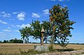 Žostautai roofed pole (Žostautų stogastulpis)
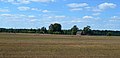 Western part of Žostautai nearby forest


References
- "Zasztowty". Geographical Dictionary of the Kingdom of Poland (in Polish). 14. Warszawa: Kasa im. Józefa Mianowskiego. 1895. p. 456.
- "2011 census". Statistikos Departamentas (Lithuania). Retrieved August 21, 2017.
- "Žostautai". Tarybų Lietuvos enciklopedija (in Lithuanian). Vol. 4. Vilnius: Vyriausioji enciklopedijų redakcija. 1988. p. 687.
Pernarava Eldership | ||
|---|---|---|
| Towns |  | |
| Villages |
| |
Текст в блоке "Читать" взят с сайта "Википедия" и доступен по лицензии Creative Commons Attribution-ShareAlike; в отдельных случаях могут действовать дополнительные условия.
Другой контент может иметь иную лицензию. Перед использованием материалов сайта WikiSort.org внимательно изучите правила лицензирования конкретных элементов наполнения сайта.
Другой контент может иметь иную лицензию. Перед использованием материалов сайта WikiSort.org внимательно изучите правила лицензирования конкретных элементов наполнения сайта.
2019-2025
WikiSort.org - проект по пересортировке и дополнению контента Википедии
WikiSort.org - проект по пересортировке и дополнению контента Википедии