world.wikisort.org - Kazakhstan
Zaysan or Zaisan (Kazakh: Зайсан, Zaisan; Russian: Зайсан), is a town in the East Kazakhstan Region of Kazakhstan, the administrative center of Zaysan District. It is situated near the southeastern corner of Lake Zaysan at an altitude of 660 meters (2170 ft) above sea level.[1] Population: 14,389 (2009 Census results);[2] 16,021 (1999 Census results).[2] The town is located near the eastern terminus of European route E127, which connects it with Omsk in Russia as well as the rest of the European route network.
Zaysan
Зайсан | |
|---|---|
 Zaysan | |
| Coordinates: 47°28′00″N 84°52′00″E | |
| Country | |
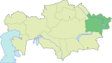
| Region | East Kazakhstan Region |
| Founded: Established: | 1868 1941 |
| Elevation | 660 m (2,170 ft) |
| Population (2009) | |
| • Total | 14,389 |
| Time zone | UTC+6 (OMST) |
| • Summer (DST) | UTC+7 (OMSST) |
History
Zaysan was founded in 1868 as a Russian military post.[3]
Climate
Zaysan has a hot-summer humid continental climate (Köppen climate classification Dfa).
| Climate data for Zaysan (1991–2020, extremes 1925–present) | |||||||||||||
|---|---|---|---|---|---|---|---|---|---|---|---|---|---|
| Month | Jan | Feb | Mar | Apr | May | Jun | Jul | Aug | Sep | Oct | Nov | Dec | Year |
| Record high °C (°F) | 8.6 (47.5) |
10.8 (51.4) |
24.3 (75.7) |
33.0 (91.4) |
35.8 (96.4) |
39.1 (102.4) |
42.0 (107.6) |
41.1 (106.0) |
37.8 (100.0) |
32.8 (91.0) |
17.4 (63.3) |
13.9 (57.0) |
42.0 (107.6) |
| Average high °C (°F) | −12.6 (9.3) |
−8.7 (16.3) |
0.2 (32.4) |
15.1 (59.2) |
21.8 (71.2) |
27.2 (81.0) |
29.1 (84.4) |
27.8 (82.0) |
21.6 (70.9) |
13.1 (55.6) |
0.1 (32.2) |
−9.0 (15.8) |
10.5 (50.9) |
| Daily mean °C (°F) | −16.5 (2.3) |
−13.4 (7.9) |
−4.6 (23.7) |
9.1 (48.4) |
16.1 (61.0) |
21.7 (71.1) |
23.6 (74.5) |
22.2 (72.0) |
15.7 (60.3) |
7.3 (45.1) |
−4.3 (24.3) |
−13.1 (8.4) |
5.3 (41.5) |
| Average low °C (°F) | −20.2 (−4.4) |
−17.4 (0.7) |
−8.7 (16.3) |
3.9 (39.0) |
10.8 (51.4) |
16.8 (62.2) |
18.8 (65.8) |
17.4 (63.3) |
10.7 (51.3) |
2.8 (37.0) |
−7.7 (18.1) |
−16.7 (1.9) |
0.9 (33.6) |
| Record low °C (°F) | −39.8 (−39.6) |
−40.4 (−40.7) |
−34.5 (−30.1) |
−14.5 (5.9) |
−3.4 (25.9) |
0.8 (33.4) |
8.1 (46.6) |
2.9 (37.2) |
−2.3 (27.9) |
−17.8 (0.0) |
−38.1 (−36.6) |
−40.9 (−41.6) |
−40.9 (−41.6) |
| Average precipitation mm (inches) | 15 (0.6) |
13 (0.5) |
18 (0.7) |
29 (1.1) |
41 (1.6) |
35 (1.4) |
42 (1.7) |
25 (1.0) |
29 (1.1) |
29 (1.1) |
27 (1.1) |
16 (0.6) |
319 (12.6) |
| Mean monthly sunshine hours | 138 | 163 | 202 | 242 | 282 | 304 | 327 | 311 | 254 | 182 | 129 | 116 | 2,650 |
| Source 1: Pogoda.ru.net[4] | |||||||||||||
| Source 2: NOAA (sun, 1961–1990)[5] | |||||||||||||
References
- Falling Rain Global Gazetteer entry for Zaysan, Kazakhstan. Retrieved January 29, 2006.
- "Население Республики Казахстан" (in Russian). Департамент социальной и демографической статистики. Retrieved 8 December 2013.
- Cohen, Saul (1998). The Columbia Gazetteer of the World. Columbia University Press. p. 3547.
- "Weather and Climate- The Climate of Zaysan" (in Russian). Weather and Climate (Погода и климат). Retrieved 5 January 2022.
- "Zajsan (Zaysan) Climate Normals 1961–1990". National Oceanic and Atmospheric Administration. Retrieved 5 January 2022.
External links
East Kazakhstan Region | ||
|---|---|---|
Capital: Oskemen | ||
| Districts |
|  |
| Cities of regional subordination |
| |
| Major cities |
| |
| Nuclear test sites |
| |
На других языках
- [en] Zaysan (town)
[ru] Зайсан (город)
Зайсан — город в Казахстане, административный центр Зайсанского района Восточно-Казахстанской области.Текст в блоке "Читать" взят с сайта "Википедия" и доступен по лицензии Creative Commons Attribution-ShareAlike; в отдельных случаях могут действовать дополнительные условия.
Другой контент может иметь иную лицензию. Перед использованием материалов сайта WikiSort.org внимательно изучите правила лицензирования конкретных элементов наполнения сайта.
Другой контент может иметь иную лицензию. Перед использованием материалов сайта WikiSort.org внимательно изучите правила лицензирования конкретных элементов наполнения сайта.
2019-2025
WikiSort.org - проект по пересортировке и дополнению контента Википедии
WikiSort.org - проект по пересортировке и дополнению контента Википедии