world.wikisort.org - Japon
Kunisaki (国東市, Kunisaki-shi) est une municipalité ayant le statut de ville dans la préfecture d'Ōita, au Japon.
| Kunisaki-shi 国東市 | |
 Hôtel de ville de Kunisaki. | |
 Drapeau | |
| Administration | |
|---|---|
| Pays | |
| Région | Kyūshū |
| Préfecture | Ōita |
| Maire | Akifumi Mikawa |
| Code postal | 873-0501 |
| Démographie | |
| Population | 26 629 hab. () |
| Densité | 84 hab./km2 |
| Géographie | |
| Coordonnées | 33° 33′ 55″ nord, 131° 43′ 52″ est |
| Superficie | 31 807 ha = 318,07 km2 |
| Localisation | |
| Liens | |
| Site web | |
| modifier |
|
Géographie
Situation
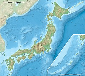
La ville de Kunisaki est située dans le nord-est de la préfecture d'Ōita et forme la pointe de la péninsule de Kunisaki (en).
Démographie
Au , la population de Kunisaki s'élevait à 29 070 habitants[1] répartis sur une superficie de 318,07 km2.
Municipalités voisines
Histoire
Le bourg de Kunisaki a été créé en 1894. Il obtient le statut de ville en 2006.
Culture locale et patrimoine
- Futago-ji
Transports
L'aéroport d'Ōita se trouve sur le territoire de la ville.
Symboles municipaux
L'arbre symbole de la municipalité de Kunisaki est le camphrier, sa fleur symbole la fleur de colza et son oiseau symbole le faisan versicolore, oiseau national du Japon[2].
Références et notes
- (en) Cet article est partiellement ou en totalité issu de l’article de Wikipédia en anglais intitulé « Kunisaki » (voir la liste des auteurs).
- (ja) 国東市役場, « 国東市 », sur city.kunisaki.oita.jp (consulté le ).
- (ja) 国東市役場, « 国東市の花・木・鳥 » [« Symboles de la ville »], sur city.kunisaki.oita.jp (consulté le ).
Voir aussi
Articles connexes
- Préfecture d'Ōita
Liens externes
- (ja) Site officiel
- Portail de la préfecture d'Ōita
На других языках
[de] Kunisaki
Kunisaki (japanisch 国東市, -shi) ist eine Stadt in der Präfektur Ōita.[en] Kunisaki
Kunisaki (国東市, Kunisaki-shi) is a small coastal city located in Ōita Prefecture, Kyushu, Japan. It is located on the Kunisaki Peninsula facing the Seto Inland Sea. Mostly covered by forests and farmlands, the peninsula is dotted with temples. The modern city of Kunisaki was founded on March 31, 2006, from the merger of the former town of Kunisaki, absorbing the towns of Aki, Kunimi and Musashi (all from Higashikunisaki District). [citation needed] As of March 31, 2017, the city has an estimated population of 29,098, with 13,223 households and a population density of 92/km2 (240/sq mi).[1] The total area is 317.84 km2 (122.72 sq mi). [citation needed]- [fr] Kunisaki
[ru] Кунисаки
Кунисаки (яп. 国東市 Кунисаки-си) — город в Японии, находящийся в префектуре Оита. Площадь города составляет 317,84 км²[1], население — 29 674 человека (1 августа 2014)[2], плотность населения — 93,36 чел./км².Текст в блоке "Читать" взят с сайта "Википедия" и доступен по лицензии Creative Commons Attribution-ShareAlike; в отдельных случаях могут действовать дополнительные условия.
Другой контент может иметь иную лицензию. Перед использованием материалов сайта WikiSort.org внимательно изучите правила лицензирования конкретных элементов наполнения сайта.
Другой контент может иметь иную лицензию. Перед использованием материалов сайта WikiSort.org внимательно изучите правила лицензирования конкретных элементов наполнения сайта.
2019-2025
WikiSort.org - проект по пересортировке и дополнению контента Википедии
WikiSort.org - проект по пересортировке и дополнению контента Википедии


