world.wikisort.org - Japan
Tawaramoto (田原本町, Tawaramoto-chō) is a town located in Shiki District, Nara Prefecture, Japan. As of March 31, 2017, the town has an estimated population of 32,241.[1] The total area is 21.09 km².[2] It has many temples and shrines including Jinrakuji.
This article needs additional citations for verification. (October 2022) |
Tawaramoto
田原本町 | |
|---|---|
Town | |
 Tawaramoto Town Office | |
 Flag  Chapter | |
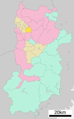
 Location of Tawaramoto in Nara Prefecture | |
 | |
 Tawaramoto Location in Japan | |
| Coordinates: 34°33′N 135°48′E | |
| Country | Japan |
| Region | Kansai |
| Prefecture | Nara Prefecture |
| District | Shiki |
| Area | |
| • Total | 21.09 km2 (8.14 sq mi) |
| Population (March 31, 2017) | |
| • Total | 32,241 |
| • Density | 1,500/km2 (4,000/sq mi) |
| Time zone | UTC+09:00 (JST) |
| City hall address | 890-1 Tawarmoto-chō, Nara-ken 636-0392 |
| Website | www |
| Symbols | |
| Flower | Narcissus |
| Tree | Quercus Gilva |
Geography
Located in the center of the Nara Basin, the majority of the land is flat. The Yamato River flows through the eastern portion of the town.
Surrounding municipalities
Education
- Tawaramoto Agriculture School
- Koutou Special School
- Shiki High School
References
- "Population of Tawaramoto Town" (in Japanese). Japan: Tawaramoto Town. Retrieved 23 April 2017.
- "Nature of Tawaramoto Town" (in Japanese). Japan: Tawaramoto Town. Retrieved 23 April 2017.
External links
 Media related to Tawaramoto, Nara at Wikimedia Commons
 Geographic data related to Tawaramoto, Nara at OpenStreetMap
- Tawaramoto official website (in Japanese)
Nara (capital) | ||
| Core city | ||
| Cities | ||
| Districts |
| |
List of mergers in Nara Prefecture | ||
Authority control | |
|---|---|
| General | |
| National libraries | |
| Scientific databases | |
This Nara Prefecture location article is a stub. You can help Wikipedia by expanding it. |
На других языках
- [en] Tawaramoto, Nara
[ru] Таварамото
Таварамото (яп. 田原本町 Таварамото-тё:) — посёлок в Японии, находящийся в уезде Сики префектуры Нара. Площадь посёлка составляет 21,10 км²[1], население — 31 844 человека (1 августа 2014)[2], плотность населения — 1509,19 чел./км².Текст в блоке "Читать" взят с сайта "Википедия" и доступен по лицензии Creative Commons Attribution-ShareAlike; в отдельных случаях могут действовать дополнительные условия.
Другой контент может иметь иную лицензию. Перед использованием материалов сайта WikiSort.org внимательно изучите правила лицензирования конкретных элементов наполнения сайта.
Другой контент может иметь иную лицензию. Перед использованием материалов сайта WikiSort.org внимательно изучите правила лицензирования конкретных элементов наполнения сайта.
2019-2026
WikiSort.org - проект по пересортировке и дополнению контента Википедии
WikiSort.org - проект по пересортировке и дополнению контента Википедии