world.wikisort.org - Japan
Shirakawa (白川町, Shirakawa-chō) is a town located in Kamo District, Gifu Prefecture, Japan. As of 1 January 2019[update], the town had an estimated population of 8,288 and a population density of 36 persons per km2, in 3159 households.[1] The total area of the town was 237.90 square kilometres (91.85 sq mi).
Shirakawa
白川町 | |
|---|---|
Town | |
 Shirakawa Hirono tea farm | |
 Flag  Seal | |
 Location of Shirakawa in Gifu Prefecture | |
 Shirakawa | |
| Coordinates: 35°34′54.8″N 137°11′16.3″E | |
| Country | Japan |
| Region | Chūbu |
| Prefecture | Gifu |
| District | Kamo |
| Government | |
| • Mayor | Yoshihiro Imai |
| Area | |
| • Total | 237.90 km2 (91.85 sq mi) |
| Population (January 1, 2019) | |
| • Total | 8,288 |
| • Density | 35/km2 (90/sq mi) |
| Time zone | UTC+9 (Japan Standard Time) |
| Phone number | 0574-72-1311 |
| Address | Kawamata 715, Shirakawa-chō, Kamo-gun, Gifu-ken 509-1192 |
| Climate | Cfa |
| Website | Official website (in Japanese) |
| Symbols | |
| Flower | Azalea |
| Tree | Hinoki |
Geography
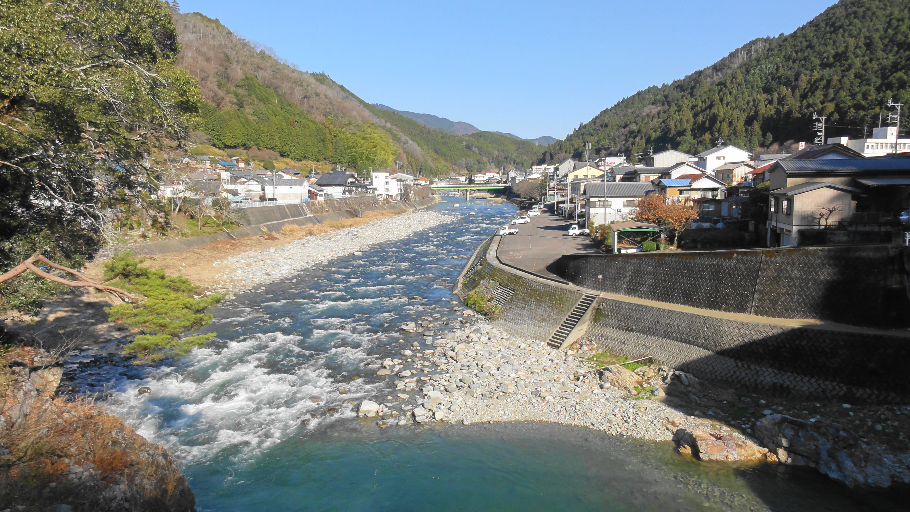
Shirakawa is in the lower reaches of the Japanese Alps in southern Gifu Prefecture. It lies nestled in valleys formed by several rivers, which combine to form the Shirakawa river at one end of the town. The rivers, though substantially developed and altered, remain a source of Ayu, a sweet river fish. The low mountains surrounding the town are heavily forested, primarily with evergreen trees. Japanese macaques, bears, and wild boar are known to live in the local forests. The town has a climate characterized by hot and humid summers, and mild winters (Köppen climate classification Cfa). The average annual temperature in Shirakawa is 11.4 °C. The average annual rainfall is 2238 mm with September as the wettest month. The temperatures are highest on average in August, at around 24.5 °C, and lowest in January, at around -0.9 °C.[2]
Neighbouring municipalities
- Gifu Prefecture
- Nakatsugawa
- Ena
- Gero
- Hichisō
- Yaotsu
- Higashishirakawa
Climate
The town has a climate characterized by hot and humid summers, and mild winters (Köppen climate classification Cfa). The average annual temperature in Nakatsugawa is 11.9 °C (53.4 °F). The average annual rainfall is 2,176.0 mm (85.67 in) with July as the wettest month. The temperatures are highest on average in August, at around 24.1 °C (75.4 °F), and lowest in January, at around 0.0 °C (32.0 °F).[3]
| Climate data for Kurokawa, Shirakawa (1998−2020 normals, extremes 1998−present) | |||||||||||||
|---|---|---|---|---|---|---|---|---|---|---|---|---|---|
| Month | Jan | Feb | Mar | Apr | May | Jun | Jul | Aug | Sep | Oct | Nov | Dec | Year |
| Record high °C (°F) | 14.2 (57.6) |
18.8 (65.8) |
22.0 (71.6) |
27.9 (82.2) |
31.4 (88.5) |
33.3 (91.9) |
37.2 (99.0) |
37.4 (99.3) |
35.3 (95.5) |
29.8 (85.6) |
22.6 (72.7) |
19.7 (67.5) |
37.4 (99.3) |
| Average high °C (°F) | 5.4 (41.7) |
7.0 (44.6) |
11.3 (52.3) |
17.0 (62.6) |
22.3 (72.1) |
25.1 (77.2) |
28.5 (83.3) |
30.2 (86.4) |
26.2 (79.2) |
20.4 (68.7) |
14.3 (57.7) |
7.9 (46.2) |
18.0 (64.3) |
| Daily mean °C (°F) | 0.0 (32.0) |
1.0 (33.8) |
4.6 (40.3) |
10.1 (50.2) |
15.5 (59.9) |
19.4 (66.9) |
23.2 (73.8) |
24.1 (75.4) |
20.5 (68.9) |
14.3 (57.7) |
7.9 (46.2) |
2.4 (36.3) |
11.9 (53.5) |
| Average low °C (°F) | −4.4 (24.1) |
−3.9 (25.0) |
−1.1 (30.0) |
3.8 (38.8) |
9.4 (48.9) |
14.8 (58.6) |
19.4 (66.9) |
20.1 (68.2) |
16.4 (61.5) |
9.7 (49.5) |
3.0 (37.4) |
−1.9 (28.6) |
7.1 (44.8) |
| Record low °C (°F) | −12.8 (9.0) |
−12.3 (9.9) |
−10.2 (13.6) |
−5.3 (22.5) |
−0.8 (30.6) |
5.9 (42.6) |
13.7 (56.7) |
11.5 (52.7) |
6.2 (43.2) |
−0.5 (31.1) |
−4.1 (24.6) |
−10.6 (12.9) |
−12.8 (9.0) |
| Average precipitation mm (inches) | 76.2 (3.00) |
103.0 (4.06) |
173.5 (6.83) |
180.2 (7.09) |
187.4 (7.38) |
244.2 (9.61) |
332.8 (13.10) |
232.1 (9.14) |
256.4 (10.09) |
196.3 (7.73) |
107.0 (4.21) |
85.7 (3.37) |
2,176 (85.67) |
| Average precipitation days (≥ 1.0 mm) | 10.0 | 9.1 | 11.3 | 11.3 | 11.5 | 14.0 | 16.0 | 13.1 | 11.9 | 10.9 | 8.7 | 10.3 | 138.1 |
| Mean monthly sunshine hours | 162.0 | 169.5 | 195.3 | 202.3 | 222.3 | 163.3 | 167.0 | 199.1 | 162.4 | 172.6 | 163.5 | 145.5 | 2,124.6 |
| Source: Japan Meteorological Agency[3][4] | |||||||||||||
Demographics
Per Japanese census data,[5] the population of Shirakawa has declined steadily over the past 50 years.
| Year | Pop. | ±% |
|---|---|---|
| 1970 | 14,059 | — |
| 1980 | 12,922 | −8.1% |
| 1990 | 12,118 | −6.2% |
| 2000 | 11,282 | −6.9% |
| 2010 | 9,530 | −15.5% |
| 2020 | 7,412 | −22.2% |

History
The area around Shirakawa was part of traditional Mino Province. During the Edo period, it was largely controlled by Owari Domain under the Tokugawa shogunate. During the post-Meiji restoration cadastral reforms, the area was organised into Mugi District, Gifu. The village of Sakanohigashi was formed on April 1, 1897 with the establishment of the modern municipalities system. In 1953 the hamlet of Nishi-Shirakawa separated out to form the town of Shirakawa and joined Kamo District., and the following year Shirakawa annexed the remainder of Sakanohigashi village. In 1956, Shirakawa annexed the villages of Kurosawa, Sami, and Sahara.
Economy
The local economy is dominated by forestry and agriculture. Shirakawa is noted for its production of Hinoki wood, and also of green tea.
Education
Shirakawa has five public elementary schools and three public middle schools operated by the town government. The town does not have a high school.
Transportation
Railway
 Central Japan Railway Company - Takayama Main Line
Highway
 National Route 41
 National Route 256
Sister city relations
 - Pistoia, Tuscany, Italy (est. October 30, 1994)
 - Songyuan, Jilin, China, friendship city from 1981
References
- Shirakawa Town official statistics(in Japanese)
- Shirakawa climate data
- 気象庁 / 平年値(年・月ごとの値). JMA. Retrieved May 30, 2022.
- 観測史上1~10位の値(年間を通じての値). JMA. Retrieved May 30, 2022.
- Shirakawa population statistics
External links
 Media related to Shirakawa, Gifu (town) at Wikimedia Commons
- Shirakawa official website (in Japanese)
Authority control | |
|---|---|
| General | |
| National libraries | |
Gifu (capital) | ||
| Core city | ||
| Cities | ||
| Districts |
| |
List of mergers in Gifu Prefecture | ||
This Gifu Prefecture location article is a stub. You can help Wikipedia by expanding it. |
На других языках
- [en] Shirakawa, Gifu (town)
[es] Shirakawa (distrito de Kamo, Gifu)
Shirakawa (白川町, Shirakawa-chō?) es un pueblo localizado en la prefectura de Gifu, Japón. En octubre de 2019 tenía una población estimada de 7.499 habitantes y una densidad de población de 31,5 personas por km². Su área total es de 237,90 km².[ru] Сиракава (посёлок, Гифу)
Сиракава (яп. 白川町 Сиракава-тё:) — посёлок в Японии, находящийся в уезде Камо префектуры Гифу. Площадь посёлка составляет 237,89 км²[1], население — 8695 человек (1 июля 2014)[2], плотность населения — 36,55 чел./км².Другой контент может иметь иную лицензию. Перед использованием материалов сайта WikiSort.org внимательно изучите правила лицензирования конкретных элементов наполнения сайта.
WikiSort.org - проект по пересортировке и дополнению контента Википедии