world.wikisort.org - Japan
Okuizumo (奥出雲町, Okuizumo-chō) is a town located in Nita District, Shimane Prefecture, Japan.
Okuizumo
奥出雲町 | |
|---|---|
Town | |
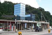
 Okuizumo Town Hall | |
 Flag  Seal | |
 Location of Okuizumo in Shimane Prefecture | |
 Okuizumo Location in Japan | |
| Coordinates: 35°11′51″N 133°0′9″E | |
| Country | Japan |
| Region | Chūgoku San'in |
| Prefecture | Shimane Prefecture |
| District | Nita |
| Area | |
| • Total | 368.06 km2 (142.11 sq mi) |
| Population (March 1, 2017) | |
| • Total | 12,655 |
| • Density | 34/km2 (89/sq mi) |
| Time zone | UTC+09:00 (JST) |
| Climate | Cfa |
| Website | www |

It was formed on March 31, 2005 from the merger of the towns of Nita and Yokota.
As of March 1, 2017, the town has a population of 12,655 and a density of 34 persons per km². The area is 368.06 km².
History
The town of Okuizumo was one of the early centers of Tatara iron making method and remains the only modern site of it, producing a steel for the traditional Japanese swords.[1]
Nearby Komaki mine was used to produce tungsten from 1911 to 1984.[2]
Geography
Climate
Okuizumo has a humid subtropical climate (Köppen climate classification Cfa) with very warm summers and cool winters. Precipitation is abundant throughout the year. The average annual temperature in Okuizumo is 12.3 °C (54.1 °F). The average annual rainfall is 1,754.6 mm (69.08 in) with July as the wettest month. The temperatures are highest on average in August, at around 24.6 °C (76.3 °F), and lowest in January, at around 0.7 °C (33.3 °F).[3] The highest temperature ever recorded in Okuizumo was 36.3 °C (97.3 °F) on 19 August 2010; the coldest temperature ever recorded was −13.1 °C (8.4 °F) on 28 February 1981.[4]
| Climate data for Yokota, Okuizumo (1991−2020 normals, extremes 1978−present) | |||||||||||||
|---|---|---|---|---|---|---|---|---|---|---|---|---|---|
| Month | Jan | Feb | Mar | Apr | May | Jun | Jul | Aug | Sep | Oct | Nov | Dec | Year |
| Record high °C (°F) | 16.1 (61.0) |
21.0 (69.8) |
23.2 (73.8) |
30.5 (86.9) |
32.7 (90.9) |
33.8 (92.8) |
35.4 (95.7) |
36.3 (97.3) |
35.7 (96.3) |
30.3 (86.5) |
25.5 (77.9) |
21.4 (70.5) |
36.3 (97.3) |
| Average high °C (°F) | 4.9 (40.8) |
6.2 (43.2) |
11.0 (51.8) |
17.6 (63.7) |
22.7 (72.9) |
25.7 (78.3) |
29.0 (84.2) |
30.3 (86.5) |
25.6 (78.1) |
20.1 (68.2) |
14.3 (57.7) |
7.8 (46.0) |
17.9 (64.3) |
| Daily mean °C (°F) | 0.7 (33.3) |
1.4 (34.5) |
5.0 (41.0) |
10.7 (51.3) |
16.1 (61.0) |
20.0 (68.0) |
23.9 (75.0) |
24.6 (76.3) |
20.2 (68.4) |
14.0 (57.2) |
8.4 (47.1) |
3.1 (37.6) |
12.3 (54.2) |
| Average low °C (°F) | −2.9 (26.8) |
−3.0 (26.6) |
−0.5 (31.1) |
3.9 (39.0) |
9.7 (49.5) |
15.0 (59.0) |
19.8 (67.6) |
20.2 (68.4) |
15.8 (60.4) |
8.8 (47.8) |
3.3 (37.9) |
−0.8 (30.6) |
7.4 (45.4) |
| Record low °C (°F) | −12.2 (10.0) |
−13.1 (8.4) |
−10.6 (12.9) |
−5.2 (22.6) |
−1.6 (29.1) |
4.7 (40.5) |
7.5 (45.5) |
11.4 (52.5) |
2.5 (36.5) |
−0.7 (30.7) |
−4.5 (23.9) |
−11.5 (11.3) |
−13.1 (8.4) |
| Average precipitation mm (inches) | 143.1 (5.63) |
114.4 (4.50) |
129.5 (5.10) |
106.4 (4.19) |
114.2 (4.50) |
178.0 (7.01) |
237.3 (9.34) |
154.0 (6.06) |
210.7 (8.30) |
131.1 (5.16) |
96.1 (3.78) |
139.7 (5.50) |
1,754.6 (69.08) |
| Average snowfall cm (inches) | 155 (61) |
128 (50) |
34 (13) |
0 (0) |
0 (0) |
0 (0) |
0 (0) |
0 (0) |
0 (0) |
0 (0) |
3 (1.2) |
86 (34) |
401 (158) |
| Average precipitation days (≥ 1.0 mm) | 18.6 | 15.4 | 14.9 | 11.0 | 10.2 | 12.2 | 13.6 | 10.9 | 12.1 | 10.4 | 12.5 | 17.7 | 159.5 |
| Average snowy days (≥ 3 cm) | 13.5 | 12.6 | 3.2 | 0 | 0 | 0 | 0 | 0 | 0 | 0 | 0.2 | 7.2 | 36.7 |
| Mean monthly sunshine hours | 52.8 | 68.4 | 132.4 | 180.5 | 201.8 | 149.0 | 152.5 | 182.2 | 130.6 | 135.4 | 100.6 | 63.6 | 1,549.8 |
| Source: Japan Meteorological Agency[4][3] | |||||||||||||
Demographics
Per Japanese census data, the population of Okuizumo in 2020 is 11,849 people.[5] Okuizumo has been conducting censuses since 1920.
|
|
| ||||||||||||||||||||||||||||||||||||||||||||||||||||||||||||||||||||||||
| Okuizumo population statistics[5] | ||||||||||||||||||||||||||||||||||||||||||||||||||||||||||||||||||||||||||
References
- "Sights Detail - SIGHTSEEING NAVIGATION IN SHIMANE". www.kankou-shimane.com. Archived from the original on 2012-05-29.
- "Komaki mine, Komaki, Okuizumo, Nita District, Shimane Prefecture, Japan".
- 気象庁 / 平年値(年・月ごとの値). JMA. Retrieved April 26, 2022.
- 観測史上1~10位の値(年間を通じての値). JMA. Retrieved April 26, 2022.
- Okuizumo population statistics
External links
 Media related to Okuizumo, Shimane at Wikimedia Commons
- Okuizumo official website (in Japanese)
На других языках
- [en] Okuizumo
[ru] Окуидзумо
Окуидзумо (яп. 奥出雲町 Окуидзумо-тё:) — посёлок в Японии, находящийся в уезде Нита префектуры Симане. Площадь посёлка составляет 368,06 км²[1], население — 13 482 человека (1 августа 2014)[2], плотность населения — 36,63 чел./км².Другой контент может иметь иную лицензию. Перед использованием материалов сайта WikiSort.org внимательно изучите правила лицензирования конкретных элементов наполнения сайта.
WikiSort.org - проект по пересортировке и дополнению контента Википедии