world.wikisort.org - Japan
Kurihara (栗原市, Kurihara-shi) is a city located in Miyagi Prefecture, Japan. As of 30 April 2020[update], the city had an estimated population of 66,565, and a population density of 83 persons per km2 in 24,994 households.[1] The total area of the city is 804.97 square kilometres (310.80 sq mi). Parts of the city are within the borders of the Kurikoma Quasi-National Park.
This article needs additional citations for verification. (April 2015) |
Kurihara
栗原市 | |
|---|---|
City | |
 Kurihara-Kogen Station, Tanabata, Kuriden Rail Park, Lotus flowers, Hanayama Dam, Kurikoma QNP | |
 Flag  Seal | |
 Location of Kurihara in Miyagi Prefecture | |
 Kurihara | |
| Coordinates: 38°43′48.4″N 141°1′17.3″E | |
| Country | Japan |
| Region | Tōhoku |
| Prefecture | Miyagi |
| Government | |
| • -Mayor | Isamu Satō |
| Area | |
| • Total | 804.97 km2 (310.80 sq mi) |
| Population (April 30, 2020) | |
| • Total | 66,565 |
| • Density | 83/km2 (210/sq mi) |
| Time zone | UTC+9 (Japan Standard Time) |
| Phone number | 0228-22-1122 |
| Address | 1-7-1 Tsukidate Yakushi, Kurihara-shi, Miyagi-ken 987-2293 |
| Climate | Cfa |
| Website | Official website |
| Symbols | |
| Flower | Nikkōkisuge (Hemerocallis dumortieri var. esculenta) |
| Tree | Kousa Dogwood |

Geography
Kurihara covers a part of the northwestern corner of Miyagi Prefecture. It is mostly rice farmland, and small mountain ridges, the largest of which cluster around Mount Kurikoma, the tallest mountain in Kurihara, which is located at the furthest northwestern point of Miyagi Prefecture. In summer, the lotus on Lake Izunuma bloom. In fall, Mount Kurikoma is covered in fall colors and in winter migrating swans and geese come in flocks to spend the season on Kurihara's lakes.
Neighboring municipalities
Miyagi Prefecture
- Tome
- Ōsaki
Akita Prefecture
Iwate Prefecture
Climate
The climate of Kurihara is classified as humid subtropical (Cfa) per the Köppen climate classification system. As with most of Japan, the summers in Kurihara are hot and humid with temperatures usually around 24.5 °C (76.1 °F). Summer is also typhoon season, however, since Kurihara is so far north and inland the area is rarely affected. Fall and spring are mild, with temperatures in the low to mid 20s (Celsius). In fall, the days usually begin foggy and cold but clear up by midday. Spring comes late to the region and is mostly sunny punctuated with random light showers. The temperature fluctuates around freezing in winter, falling to an average low of −1.3 °C (29.7 °F), and snow levels vary with altitude.[2]
| Climate data for Kurikoma[lower-alpha 1], Kurihara (1991−2020 normals, extremes 1976−present) | |||||||||||||
|---|---|---|---|---|---|---|---|---|---|---|---|---|---|
| Month | Jan | Feb | Mar | Apr | May | Jun | Jul | Aug | Sep | Oct | Nov | Dec | Year |
| Record high °C (°F) | 11.3 (52.3) |
14.3 (57.7) |
17.4 (63.3) |
28.2 (82.8) |
30.6 (87.1) |
30.8 (87.4) |
32.1 (89.8) |
33.3 (91.9) |
31.3 (88.3) |
26.7 (80.1) |
19.7 (67.5) |
15.7 (60.3) |
33.3 (91.9) |
| Average high °C (°F) | 0.1 (32.2) |
0.8 (33.4) |
4.5 (40.1) |
11.4 (52.5) |
17.3 (63.1) |
20.4 (68.7) |
23.7 (74.7) |
24.9 (76.8) |
21.1 (70.0) |
15.6 (60.1) |
9.4 (48.9) |
3.0 (37.4) |
12.7 (54.8) |
| Daily mean °C (°F) | −2.9 (26.8) |
−2.4 (27.7) |
0.6 (33.1) |
6.3 (43.3) |
12.0 (53.6) |
15.9 (60.6) |
19.7 (67.5) |
20.7 (69.3) |
17.0 (62.6) |
11.2 (52.2) |
5.2 (41.4) |
−0.2 (31.6) |
8.6 (47.5) |
| Average low °C (°F) | −6.3 (20.7) |
−6.2 (20.8) |
−3.4 (25.9) |
1.3 (34.3) |
6.8 (44.2) |
11.6 (52.9) |
16.2 (61.2) |
17.2 (63.0) |
13.3 (55.9) |
6.8 (44.2) |
0.8 (33.4) |
−3.6 (25.5) |
4.5 (40.2) |
| Record low °C (°F) | −15.5 (4.1) |
−14.1 (6.6) |
−12.7 (9.1) |
−7.9 (17.8) |
−1.2 (29.8) |
1.7 (35.1) |
6.3 (43.3) |
8.7 (47.7) |
1.0 (33.8) |
−1.7 (28.9) |
−7.2 (19.0) |
−13.6 (7.5) |
−15.5 (4.1) |
| Average precipitation mm (inches) | 126.8 (4.99) |
96.8 (3.81) |
125.8 (4.95) |
135.7 (5.34) |
164.8 (6.49) |
228.2 (8.98) |
263.5 (10.37) |
253.9 (10.00) |
261.6 (10.30) |
187.0 (7.36) |
137.4 (5.41) |
152.9 (6.02) |
2,124.9 (83.66) |
| Average snowfall cm (inches) | 268 (106) |
207 (81) |
169 (67) |
37 (15) |
0 (0) |
0 (0) |
0 (0) |
0 (0) |
0 (0) |
0 (0) |
36 (14) |
208 (82) |
924 (364) |
| Average precipitation days (≥ 1.0 mm) | 19.8 | 16.9 | 15.9 | 13.4 | 12.5 | 13.8 | 16.7 | 16.4 | 15.5 | 13.4 | 15.4 | 19.0 | 188.7 |
| Average snowy days (≥ 3 cm) | 22.3 | 19.3 | 17.2 | 5.0 | 0 | 0 | 0 | 0 | 0 | 0 | 3.6 | 16.5 | 83.9 |
| Mean monthly sunshine hours | 82.0 | 88.7 | 128.9 | 168.1 | 178.3 | 127.4 | 100.6 | 111.3 | 100.2 | 122.9 | 113.5 | 80.3 | 1,401 |
| Source: Japan Meteorological Agency[3][4] | |||||||||||||
| Climate data for Tsukidate, Kurihara (1991−2020 normals, extremes 1976−present) | |||||||||||||
|---|---|---|---|---|---|---|---|---|---|---|---|---|---|
| Month | Jan | Feb | Mar | Apr | May | Jun | Jul | Aug | Sep | Oct | Nov | Dec | Year |
| Record high °C (°F) | 15.0 (59.0) |
18.4 (65.1) |
22.9 (73.2) |
29.5 (85.1) |
33.5 (92.3) |
33.7 (92.7) |
36.4 (97.5) |
37.3 (99.1) |
34.7 (94.5) |
29.6 (85.3) |
23.5 (74.3) |
19.8 (67.6) |
37.3 (99.1) |
| Average high °C (°F) | 4.1 (39.4) |
5.2 (41.4) |
9.3 (48.7) |
15.6 (60.1) |
20.9 (69.6) |
24.0 (75.2) |
27.1 (80.8) |
28.6 (83.5) |
24.9 (76.8) |
19.3 (66.7) |
13.0 (55.4) |
6.7 (44.1) |
16.6 (61.8) |
| Daily mean °C (°F) | −0.3 (31.5) |
0.4 (32.7) |
3.7 (38.7) |
9.2 (48.6) |
14.9 (58.8) |
18.9 (66.0) |
22.4 (72.3) |
23.6 (74.5) |
19.8 (67.6) |
13.6 (56.5) |
7.2 (45.0) |
2.0 (35.6) |
11.3 (52.3) |
| Average low °C (°F) | −4.7 (23.5) |
−4.4 (24.1) |
−1.8 (28.8) |
2.9 (37.2) |
9.4 (48.9) |
14.6 (58.3) |
18.8 (65.8) |
19.8 (67.6) |
15.5 (59.9) |
8.3 (46.9) |
1.9 (35.4) |
−2.4 (27.7) |
6.5 (43.7) |
| Record low °C (°F) | −17.0 (1.4) |
−18.3 (−0.9) |
−12.5 (9.5) |
−6.6 (20.1) |
0.7 (33.3) |
5.6 (42.1) |
6.2 (43.2) |
11.2 (52.2) |
3.8 (38.8) |
−2.7 (27.1) |
−6.0 (21.2) |
−14.9 (5.2) |
−18.3 (−0.9) |
| Average precipitation mm (inches) | 42.1 (1.66) |
35.1 (1.38) |
73.0 (2.87) |
87.3 (3.44) |
111.9 (4.41) |
134.2 (5.28) |
185.4 (7.30) |
151.6 (5.97) |
166.3 (6.55) |
131.2 (5.17) |
62.9 (2.48) |
49.8 (1.96) |
1,230.8 (48.46) |
| Average precipitation days (≥ 1.0 mm) | 8.0 | 7.2 | 9.2 | 9.3 | 9.8 | 10.5 | 13.9 | 11.7 | 11.7 | 9.4 | 8.6 | 9.0 | 118.3 |
| Mean monthly sunshine hours | 138.7 | 144.2 | 171.6 | 186.3 | 184.9 | 141.2 | 115.9 | 129.9 | 122.4 | 139.4 | 138.5 | 122.1 | 1,734.9 |
| Source: Japan Meteorological Agency[5][6] | |||||||||||||
Demographics
Per Japanese census data,[7] the population of Kurihara peaked at around the year 1950 and has declined over the past 70 years.
| Year | Pop. | ±% |
|---|---|---|
| 1920 | 82,759 | — |
| 1930 | 90,109 | +8.9% |
| 1940 | 101,186 | +12.3% |
| 1950 | 131,599 | +30.1% |
| 1960 | 129,144 | −1.9% |
| 1970 | 104,888 | −18.8% |
| 1980 | 95,801 | −8.7% |
| 1990 | 91,852 | −4.1% |
| 2000 | 84,947 | −7.5% |
| 2010 | 74,932 | −11.8% |
| 2020 | 64,637 | −13.7% |
History
The area of present-day Kurihara was part of ancient Mutsu Province, and has been settled since at least the Jōmon period by the Emishi people. During the later portion of the Heian period, the area was ruled by the Northern Fujiwara. During the Sengoku period, the area was contested by various samurai clans before the area came under the control of the Date clan of Sendai Domain during the Edo period, under the Tokugawa shogunate.
With the establishment of the modern municipalities system on April 1, 1889, the area was organized into Kurihara District, Miyagi Prefecture.
During the Meiji period, many mines were dug in the mountains of Kurihara, and the Hosokura mine was at one point Japan's largest producer of lead and zinc. The mine closed in 1987.
The city of Kurihara was established on April 1, 2005, from the merger of the towns of Ichihasama, Kannari, Kurikoma, Semine, Shiwahime, Takashimizu, Tsukidate, Uguisuzawa and Wakayanagi, and the village of Hanayama (all from Kurihara District, which was dissolved as a result of the merger). The new city hall is located in former Tsukidate. Although technically referred to as a "city", Kurihara in fact functions more like a county composed of ten separate towns. The UK equivalent would be an English unitary county council, such as Herefordshire.
Government
Kurihara has a mayor-council form of government with a directly elected mayor and a unicameral city legislature of 26 members. Kurihara contributes two seats to the Miyagi Prefectural legislature. In terms of national politics, the city is part of Miyagi 6th district of the lower house of the Diet of Japan.
Economy
The economy of Kurihara is largely based on agriculture. Mining, which once formed a significant percentage of the economy has largely disappeared with the closure of the last mines in the 1980s.
Education
Kurihara has 13 public elementary schools and eight public junior high schools operated by the city government and five public high schools operated by the Miyagi Prefectural Board of Education. The prefecture also operates one special education school for the handicapped.
Transportation
Railway
![]() East Japan Railway Company (JR East) - Tōhoku Shinkansen
East Japan Railway Company (JR East) - Tōhoku Shinkansen
![]() East Japan Railway Company (JR East) - Tōhoku Main Line
East Japan Railway Company (JR East) - Tōhoku Main Line
Highway
 Tōhoku Expressway
 National Route 4
 National Route 398
 National Route 457
Local attractions
- Kurikoma Quasi-National Park is centered on Mt. Kurikoma, a dormant volcano straddling the tri-prefectural border of Miyagi, Akita and Iwate. It is 1627 meters high, conical, and has a 365 degree panoramic view. There is an abundance of diverse alpine flora in the wetlands near its peak and expansive virgin beech forests that are home to many precious birds, insects, and other fauna. There are extensive hiking trails with hot springs located at the base and top of the mountain.
- Iji Castle ruins, a National Historic Site[8]
- Sekai Yachi Wetlands Flower Park is a 14.34-hectare wetlands area is situated in the southern foothills of Mt. Kurikoma, between 669 and 707 meters above sea level. Late June is the best time to see the Middendorff's daylilies. The flowering seasons are spring and summer.
- Miyagi Prefectural Sanctuary Center of Izunuma-Uchinuma is a protected area created in order to protect the abundant plant and animal life in the area. Lake Izunuma, the largest lake in Miyagi, is home to 223 species of waterfowl, or 42% of Japan's 535 total species of water birds. Migrating birds including swans, geese, and ducks, winter here. From late July to late August is when the lotus flowers bloom and the Izunuma-Uchinuma Lotus Festival is held.
- Former Arikabe-juku Honjin, National Historic Site [9]
- Sannō-Gakoi Site, National Historic Site[10]
- Nuruyu Bansho Site, National Historic Site [11]
- Irinosawa Site, National Historic Site
Culture
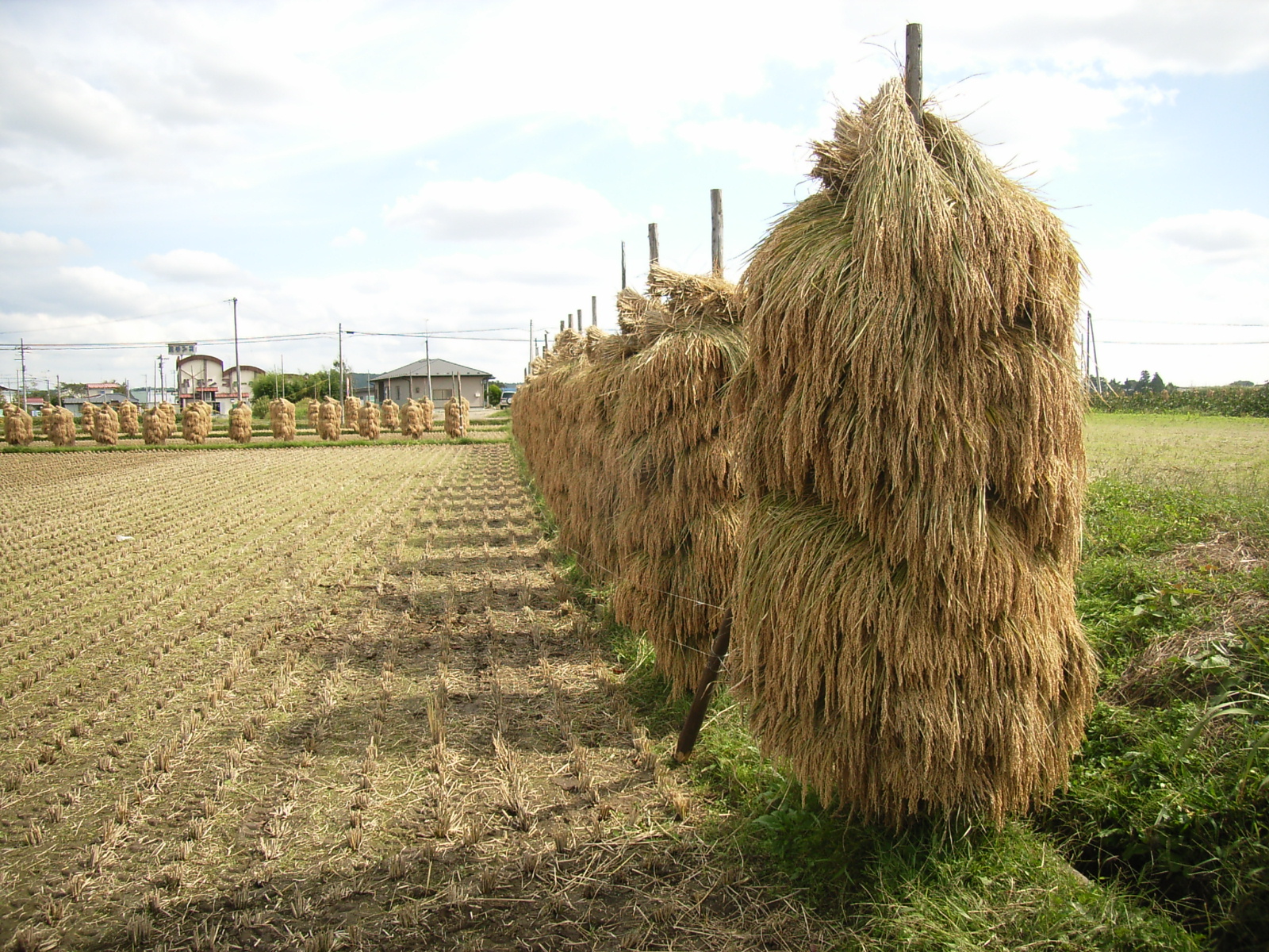
Kurihara is known for its rice production. There are also a number of waterfalls, parks filled with cherry blossoms in spring, and flower gardens. These include: Abazu Gorge, Shiraito Falls, Gorindoyama Park, Hasama River Park, and Sanno Historic Park Iris Garden.
It is also a renowned place for viewing the autumn leaves, especially around Mt. Kurikoma. Kurihara also has an abundance of hot spring resorts. These include: Yu-no-Kura Hot Spring, Yubama Hot Spring, Hanayama Hot Spring, and Nuruyu Hot Spring.
Festivals
- Late March Tohoku Draft Horse Pull Kurikoma Tournament (Kurikoma)
- 1st Sun of April Obasama Festival and Longevity Rites (Kannari)
- Mid-April Izumiya Oyashiki Festival (Semine)
- April 29 Masaoka Festival (Ichihasama)
- Mid-April Cherry Blossom Festivals (all areas)
- May 5 Hanayama Rifle Festival (Hanayama)
- Mid-June Iris Festival (Ichihasama)
- Mid-June Ichihasama Lily Garden Opening (Ichihasama)
- 1st Sun of July Iris Festival and Kagura Sacred Dance (Ichihasama)
- 3rd Sun of July Michinoku Kagura Sacred Dance Festival (Tsukidate)
- Late July Kurikoma Float Parade Festival (Kurikoma)
- August Izunuma-Uchinuma Lotus Festival (Wakayanagi, Tsukidate)
- August 5–6 Tsukidate Tanabata Festival (Tsukidate)
- August 14 Waterwheel (Suisha) Festival (Shiwahime)
- August 15–16 Wakayanagi Summer Festival (Wakayanagi)
- Early October Autumn Lake Festival (Hanayama)
- Oct-Nov Tagaiichi Markets and Festivals
- November 3 Tsukidate Yakushi Festival
- Early Nov Industries Festival
- Dec-Feb Festivals to Beckon and Welcome Spring (all areas)
- Mid-Jan Donto Festivals (all areas)
Noted people from Kurihara
- Yoshiaki Hoshi, musician
- Kōbōyama Daizō, sumo wrestler
- Jun Izumida, professional wrestler
- Yohei "Yoh" Komatsu, Japanese professional wrestler
References
- Kurihara city official statistics(in Japanese)
- Kurihara climate data
- 観測史上1~10位の値(年間を通じての値). JMA. Retrieved March 23, 2022.
- 気象庁 / 平年値(年・月ごとの値). JMA. Retrieved March 23, 2022.
- 観測史上1~10位の値(年間を通じての値). JMA. Retrieved March 23, 2022.
- 気象庁 / 平年値(年・月ごとの値). JMA. Retrieved March 23, 2022.
- Kurihara population statistics
- "伊治城跡 いじじょうあと". Cultural Heritage Online (in Japanese). Agency for Cultural Affairs. Retrieved 25 December 2016.
- "旧有壁宿本陣 きゅうありかべじゅくほんじん". Cultural Heritage Online (in Japanese). Agency for Cultural Affairs. Retrieved 25 December 2016.
- "山王囲遺跡 さんのうがこいいせき". Cultural Heritage Online (in Japanese). Agency for Cultural Affairs. Retrieved 25 December 2016.
- "仙台藩花山村寒湯番所跡 せんだいはんはなやまむらぬるゆばんしゅあと". Cultural Heritage Online (in Japanese). Agency for Cultural Affairs. Retrieved 25 December 2016.
Notes
- former Kurikoma town, the weather station name in Japanese is Japanese: 駒ノ湯
External links
- Official Website (in Japanese)
Sendai (capital) | |||
| Sendai |
| ||
| Cities | |||
| Districts |
| ||
List of mergers in Miyagi Prefecture | |||
На других языках
[de] Kurihara
Kurihara (japanisch .mw-parser-output .Hani{font-size:110%}栗原市, -shi) ist eine Stadt in der Präfektur Miyagi auf Honshū, der Hauptinsel von Japan.- [en] Kurihara, Miyagi
[es] Kurihara (Miyagi)
Kurihara (栗原市, Kurihara-shi?) es una ciudad localizada en la prefectura de Miyagi, Japón. En octubre de 2018 tenía una población de 66.522 habitantes y una densidad de población de 82,6 personas por km². Su área total es de 804,97 km².[ru] Курихара (город)
Курихара (яп. 栗原市 Курихара-си) — город в Японии, находящийся в префектуре Мияги. Площадь города составляет 804,93 км²[1], население — 73 071 человек (31 июля 2014)[2], плотность населения — 90,78 чел./км².Другой контент может иметь иную лицензию. Перед использованием материалов сайта WikiSort.org внимательно изучите правила лицензирования конкретных элементов наполнения сайта.
WikiSort.org - проект по пересортировке и дополнению контента Википедии