world.wikisort.org - Japan
Kiyama (基山町, Kiyama-chō) is a town located in Miyaki District, Saga Prefecture, Japan on the island of Kyūshū. It can be considered part of an economic sphere with nearby cities Tosu in Saga Prefecture and Ogōri and Kurume in Fukuoka Prefecture. Approximately 10 percent of the population of Kiyama works or goes to school in the city of Fukuoka and as such Kiyama can be considered a part of the Fukuoka metropolitan area. It is also known as a commuter town for Kurume. As of March 1, 2017, the town has an estimated population of 17,398.
Kiyama
基山町 | |
|---|---|
Town | |
 Japan National Route 3 from footbridge of Kiyama Station | |
 Flag  Emblem | |
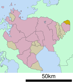 Location of Kiyama in Saga Prefecture | |
 Kiyama Location in Japan | |
| Coordinates: 33°26′N 130°31′E | |
| Country | Japan |
| Region | Kyushu |
| Prefecture | Saga Prefecture |
| District | Miyaki |
| Area | |
| • Total | 22.12 km2 (8.54 sq mi) |
| Population (March 1, 2017) | |
| • Total | 17,398 |
| • Density | 790/km2 (2,000/sq mi) |
| Time zone | UTC+09:00 (JST) |
| City hall address | 666 Ōaza Miyaura, Kiyama-chō, Miyaki-gun, Saga-ken 841-0204 |
| Website | www |
| Symbols | |
| Flower | Azalea |
| Tree | Azalea |
Geography
Kiyama is located on the eastern end of Saga Prefecture. It shares its southern border with Tosu and the rest of the town borders Fukuoka Prefecture.
Adjoining municipalities
History
- April 1, 1889 - The modern municipal system is established and the village of Kiyama is formed.
- January 1, 1939 - Kiyama gains town status.
Education
Public schools
- Kiyama Junior High School (基山町立基山中学校)
- Kiyama Elementary School (基山町立基山小学校)
- Wakaki Elementary School (基山町立若基小学校)
Private schools
- Tōmeikan Junior and Senior High School
Transportation
Air
The closest airport is Fukuoka Airport.
Rail
- JR Kyushu
- Kagoshima Main Line
- Amagi Railway
The main station is Kiyama Station.
Road
- Expressways
- Kyūshū Expressway
- Kiyama Parking Area
- There are no interchanges within the town's borders.
- Kyūshū Expressway
- National highways
- Route 3
- Main prefectural roads
- Tosu-Chikushi Route 17
Scenic and historic places
- Kii Castle (National Historic Landmark)[2]
- Daikōzenji (in the later half of April and the early half of May about 50,000 azaleas are in bloom here)[3]
- Ryūkōtokuji, a temple of Shingon Buddhism
- Araho-jinja, a Shinto shrine[4]
References
- "JRけやき台駅で人身事故 運転再開【佐賀県】(佐賀ニュース サガテレビ)". Yahoo!ニュース (in Japanese). Retrieved 2022-10-21.
- "Kii Castle Ruins - Castle in Kiyama". japan-places.com. Retrieved 2022-10-21.
- 大興善寺契園(ちぎりえん) [The Chigiri-en Garden in Daikōzen-ji Temple] (in Japanese). Daikouzenji. Archived from the original on July 10, 2019. Retrieved August 22, 2018.
- 荒穂神社 / 基山町 [Araho-jinja] (in Japanese). Saga Prefecture. Retrieved September 20, 2019.
External links
 Media related to Kiyama, Saga at Wikimedia Commons
- Kiyama official website (in Japanese)
Saga (capital) | ||
| Special city | ||
| Cities | ||
| Districts | ||
List of mergers in Saga Prefecture | ||
Authority control | |
|---|---|
| General | |
| National libraries | |
На других языках
- [en] Kiyama, Saga
[ru] Кияма
Кияма (яп. 基山町 Кияма-тё:, «Городок у основания горы») — посёлок в Японии, находящийся в уезде Мияки префектуры Сага. Площадь посёлка составляет 22,12 км²[1], население — 17 477 человек (1 августа 2014)[2], плотность населения — 790,10 чел./км².Другой контент может иметь иную лицензию. Перед использованием материалов сайта WikiSort.org внимательно изучите правила лицензирования конкретных элементов наполнения сайта.
WikiSort.org - проект по пересортировке и дополнению контента Википедии