world.wikisort.org - Japan
Kitadaitō (北大東村, Kitadaitō-son) is a village consisting of the islands of Kitadaitōjima and Okidaitōjima of Shimajiri District, Okinawa Prefecture, Japan.
Kitadaitō
北大東村 | |
|---|---|
Village | |
 Kitadaitō landscape | |
 Flag  Emblem | |
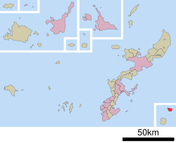 Location of Kitadaitō in Okinawa Prefecture | |
 Kitadaitō Location in Japan | |
| Coordinates: 25°56′45″N 131°17′56″E | |
| Country | Japan |
| Region | Kyushu (Ryukyu) |
| Prefecture | Okinawa Prefecture |
| District | Shimajiri |
| Government | |
| • Mayor | Mitsumasa Miyagi |
| Area | |
| • Total | 13.10 km2 (5.06 sq mi) |
| Population (October 1, 2016) | |
| • Total | 615 |
| • Density | 47/km2 (120/sq mi) |
| Time zone | UTC+09:00 (JST) |
| City hall address | 218 Aza Nakano, Kitadaitō-son, Shimajiri-gun, Okinawa-ken 901-3992 |
| Climate | Af |
| Website | vill |
| Symbols | |
| Flower | Crinum asiaticum |
| Tree | Livistona |
As of October 2016, the village has an estimated population of 615 and a density of 47 persons per km2. The total area is 13.10 km2. All of the inhabitants live on Kitadaitōjima.
Climate
Kitadaitō has a tropical rainforest climate (Köppen climate classification Af) with very warm summers and mild winters. Precipitation is significant throughout the year; the wettest month is June and the driest month is February. The island is subject to frequent typhoons.
| Climate data for Kitadaitō (2003−2020 normals, extremes 2003−present) | |||||||||||||
|---|---|---|---|---|---|---|---|---|---|---|---|---|---|
| Month | Jan | Feb | Mar | Apr | May | Jun | Jul | Aug | Sep | Oct | Nov | Dec | Year |
| Record high °C (°F) | 26.4 (79.5) |
27.0 (80.6) |
27.8 (82.0) |
29.6 (85.3) |
32.4 (90.3) |
33.1 (91.6) |
33.8 (92.8) |
34.5 (94.1) |
34.9 (94.8) |
32.3 (90.1) |
30.3 (86.5) |
28.3 (82.9) |
34.9 (94.8) |
| Average high °C (°F) | 20.9 (69.6) |
21.2 (70.2) |
22.3 (72.1) |
24.3 (75.7) |
26.9 (80.4) |
29.7 (85.5) |
31.8 (89.2) |
31.9 (89.4) |
31.2 (88.2) |
29.1 (84.4) |
26.1 (79.0) |
22.5 (72.5) |
26.5 (79.7) |
| Daily mean °C (°F) | 18.5 (65.3) |
18.8 (65.8) |
19.6 (67.3) |
21.6 (70.9) |
24.4 (75.9) |
27.1 (80.8) |
29.1 (84.4) |
29.2 (84.6) |
28.5 (83.3) |
26.5 (79.7) |
23.7 (74.7) |
20.3 (68.5) |
23.9 (75.1) |
| Average low °C (°F) | 16.2 (61.2) |
16.5 (61.7) |
17.5 (63.5) |
19.5 (67.1) |
22.3 (72.1) |
25.2 (77.4) |
26.9 (80.4) |
27.0 (80.6) |
26.3 (79.3) |
24.5 (76.1) |
21.8 (71.2) |
18.2 (64.8) |
21.8 (71.3) |
| Record low °C (°F) | 8.6 (47.5) |
8.2 (46.8) |
9.9 (49.8) |
12.0 (53.6) |
15.9 (60.6) |
20.0 (68.0) |
22.5 (72.5) |
23.4 (74.1) |
20.8 (69.4) |
18.2 (64.8) |
14.8 (58.6) |
10.8 (51.4) |
8.2 (46.8) |
| Average precipitation mm (inches) | 67.1 (2.64) |
65.7 (2.59) |
70.5 (2.78) |
112.6 (4.43) |
210.5 (8.29) |
206.4 (8.13) |
79.4 (3.13) |
126.1 (4.96) |
145.1 (5.71) |
175.8 (6.92) |
104.7 (4.12) |
105.1 (4.14) |
1,469 (57.83) |
| Average precipitation days (≥ 1.0 mm) | 8.5 | 7.2 | 6.6 | 7.7 | 10.8 | 10.1 | 6.7 | 10.2 | 10.1 | 10.4 | 8.2 | 9.2 | 105.7 |
| Source: Japan Meteorological Agency[1][2] | |||||||||||||
History
Kitadaitōjima remained uninhabited until formally claimed by the Empire of Japan in 1885. In 1900, a team of pioneers from Hachijōjima became the first human inhabitants of the island, and started the cultivation of sugar cane from 1903. Until World War II, Kitadaitōjima was owned in its entirety by Dai Nippon Sugar (now Dai Nippon Meiji Sugar), which also operated mines for the extraction of guano for use in fertilizer. After World War II, the island was occupied by the United States. The village of Kitadaitō was established in 1946. The island was returned to Japan in 1972.
Economy

Formerly heavily dependent on phosphate mining, the village economy is now based on cultivation of sugar cane, commercial fishing, and seasonal tourism. There is no port on the island and ships must be loaded/offloaded by crane.
Transport
The island has an airport, Kitadaito Airport, with one flight a day to Minami-Daito Airport
Education
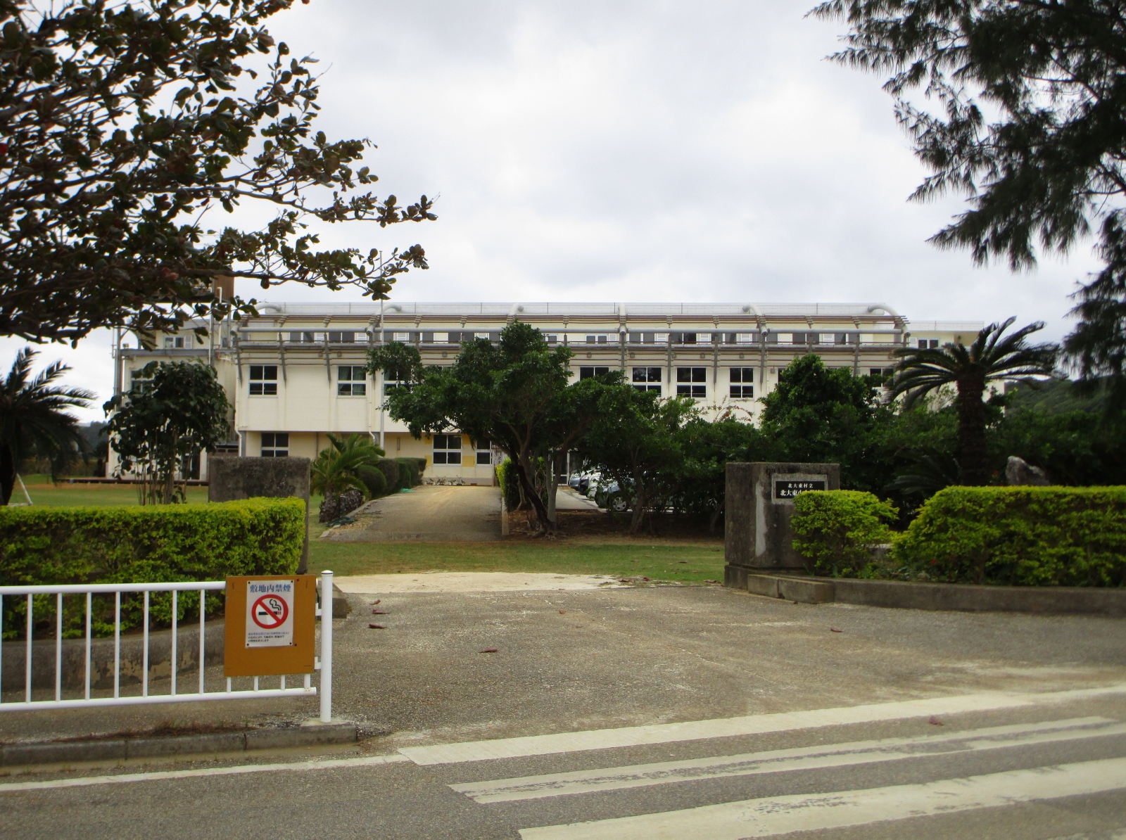
There is the Kitadaito Village Kitadaito Elementary-Junior High School (北大東村立北大東小中学校 Kitadaitō Sonritsu Kitadaitō Shōchūgakkō) and the Kitadaito Village Kitadaito Kindergarten (北大東村立北大東幼稚園 Kitadaitō Sonritsu Kitadaitō Yōchien).[3]
References
- 観測史上1~10位の値(年間を通じての値). JMA. Retrieved March 17, 2022.
- 気象庁 / 平年値(年・月ごとの値). JMA. Retrieved March 17, 2022.
- "教育 Archived 2014-05-29 at the Wayback Machine" (Education) (Archive). Village of Kitadaito. Retrieved on May 29, 2014.
External links
![]() Media related to Kitadaitō, Okinawa at Wikimedia Commons
Media related to Kitadaitō, Okinawa at Wikimedia Commons
- Kitadaitō official website (in Japanese)
- Kitadaito Elementary-Junior High School (in Japanese)
 Kitadaito travel guide from Wikivoyage
Naha (capital) | ||
| Core city |
| |
| Cities |
| |
| Districts |
| |
List of mergers in Okinawa Prefecture
| ||
На других языках
- [en] Kitadaitō, Okinawa
[ru] Китадайто (село)
Китадайто (яп. 北大東村 Китадайто:-сон) — село в Японии, находящееся в уезде Симадзири префектуры Окинава. Площадь села составляет 13,10 км²[1], население — 680 человек (1 августа 2014)[2], плотность населения — 51,91 чел./км².Другой контент может иметь иную лицензию. Перед использованием материалов сайта WikiSort.org внимательно изучите правила лицензирования конкретных элементов наполнения сайта.
WikiSort.org - проект по пересортировке и дополнению контента Википедии