world.wikisort.org - Japan
Fujikawa (富士川町, Fujikawa-chō) is a town located in Yamanashi Prefecture, Japan. As of 1 June 2019[update], the town had an estimated population of 15,125 in 6323 households,[1] and a population density of 140 persons per km2. The total area of the town is 111.98 square kilometres (43.24 sq mi). .
Fujikawa
富士川町 | |
|---|---|
Town | |
 Oboshi Park in Fujikawa Town | |
 Flag  Seal | |
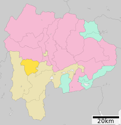 Location of Fujikawa in Yamanashi Prefecture | |
 Fujikawa | |
| Coordinates: 35°33′40″N 138°27′41″E | |
| Country | Japan |
| Region | Chūbu Tōkai |
| Prefecture | Yamanashi Prefecture |
| District | Minamikoma |
| Area | |
| • Total | 111.98 km2 (43.24 sq mi) |
| Population (June 1, 2019) | |
| • Total | 15,125 |
| • Density | 140/km2 (350/sq mi) |
| Time zone | UTC+9 (Japan Standard Time) |
| Phone number | 0556-22-1111 |
| Address | 1134 Tenjinnakajo Fujkawa-cho Minimikoma-gun, Yamanashi-ken 400-0592 |
| Website | Official website |

Geography
Fujikawa is in the southwestern in Yamanashi Prefecture, bordered by the 2000-meter Kushigatayama to the west, and the Fuji River to the east. In terms of land use, 81% of the town area is forested.
Neighboring municipalities
Yamanashi Prefecture
- Minami-Alps
- Minobu
- Hayakawa
- Ichikawamisato
Demographics
Per Japanese census data,[2] the population of Fujikawa has gradually decreased over the past 40 years.
| Year | Pop. | ±% |
|---|---|---|
| 1960 | 21,558 | — |
| 1970 | 19,864 | −7.9% |
| 1980 | 18,815 | −5.3% |
| 1990 | 18,170 | −3.4% |
| 2000 | 17,544 | −3.4% |
| 2010 | 16,225 | −7.5% |
Climate
The town has a climate characterized by characterized by hot and humid summers, and relatively mild winters (Köppen climate classification Cfa). The average annual temperature in Fujikawa is 13.7 °C. The average annual rainfall is 1415 mm with September as the wettest month. The temperatures are highest on average in August, at around 25.9 °C, and lowest in January, at around 2.0 °C.[3]
History
During the Edo period, all of Kai Province was tenryō territory under direct control of the Tokugawa shogunate. During the cadastral reform of the early Meiji period on April 1, 1889, Minamikoma District within Yamanashi Prefecture was created and organized into 22 villages. Kajikazawa village was raised to town status on August 1, 1898 and Masuho on April 3, 1951.
In 2003, a proposal was raised to merge the towns of Masuho and Kajikazawa with the towns of Ichikawadaimon, Mitama and Rokugō from Nishiyatsushiro District into a new city, or to merge with neighboring Minami-Alps. The proposal was not successful, and instead the three towns in Nishiyatsushiro merged to form Ichikawamisato on October 1, 2005, whereas Masuho and Kajikazawa merged to form Fujikawa on March 8, 2010.
Economy
The economy of Fujikawa is primarily based on forestry and agriculture.
Education
Fujikawa has three public elementary schools and two public junior high schools operated by the town government. The town does not have a high school.
Transportation
Railway
The town has no passenger rail service. The nearest train stations are Kajikazawaguchi Station or Ichikawa-Daimon Station in Ichikawamisato, Yamanashi.
Highway
 Chūbu-Ōdan Expressway
 National Route 52
 National Route 140
Notable people from Fujikawa
- Kunio Yonenaga – shogi master
- Masaki Fukai – professional football player
- Yu Hasegawa – professional football player
- Yoshifumi Kashiwa – professional football player
References
External links
![]() Media related to Fujikawa, Yamanashi at Wikimedia Commons
Media related to Fujikawa, Yamanashi at Wikimedia Commons
- Official Website (in Japanese)
Kōfu (capital) | ||
| Core city |
| |
| Cities |
| |
| Districts |
| |
List of mergers in Yamanashi Prefecture | ||
Authority control | |
|---|---|
| General | |
| National libraries | |
На других языках
- [en] Fujikawa, Yamanashi
[ru] Фудзикава
Фудзикава (яп. 富士川町 Фудзикава-тё:) — посёлок в Японии, находящийся в уезде Минамикома префектуры Яманаси. Площадь посёлка составляет 111,98 км²[1], население — 15 494 человека (1 августа 2014)[2], плотность населения — 138,36 чел./км².Другой контент может иметь иную лицензию. Перед использованием материалов сайта WikiSort.org внимательно изучите правила лицензирования конкретных элементов наполнения сайта.
WikiSort.org - проект по пересортировке и дополнению контента Википедии