world.wikisort.org - Japan
Asahi (朝日町, Asahi-chō) was a town located in Kamikawa (Teshio) District, Kamikawa Subprefecture, Hokkaido, Japan.
This article may be expanded with text translated from the corresponding article in Japanese. (June 2022) Click [show] for important translation instructions.
|
Asahi
朝日町 | |
|---|---|
Town | |
 Flag  Emblem | |
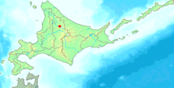 Location of Asahi in Hokkaido (Kamikawa Subprefecture) | |
 Asahi Location in Japan | |
| Coordinates: 44°7′N 142°35′E | |
| Country | Japan |
| Region | Hokkaido |
| Prefecture | Hokkaido (Kamikawa Subprefecture) |
| Now part of Shibetsu | September 1, 2005 |
| Area | |
| • Total | 522.01 km2 (201.55 sq mi) |
| Population (2004) | |
| • Total | 1,799 |
| • Density | 3.45/km2 (8.9/sq mi) |
| Time zone | UTC+09:00 (JST) |
| City hall address | 10 of 4040 Central, Asahi-cho, Kamikawa-gun, Hokkaido 095-0492 |
| Website | web |
| Symbols | |
| Flower | Rhododendron dauricum |
| Tree | Picea glehnii |
As of 2004, the town had an estimated population of 1,799 and a density of 3.45 persons per km2. The total area was 522.01 km2.
On September 1, 2005, Asahi was merged into the expanded city of Shibetsu.
History
- 1949: Asahi village was split from Kamishibetsu village (now Shibetsu city).
- 1962: Asahi village became a town.
- 2005: Asahi village merged with Shibetsu city.
Climate
| Climate data for Asahi, Hokkaido (1991−2020 normals, extremes 1977−present) | |||||||||||||
|---|---|---|---|---|---|---|---|---|---|---|---|---|---|
| Month | Jan | Feb | Mar | Apr | May | Jun | Jul | Aug | Sep | Oct | Nov | Dec | Year |
| Record high °C (°F) | 8.3 (46.9) |
12.5 (54.5) |
15.8 (60.4) |
26.6 (79.9) |
32.8 (91.0) |
36.4 (97.5) |
36.9 (98.4) |
37.2 (99.0) |
32.0 (89.6) |
25.6 (78.1) |
20.3 (68.5) |
12.4 (54.3) |
37.2 (99.0) |
| Average high °C (°F) | −3.9 (25.0) |
−2.8 (27.0) |
1.8 (35.2) |
9.4 (48.9) |
17.5 (63.5) |
22.1 (71.8) |
25.6 (78.1) |
25.6 (78.1) |
21.2 (70.2) |
13.9 (57.0) |
5.3 (41.5) |
−1.6 (29.1) |
11.2 (52.1) |
| Daily mean °C (°F) | −8.0 (17.6) |
−7.4 (18.7) |
−2.9 (26.8) |
3.9 (39.0) |
10.9 (51.6) |
15.8 (60.4) |
19.7 (67.5) |
20.0 (68.0) |
15.2 (59.4) |
8.3 (46.9) |
1.5 (34.7) |
−5.0 (23.0) |
6.0 (42.8) |
| Average low °C (°F) | −13.2 (8.2) |
−13.3 (8.1) |
−8.5 (16.7) |
−1.6 (29.1) |
4.5 (40.1) |
10.1 (50.2) |
14.8 (58.6) |
15.4 (59.7) |
10.0 (50.0) |
3.4 (38.1) |
−2.3 (27.9) |
−9.3 (15.3) |
0.8 (33.5) |
| Record low °C (°F) | −28.8 (−19.8) |
−29.0 (−20.2) |
−27.0 (−16.6) |
−14.7 (5.5) |
−4.8 (23.4) |
−0.7 (30.7) |
3.5 (38.3) |
4.6 (40.3) |
0.1 (32.2) |
−5.8 (21.6) |
−17.1 (1.2) |
−26.3 (−15.3) |
−29.0 (−20.2) |
| Average precipitation mm (inches) | 48.2 (1.90) |
37.1 (1.46) |
47.3 (1.86) |
49.4 (1.94) |
69.5 (2.74) |
73.1 (2.88) |
139.2 (5.48) |
149.1 (5.87) |
151.0 (5.94) |
123.1 (4.85) |
104.8 (4.13) |
76.2 (3.00) |
1,067.9 (42.04) |
| Average precipitation days (≥ 1.0 mm) | 17.2 | 13.8 | 14.5 | 11.6 | 11.5 | 9.7 | 11.3 | 11.9 | 13.5 | 16.4 | 19.0 | 20.0 | 170.4 |
| Mean monthly sunshine hours | 59.5 | 77.8 | 117.3 | 154.4 | 193.1 | 172.5 | 166.1 | 156.4 | 151.2 | 118.6 | 53.3 | 38.1 | 1,460.6 |
| Source: JMA[1][2] | |||||||||||||
References
- 観測史上1~10位の値(年間を通じての値). JMA. Retrieved March 1, 2022.
- 気象庁 / 平年値(年・月ごとの値). JMA. Retrieved March 1, 2022.
External links
- Shibetsu official website (in Japanese)
This Hokkaidō location article is a stub. You can help Wikipedia by expanding it. |
Текст в блоке "Читать" взят с сайта "Википедия" и доступен по лицензии Creative Commons Attribution-ShareAlike; в отдельных случаях могут действовать дополнительные условия.
Другой контент может иметь иную лицензию. Перед использованием материалов сайта WikiSort.org внимательно изучите правила лицензирования конкретных элементов наполнения сайта.
Другой контент может иметь иную лицензию. Перед использованием материалов сайта WikiSort.org внимательно изучите правила лицензирования конкретных элементов наполнения сайта.
2019-2026
WikiSort.org - проект по пересортировке и дополнению контента Википедии
WikiSort.org - проект по пересортировке и дополнению контента Википедии