world.wikisort.org - Italy
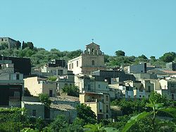
Ferla (Sicilian: A Ferra) is a town and comune in the Province of Syracuse, Sicily (southern Italy).
This article may be expanded with text translated from the corresponding article in Italian. (January 2022) Click [show] for important translation instructions.
|
Ferla | |
|---|---|
Comune | |
| Comune di Ferla | |
 Ferla | |
Location of Ferla  | |
 Ferla Location of Ferla in Italy  Ferla Ferla (Sicily) | |
| Coordinates: 37°7′N 14°57′E | |
| Country | Italy |
| Region | Sicily |
| Province | Syracuse (SR) |
| Government | |
| • Mayor | Michelangelo Giansiracusa (Action) |
| Area | |
| • Total | 24.9 km2 (9.6 sq mi) |
| Elevation | 556 m (1,824 ft) |
| Population (30 November 2017)[2] | |
| • Total | 2,450 |
| • Density | 98/km2 (250/sq mi) |
| Demonym(s) | Ferlesi |
| Time zone | UTC+1 (CET) |
| • Summer (DST) | UTC+2 (CEST) |
| Postal code | 96010 |
| Dialing code | 0931 |
| Patron saint | Saint Sebastian |
| Saint day | 20 July |
| Website | Official website |
The Necropolis of Pantalica, part of the UNESCO World Heritage Site of "Syracuse and the Rocky Necropolis of Pantalica" is situated between Ferla and Sortino.
References
- "Superficie di Comuni Province e Regioni italiane al 9 ottobre 2011". Italian National Institute of Statistics. Retrieved 16 March 2019.
- All demographics and other statistics from the Italian statistical institute (Istat)
На других языках
- [en] Ferla
[ru] Ферла
Ферла (итал. Ferla) — коммуна в Италии, располагается в регионе Сицилия, подчиняется административному центру Сиракуза.Текст в блоке "Читать" взят с сайта "Википедия" и доступен по лицензии Creative Commons Attribution-ShareAlike; в отдельных случаях могут действовать дополнительные условия.
Другой контент может иметь иную лицензию. Перед использованием материалов сайта WikiSort.org внимательно изучите правила лицензирования конкретных элементов наполнения сайта.
Другой контент может иметь иную лицензию. Перед использованием материалов сайта WikiSort.org внимательно изучите правила лицензирования конкретных элементов наполнения сайта.
2019-2025
WikiSort.org - проект по пересортировке и дополнению контента Википедии
WikiSort.org - проект по пересортировке и дополнению контента Википедии