world.wikisort.org - Italy
Carpaneto Piacentino (Piacentino: Carpané) is a comune (municipality) in the Province of Piacenza in the Italian region of Emilia-Romagna, located about 130 kilometres (81 mi) northwest of Bologna and about 15 kilometres (9 mi) southeast of Piacenza.
Carpaneto Piacentino | |
|---|---|
Comune | |
| Comune di Carpaneto Piacentino | |
 | |
 Coat of arms | |
Location of Carpaneto Piacentino  | |
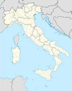  Carpaneto Piacentino Location of Carpaneto Piacentino in Italy  Carpaneto Piacentino Carpaneto Piacentino (Emilia-Romagna) | |
| Coordinates: 44°55′N 9°47′E | |
| Country | Italy |
| Region | Emilia-Romagna |
| Province | Piacenza (PC) |
| Frazioni | Zena, Celleri, Ciriano, Chero, Cimafava, Viustino, Travazzano, Badagnano, Rezzano, Magnano, Montanaro |
| Government | |
| • Mayor | Andrea Arfani |
| Area | |
| • Total | 63.2 km2 (24.4 sq mi) |
| Elevation | 400 m (1,300 ft) |
| Population (31 May 2017)[2] | |
| • Total | 7,740 |
| • Density | 120/km2 (320/sq mi) |
| Demonym(s) | Carpanetesi |
| Time zone | UTC+1 (CET) |
| • Summer (DST) | UTC+2 (CEST) |
| Postal code | 29013 |
| Dialing code | 0523 |


Sights include the Badagnano Castle and the Olmeto Castle, both located in the frazione of Badagnano.
Carpaneto Piacentino borders the following municipalities: Cadeo, Castell'Arquato, Fiorenzuola d'Arda, Gropparello, Lugagnano Val d'Arda, Pontenure, San Giorgio Piacentino.
References
- "Superficie di Comuni Province e Regioni italiane al 9 ottobre 2011". Italian National Institute of Statistics. Retrieved 16 March 2019.
- All demographics and other statistics: Italian statistical institute Istat.
External links
Emilia-Romagna · Comuni of the Province of Piacenza | ||
|---|---|---|
|  | |
| Authority control |
|
|---|

На других языках
- [en] Carpaneto Piacentino
[es] Carpaneto Piacentino
Carpaneto Piacentino es un municipio situado en el territorio de la Provincia de Piacenza, en Emilia-Romaña, (Italia).[ru] Карпането-Пьячентино
Карпането-Пьячентино (итал. Carpaneto Piacentino) — коммуна в Италии, располагается в регионе Эмилия-Романья, подчиняется административному центру Пьяченца.Текст в блоке "Читать" взят с сайта "Википедия" и доступен по лицензии Creative Commons Attribution-ShareAlike; в отдельных случаях могут действовать дополнительные условия.
Другой контент может иметь иную лицензию. Перед использованием материалов сайта WikiSort.org внимательно изучите правила лицензирования конкретных элементов наполнения сайта.
Другой контент может иметь иную лицензию. Перед использованием материалов сайта WikiSort.org внимательно изучите правила лицензирования конкретных элементов наполнения сайта.
2019-2026
WikiSort.org - проект по пересортировке и дополнению контента Википедии
WikiSort.org - проект по пересортировке и дополнению контента Википедии