world.wikisort.org - Italy
Barbania is a comune (municipality) in the Metropolitan City of Turin in the Italian region Piedmont, located about 25 kilometres (16 mi) north of Turin. It is in the middle of the Malone river plain.
Barbania | |
|---|---|
Comune | |
| Comune di Barbania | |
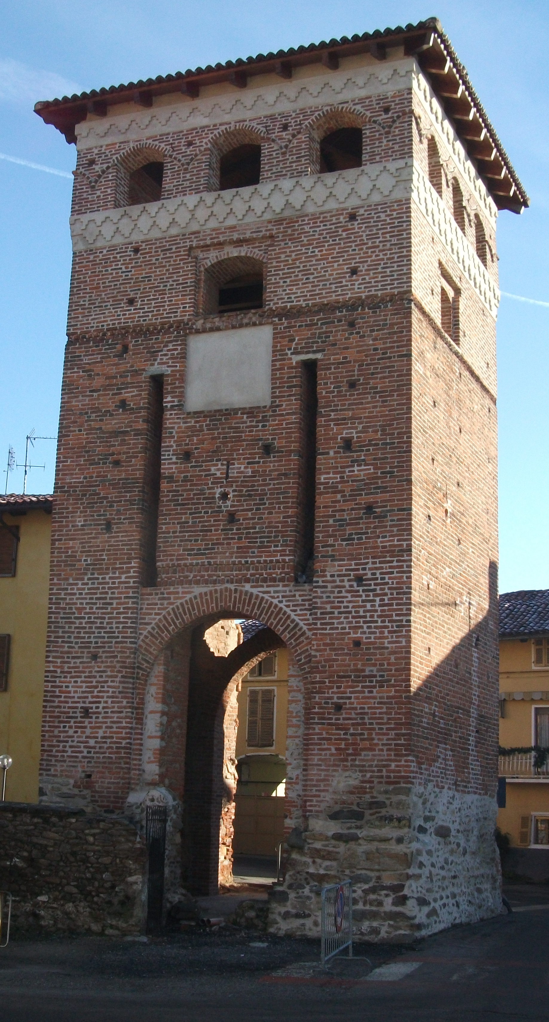 The surviving entrance to the medieval ricetto or fortress | |
 Coat of arms | |
Location of Barbania  | |
 Barbania Location of Barbania in Italy  Barbania Barbania (Piedmont) | |
| Coordinates: 45°18′N 7°38′E | |
| Country | Italy |
| Region | Piedmont |
| Metropolitan city | Turin (TO) |
| Frazioni | Boschi, Colli, Fandaglia, Gianotti, Perrero, Piana, Seita, Vignali, Zaccaria |
| Government | |
| • Mayor | Giuseppe Drovetti |
| Area | |
| • Total | 12.80 km2 (4.94 sq mi) |
| Elevation | 385 m (1,263 ft) |
| Population (1-1-2017)[2] | |
| • Total | 1,603 |
| • Density | 130/km2 (320/sq mi) |
| Demonym(s) | Barbaniesi |
| Time zone | UTC+1 (CET) |
| • Summer (DST) | UTC+2 (CEST) |
| Postal code | 10070 |
| Dialing code | 011 |
| Website | Official website |
Barbania borders the following municipalities: Rivara, Busano, Rocca Canavese, Levone, and Vauda Canavese. It originates from a Salassi Celtic village founded around the late 5th century BC. In the Middle Ages it was a free commune (11th century), until it was conquered by Philip I of Piedmont in 1305; thenceforth its history is connected with the Duchy of Savoy.
References
- "Superficie di Comuni Province e Regioni italiane al 9 ottobre 2011". Italian National Institute of Statistics. Retrieved 16 March 2019.
- All demographics and other statistics: Italian statistical institute Istat.
Authority control | |
|---|---|
| General |
|
| National libraries | |
This article on a location in the Province of Turin is a stub. You can help Wikipedia by expanding it. |
На других языках
- [en] Barbania
[ru] Барбания
Барбания (итал. Barbania, пьем. Barbanià) — коммуна в Италии, располагается в регионе Пьемонт, в провинции Турин.Текст в блоке "Читать" взят с сайта "Википедия" и доступен по лицензии Creative Commons Attribution-ShareAlike; в отдельных случаях могут действовать дополнительные условия.
Другой контент может иметь иную лицензию. Перед использованием материалов сайта WikiSort.org внимательно изучите правила лицензирования конкретных элементов наполнения сайта.
Другой контент может иметь иную лицензию. Перед использованием материалов сайта WikiSort.org внимательно изучите правила лицензирования конкретных элементов наполнения сайта.
2019-2026
WikiSort.org - проект по пересортировке и дополнению контента Википедии
WikiSort.org - проект по пересортировке и дополнению контента Википедии