world.wikisort.org - Israel
Kfar Sirkin or Kefar Syrkin (Hebrew: כְּפַר סִירְקִין) is a moshav in central Israel. Located south-east of Petah Tikva, it falls under the jurisdiction of Drom HaSharon Regional Council. In 2019 it had a population of 1,502.[1]
Kfar Sirkin
כְּפַר סִירְקִין | |
|---|---|
 | |
 Kfar Sirkin | |
| Coordinates: 32°4′36″N 34°55′25″E | |
| Country | Israel |
| District | Central |
| Council | Southern Sharon |
| Founded | 1933 |
| Population (2019)[1] | 1,502 |
| Website | http://www.kfarsirkin.org.il/ |
History
Kfar Sirkin was founded in 1933 and was named for the Zionist leader Nachman Syrkin. It served as a Jewish stronghold during the 1936–1939 Arab revolt in Palestine, with the Haganah using the village to fight off attacking Arab forces and to store weapons which were illegal under the British Mandate rule of the time.
Today, the village is agricultural. An Israel Defense Forces military base, and former RAF airfield, is located to the north-west of the village.
Gallery
 Local synagogue
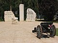 Memorial to residents who fell in the line of duty
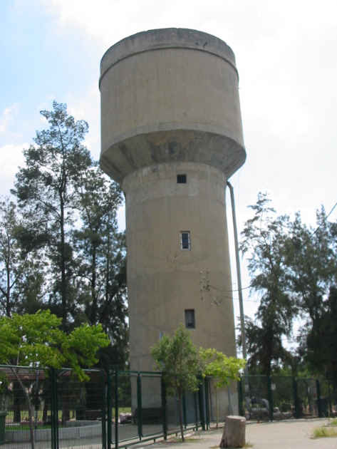
 Water tower
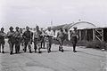 Kfar Sirkin base 16 June 1948


References
- "Population in the Localities 2019" (XLS). Israel Central Bureau of Statistics. Retrieved 16 August 2020.
External links
Authority control | |
|---|---|
| General | |
| National libraries | |
This geography of Israel article is a stub. You can help Wikipedia by expanding it. |
На других языках
- [en] Kfar Sirkin
[ru] Кфар-Сиркин
Кфар-Сиркин[1], Кефар-Сиркин[2] (ивр. כפר סירקין[3]) — мошав в центральной части Израиля вблизи от Петах-Тиквы, административно принадлежащий к региональному совету Дром-ха-Шарон. Кфар-Сиркин, основанный в 1936 году, служил аванпостом еврейских сил в ходе арабского восстания 1936—1939 годов, а затем Войны за независимость Израиля.Другой контент может иметь иную лицензию. Перед использованием материалов сайта WikiSort.org внимательно изучите правила лицензирования конкретных элементов наполнения сайта.
WikiSort.org - проект по пересортировке и дополнению контента Википедии