world.wikisort.org - Ireland
Wicklow (/ˈwɪkloʊ/ WIK-loh; Irish: Cill Mhantáin [ˌciːl̠ʲ ˈwan̪ˠt̪ˠaːnʲ], meaning 'church of the toothless one'; Old Norse: Víkingaló) is the county town of County Wicklow in Ireland. It is located south of Dublin on the east coast of the island. According to the 2016 census, it has a population of 10,584. The town is to the east of the M11 route between Dublin and Wexford. It also has railway links to Dublin, Wexford, Arklow, and Rosslare Europort. There is also a commercial port for timber and textile imports. The River Vartry is the main river flowing through the town.
Wicklow
Cill Mhantáin | |
|---|---|
Town | |
 Parnell Bridge over the River Vartry in Wicklow | |
 Coat of arms | |
 Wicklow Location in Ireland | |
| Coordinates: 52.9779°N 6.033°W | |
| Country | Ireland |
| Province | Leinster |
| County | County Wicklow |
| Elevation | 69 m (226 ft) |
| Population (2016) | |
| • Total | 10,584 |
| Time zone | UTC±0 (WET) |
| • Summer (DST) | UTC+1 (IST) |
| Eircode routing key | A67 |
| Telephone area code | +353(0)404 |
| Irish Grid Reference | T312940 |
| Website | www |
Geography

Wicklow town forms a rough semicircle around Wicklow harbour. To the immediate north lies 'The Murrough', a grassy walking area beside the sea, and the eastern coastal strip. The Murrough is a place of growing commercial use, so much so that a road by-passing the town directly to the commercial part of the area commenced construction in 2008 and was completed in summer of 2010.[citation needed] The eastern coastal strip includes Wicklow bay, a crescent shaped stone beach approximately 10 km in length.
Ballyguile Hill is to the southwest of the town. Much of the housing developments of the 1970s and 1980s occurred in this area, despite the considerable gradient from the town centre. From Wicklow the land rises into rolling hills to the west, going on to meet the Wicklow Mountains in the centre of the county. The dominant feature to the south is the rocky headlands of Bride's Head and Wicklow Head, the easternmost mainland point of the Republic of Ireland. On a very clear day, it is possible to see the Snowdonia mountain range in Wales.
Climate
Similar to much of the rest of northwestern Europe, Wicklow experiences a maritime climate (Cfb) with cool summers, mild winters, and a lack of temperature extremes. The average maximum January temperature is 9.2 °C (48.6 °F), while the average maximum July temperature is 20.4 °C (68.7 °F). On average, the sunniest month is May. The wettest month is October with 118.9 mm (4.6 in) of rain, and the driest month is April with 60.7 mm (2.4 in). With the exceptions of October and November, rainfall is evenly distributed throughout the year with rainfall falling within a relatively narrow band of between 60 mm (2.4 in) and 86 mm (3.4 in) for any one month. A considerable spike of moisture occurs in October and November, each of which records almost double the typical rainfall of April.
Wicklow is sheltered from moisture locally by Ballyguile hill and, more distantly by the Wicklow mountains. This causes the town to receive only about 60% of the rainfall the west coast receives. In addition, because Wicklow is protected by the mountains from southwesterly and westerly winds, it enjoys higher average temperatures than much of Ireland. While its location is favourable for protection against the prevailing westerly and southwesterly winds that are common to much of Ireland, Wicklow is particularly exposed to easterly winds. As these winds come from the northern European landmass Wicklow can, along with much of the east coast of Ireland, experience relatively sharp temperature drops in winter for short periods.
| Climate data for Ashford, Co. Wicklow, 12 mAOD | |||||||||||||
|---|---|---|---|---|---|---|---|---|---|---|---|---|---|
| Month | Jan | Feb | Mar | Apr | May | Jun | Jul | Aug | Sep | Oct | Nov | Dec | Year |
| Average high °C (°F) | 9.2 (48.6) |
9.4 (48.9) |
11.2 (52.2) |
12.8 (55.0) |
15.7 (60.3) |
18.7 (65.7) |
20.4 (68.7) |
19.8 (67.6) |
18.1 (64.6) |
14.9 (58.8) |
11.6 (52.9) |
9.6 (49.3) |
14.3 (57.7) |
| Daily mean °C (°F) | 6.1 (43.0) |
6.1 (43.0) |
7.1 (44.8) |
8.8 (47.8) |
11.4 (52.5) |
14.0 (57.2) |
15.6 (60.1) |
15.5 (59.9) |
13.9 (57.0) |
11.3 (52.3) |
8.2 (46.8) |
6.4 (43.5) |
10.4 (50.7) |
| Average low °C (°F) | 2.9 (37.2) |
2.8 (37.0) |
3.4 (38.1) |
4.7 (40.5) |
6.9 (44.4) |
9.5 (49.1) |
11.3 (52.3) |
11.2 (52.2) |
10.0 (50.0) |
7.4 (45.3) |
4.8 (40.6) |
3.1 (37.6) |
6.5 (43.7) |
| Average rainfall mm (inches) | 86 (3.4) |
61.8 (2.43) |
63.6 (2.50) |
60.7 (2.39) |
65.8 (2.59) |
72.1 (2.84) |
67 (2.6) |
69.8 (2.75) |
72.1 (2.84) |
118.9 (4.68) |
110.9 (4.37) |
85.6 (3.37) |
935 (36.8) |
| Average precipitation days (≥ 1 mm) | 14 | 10 | 9 | 10 | 10 | 10 | 10 | 10 | 9 | 13 | 13 | 11 | 129 |
| Mean monthly sunshine hours | 68.0 | 83.2 | 136.8 | 180.4 | 204.0 | 197.7 | 171.0 | 158.5 | 135.9 | 103.3 | 77.7 | 65.9 | 1,582.4 |
| Source 1: Met Éireann[1] | |||||||||||||
| Source 2: Ashford Weather Station[2] | |||||||||||||
Economy
Since 1995, the town has undergone significant change and expansion reflecting the simultaneous growth in the Irish economy.[citation needed] Residential developments have taken place to the west of the town along Marlton Road (R751). More recently,[when?] housing developments have been concentrated to the northwest of the town towards the neighbouring village of Rathnew. The completion of the Ashford/Rathnew bypass in 2004 meant that Wicklow is now linked to Dublin (42 km north) by dual carriageway and motorway. These factors have led to a steady growth in population of Wicklow and its surrounding townlands while its importance as a commuter town to Dublin increases.[citation needed]
Toponymy
Earlier spellings of the town's name include Wykinglo in the late 12th century, and Wykinglowe in the 14th century.[3][4]
The name is usually explained as coming from the Old Norse words Víkingr ("Viking") and ló ("meadow"), that is to say "the Vikings' meadow". Swedish toponymist Magne Oftedal[5] criticizes this, saying that -ló was never used outside Scandinavia nor in such a combination. He argues that the first element is Uikar- or Uik- ("bay"), and that the intermediate -n- of the old forms is a mistake by clerks. However, all early recorded forms show this -n-. For this reason, Liam Price[6] and A. Sommerfelt[7] derive it from Víkinga-ló ("the Vikings' meadow").
Nevertheless, the Irish patronymics Ó hUiginn and Mac Uiginn (anglicised O'Higgins and Maguigan) could bring a key for the meaning "Meadow of a man called Viking".[8][clarification needed]
The origin of the Irish name Cill Mhantáin bears no relation to the name Wicklow. It has an interesting folklore of its own. Saint Patrick and some followers are said to have tried to land on Travailahawk beach, which is to the south of the harbour. Hostile locals attacked them, causing one of Patrick's party to lose his front teeth. Manntach ("toothless one"), as he became known, was undeterred; he returned to the town and eventually founded a church,[9] hence Cill Mhantáin ("church of the toothless one").[10][11] Although its anglicised spelling Kilmantan[12] was used for a time and featured in some placenames in the town like Kilmantan Hill, it has gradually fell out of use. The Anglo-Normans who conquered this part of Ireland preferred the non-Irish placename. [citation needed]
History
During excavations to build the Wicklow road bypass in 2010, a Bronze Age cooking pit (known in Irish as a fulach fiadh) and hut site was uncovered in the Ballynerrn Lower area of the town. A radio carbon-dating exercise on the site puts the timeline of the discovery at 900 BC.[13] It has been argued that an identifiable Celtic culture had emerged in Ireland by 600 BC or even earlier.[14][15] According to the Greek cartographer and historian, Ptolemy, the area around Wicklow was settled by a Celtic tribe called the Cauci/Canci. This tribe is believed to have originated in the region containing today's Belgium/German border. The area around Wicklow was referred to as Menapia in Ptolemy's map which itself dates back to 130 AD.[13]
Vikings landed in Ireland around 795 AD and began plundering monasteries and settlements for riches and to capture slaves. In the mid-9th century, Vikings established a base which took advantage of the natural harbour at Wicklow. It is from this chapter of Wicklow's history that the name 'Wicklow' originates.[13]

The Norman influence can still be seen today in some of the town's place and family names. After the Norman invasion, Wicklow was granted to Maurice FitzGerald who set about building the 'Black Castle', a land-facing fortification that lies ruined on the coast immediately south of the harbour. The castle was briefly held by the local O'Byrne, the O'Toole and Kavanagh clans[16] in the uprising of 1641 but was quickly abandoned when English troops approached the town. Sir Charles Coote, who led the troops is then recorded as engaging in "savage and indiscriminate" slaughter of the townspeople in an act of revenge.[17] Local oral history contends that one of these acts of "wanton cruelty" was the entrapment and deliberate burning to death of an unknown number of people in a building in the town. Though no written account of this particular detail of Coote's attack on Wicklow is available, a small laneway, locally referred to as "Melancholy Lane", is said to have been where this event took place.

Though the surrounding county of Wicklow is rich in Bronze Age monuments, the oldest surviving settlement in Wicklow proper is the ruined Franciscan friary. This is located at the west end of Main Street, within the gardens of the local Catholic parish grounds. Other notable buildings include the Town Hall and Wicklow Gaol, which was built in 1702 and later renovated as a heritage centre and tourist attraction.[18] The East Breakwater, arguably the most important building in the town, was built in the early 1880s by Wicklow Harbour Commissioners. The architect was William George Strype and the builder was John Jackson. The north Groyne was completed by about 1909; John Pansing was the designer and Louis Nott of Bristol the builder. Wicklow Gaol was a place of execution up to the end of the 19th century and it was here that Billy Byrne, a leader of the 1798 rebellion, met his end in 1799. He is commemorated by a statue in the town square. At Fitzwilliam Square in the centre of Wicklow town is an obelisk commemorating the career of Captain Robert Halpin, commander of the telegraph cable ship Great Eastern, who was born in Wicklow in 1836.[19]
According to the 2016 census, Wicklow has a population of 10,584.[20]
Transport
Bus Éireann, I.P Passenger Services Ltd (trading as Wexford Bus) and Irish Rail all operate to and through the town. Bus Éireann provides an hourly which is half-hourly at peak-time service to Dublin City Centre and Airport. Also a service is operated twice daily to Arklow via Rathdrum. Wexford Bus operates 9 services to Dublin and 10 from Dublin each day. Wexford Bus' services are one hour each way, some 30 mins shorter than the Bus Eireann service. However they do not go through the town, dropping passengers at the Grand Hotel before continuing on to Arklow.
- Route 133 Wicklow (Monument) to Dublin Airport via Rathnew, Ashford, and a number of other points through Donnybrook, Dublin city centre and onwards to Dublin Airport.[21]
- Route 740A (Wexford Bus) Wicklow Town to Dublin Airport via Kilmacanogue, UCD, Leeson Street, and other stops through to Swords Road and Dublin Airport[22]
- Route 133 Wicklow (Monument) to Arklow via Rathnew, Rathdrum, Avoca, Woodenbridge and other points en route to Arklow.[21]
A train service operates northbound to Dublin Connolly via Kilcoole, Greystones, Bray, Dun Laoghaire, Pearse Street and Tara Street en route to Connolly 6 times on Monday to Fridays.[23] Other trains operate southbound to Rosslare Europort via Rathdrum, Arklow, Gorey, Enniscorthy, Wexford and Rosslare Strand.[23]
Sports and recreation
Wicklow Golf Club, founded in 1904, is located between the town and Wicklow head, while Blainroe Golf Club is situated about 3.5 km south of Wicklow. Oak Hill Cricket Club is located 7.5 km south of Wicklow. The club plays its home matches at Oak Hill Cricket Club Ground, which was constructed in 2008.[24] The ground has hosted first-class cricket matches for Ireland and Leinster Lightning.
News media
The Wicklow News was set up on 15 August 2016.[25] Their current partial address is in Wicklow.[26]
Twinning
Wicklow is twinned with the following places:
 Eichenzell, Hesse, Germany[27]
 Montigny-le-Bretonneux, Île-de-France, France[27]
 Porthmadog, Gwynedd, Wales[27]
Notable people
This section does not cite any sources. (February 2021) |
- Leo Cullen, Irish rugby union coach
- Josh van der Flier, Irish rugby union player
- Nicholas Ford, Irish-born American politician
- William Goodison, surgeon
- Robert Halpin, captain of the SS Great Eastern
- F. E. Higgins, children's author
- Hybrasil, electronica group
- Jimmy Martin, golfer
- Fionnuala McCormack, Olympic distance runner
- Paul McShane, footballer
- Ursula Stephens, Irish-born Australian politician
- John Ussher, priest
- George Drought Warburton, soldier and politician
Gallery
 Wicklow Bay with Great Sugar Loaf (centre) and Bray Head (right)
 Farmland and view of Wicklow from above
 Wicklow Harbour
 Main Street
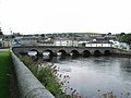 Stone Bridge over the River Vartry
 Golf course in Wicklow


See also
- List of towns and villages in Ireland
References
- "Historical Data - Ashford (Glanmore Gardens)".
- "Wicklow Weather". Ashford Weather Station.
- Liam Price, The Place-Names of the Barony of Newcastle, p. 171.
- Donall Mac Giolla Easpaig, L'influence scandinave sur la toponymie irlandaise in L'héritage maritime des Vikings en Europe en l'ouest, Colloque international de la Hague, Presses universitaire de Caen 2002. p. 467 et 468. Translation Jacques Tranier.
- Scandinavian Place-Names in Ireland in Proceedings of the Seventh Viking Congress (Dublin 1973), B. Alquist and D. Greene Editions, Dublin, Royal Irish Academy 1976. p. 130.
- Price p. 172.
- The English forms of the Names of the Main Provinces of Ireland, in Lochlann. A Review of Celtic Studies. IA. Sommerfelt Editions, Trad. ang. of Oslo University Press 1958. p. 224.
- Mac Giolla Easpaig p. 468
- The Annals of Clonmacnoise, being annals of Ireland from the earliest period to A.D. 1408. Mageoghagan, Conell & Murphy, Dennis, 1896, p. 66.
- DeAngelis, Camille (2007). Moon Handbooks: Ireland. Avalon Travel Publishing. p. 111. ISBN 978-1-59880-048-7. Retrieved 15 April 2013.
- Seán Connors. Mapping Ireland: from kingdoms to counties, Mercier Press, 2001, ISBN 1-85635-355-9, p45
- "Wicklow: Archival records". Placenames Database of Ireland Logainm.ie. Retrieved 15 April 2013.
- John Finlay (2013). Footsteps Through Wicklow's Past.
- Cunliffe, Barry, Koch, John T. (eds.), Celtic from the West, David Brown Co., 2012
- Cunliffe, Barry, Facing the Ocean, Oxford University Press, 2004
- Wills, James Lives of illustrious and distinguished Irishmen. MacGregor, Polson, 1840, p. 449.
- Wills, James Lives of illustrious and distinguished Irishmen. MacGregor, Polson, 1840, p. 448.
- S Shepherd; et al. (1992). Illustrated guide to Ireland. Reader's Digest.
- The illustrated road book of Ireland. Automobile Association. 1970.
- "Wicklow Legal Town Results". Central Statistics Office. 2011. Retrieved 5 August 2012.
- "Archived copy" (PDF). Archived from the original (PDF) on 3 April 2014. Retrieved 21 February 2014.
{{cite web}}: CS1 maint: archived copy as title (link) - "Wexford Bus timetable".
- "Irish Rail" (PDF).
- "Millionaire's dream brings top-class cricket to Wicklow". Irish Independent. Dublin. 26 June 2008. Retrieved 15 July 2018.
- WicklowNews – Wicklow’s No. 1 News Source
- Wicklow News Online Ltd - Irish Company Info - SoloCheck
- "Town Twinning". Living in Wicklow. Retrieved 9 January 2020.
Bibliography
- Cleary, J and O'Brien, A (2001) Wicklow Harbour: A History, Wicklow Harbour Commissioners
External links
- Wicklow Tourism page on Wicklow Town
- Wicklow Chamber of Commerce
- History of Wicklow Town in MP3 format
- Wicklow Mountains National Park
- Dublin & Wicklow Walks
Places in County Wicklow | ||
|---|---|---|
County town: Wicklow | ||
| Towns |  | |
| Villages |
| |
| ||
Authority control | |
|---|---|
| General | |
| National libraries | |
| Other |
|
На других языках
[de] Wicklow
Wicklow (irisch: Cill Mhantáin) ist eine Stadt in der Grafschaft Wicklow in der Republik Irland und der Verwaltungssitz des gleichnamigen Countys. Die Stadt liegt südlich der irischen Hauptstadt Dublin an der Ostküste von Irland. Laut der Volkszählung von 2016 leben 10584 Personen dort.[1]- [en] Wicklow
[ru] Уиклоу (город)
Уиклоу[2] (англ. Wicklow; ирл. Cill Mhantáin (Киль-Вантань), «церковь безоднозубого»[3][4]) — (малый) город в Ирландии, административный центр графства Уиклоу (провинция Ленстер), а также его крупнейший город.Другой контент может иметь иную лицензию. Перед использованием материалов сайта WikiSort.org внимательно изучите правила лицензирования конкретных элементов наполнения сайта.
WikiSort.org - проект по пересортировке и дополнению контента Википедии