world.wikisort.org - Ireland
Tallow (/ˈtæl.oʊ/; Irish: Tulach an Iarainn, meaning 'hillock of the iron'[2]) is a town, civil parish and townland in County Waterford, Ireland. Tallow is in the province of Munster near the border between County Cork and County Waterford and situated on a small hill just south of the River Bride.
| Year | Pop. | ±% |
|---|---|---|
| 1813 | 2,258 | — |
| 1821 | 2,329 | +3.1% |
| 1831 | 2,998 | +28.7% |
| 1841 | 2,969 | −1.0% |
| 1851 | 1,986 | −33.1% |
| 1861 | 1,619 | −18.5% |
| 1871 | 1,332 | −17.7% |
| 1881 | 1,232 | −7.5% |
| 1891 | 1,088 | −11.7% |
| 1901 | 964 | −11.4% |
| 1911 | 849 | −11.9% |
| 1926 | 782 | −7.9% |
| 1936 | 779 | −0.4% |
| 1946 | 722 | −7.3% |
| 1951 | 716 | −0.8% |
| 1956 | 842 | +17.6% |
| 1961 | 819 | −2.7% |
| 1966 | 813 | −0.7% |
| 1971 | 883 | +8.6% |
| 1981 | 937 | +6.1% |
| 1986 | 867 | −7.5% |
| 1991 | 858 | −1.0% |
| 1996 | 802 | −6.5% |
| 2002 | 845 | +5.4% |
| 2006 | 911 | +7.8% |
| 2011 | 962 | +5.6% |
| 2016 | 946 | −1.7% |
| [3][4][5][6][7] | ||
Tallow
Tulach an Iarainn | |
|---|---|
Town | |
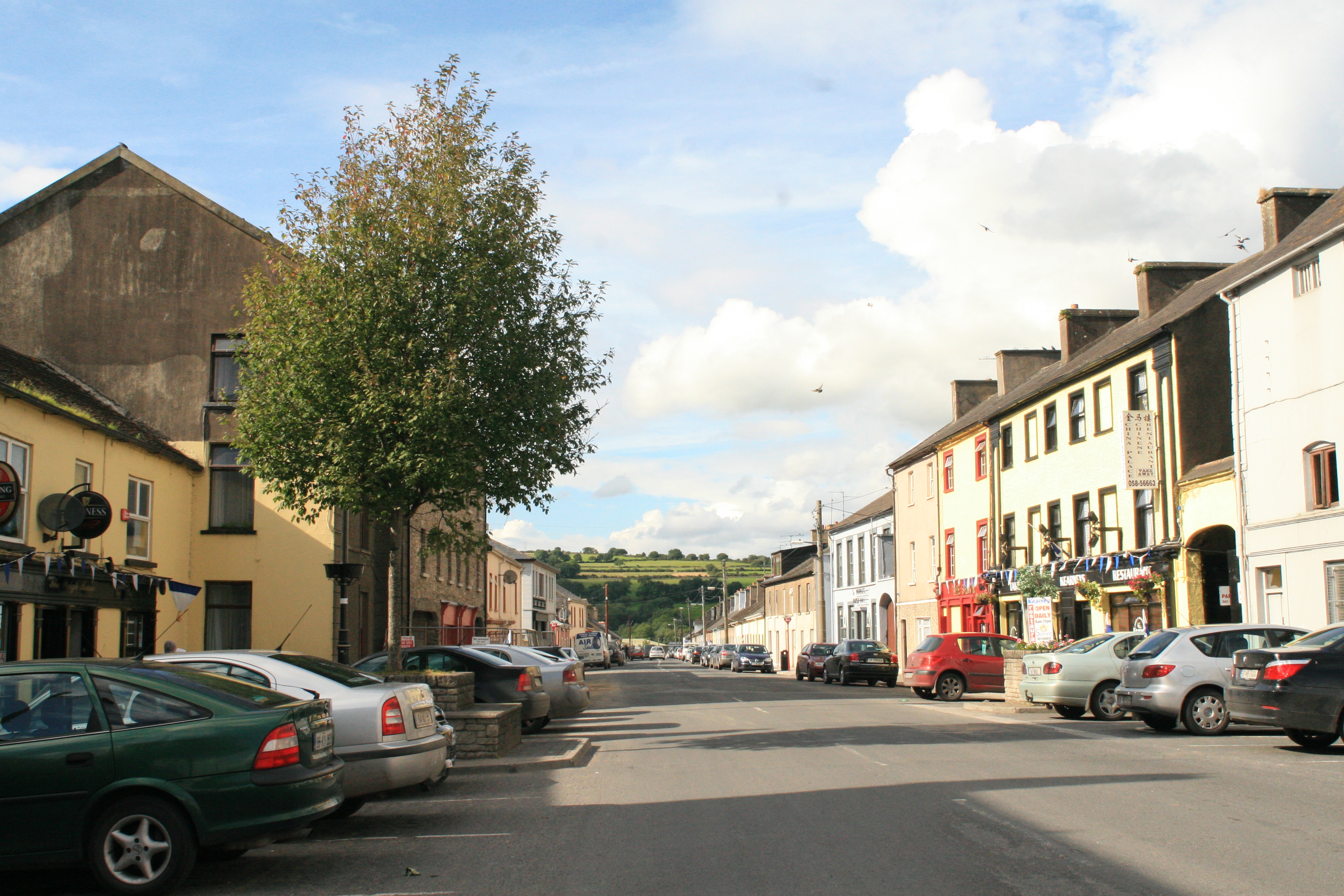
 Main Street in Tallow. | |
 Tallow Location in Ireland | |
| Coordinates: 52°5′37″N 8°0′24″W | |
| Country | Ireland |
| Province | Munster |
| County | Waterford |
| Population (2016)[1] | |
| • Total | 946 |
| Time zone | UTC+0 (WET) |
| • Summer (DST) | UTC-1 (IST (WEST)) |
| Irish Grid Reference | W995934 |
| Website | tallowwaterford |
History

Early records show a Tallow as being an important centre for iron smelting.[citation needed] Indeed, the town name Tulach an Iarainn translates as "The Hill of the Iron" in English. Tallow became a centre for grain export down the river to Youghal and wool combing in the 18th century. The famine also hit the town and surrounding area hard, leading to a decline in population.
Before the Act of Union (Ireland) 1800, Tallow was the centre of a constituency of the same name in the Irish House of Commons from 1613 until the dissolution of the Kingdom of Ireland in 1800.[8]
Government
Tallow is located in the Lismore Electoral Area of Waterford City and County Council. Following the 2019 local elections, two county councillors from Tallow were elected; John Pratt (Labour) and James Tobin (Fianna Fáil).[9]
Amenities
Tallow has a number of public houses and restaurants, clustered on the Main Street. There are also a number of convenience stores including Centra, Spar and Daybreak. The town also has a library,[10] barbers, pharmacy, veterinarian, co-op store and antiques shop.
Religion
The Roman Catholic Parish of Tallow centres on the Church of the Immaculate Conception on Chapel Street, built in 1826. It is the tallest building in the town.
St Catherine's Church of Ireland on Mill Road, was built in 1775 but closed in the 1960s due to falling numbers of parishioners. The nearest Anglican church is St Mary's, Fountains, 7 km east in the townland of Kilanthony.
Sports
Tallow GAA play at Pairc Eamonn De Paor on the outskirts of the town and field Hurling teams in County and Provincial competitions. The town also has a soccer club, Brideview United AFC, who compete in the West Waterford East Cork League.
Fishing and horse racing are also local sports, and the Tallow Horse Fair is held annually at the beginning of September.[11]
Transport
Road
The town lies at the junction of the R627, R628 and R634 regional roads.
Rail
Tallow Road railway station opened on 27 September 1872 and finally closed on 27 March 1967. It was served by the Cork to Rosslare boat train.[12][13]
Bus
Since December 2015 improvements to the frequency of the Local Link (formerly known as Déise Link) bus service are in effect.[citation needed] There are now[when?] four services a day each way Mondays to Saturdays inclusive to Dungarvan via Lismore and Cappoquin including a commuter service. Connections to Waterford and Rosslare Europort are made at Dungarvan. In the other direction there are two services a day to and from Fermoy where connections can be made for Cork and Dublin.[14] On Saturdays a local bus company operate a service to Cork.
Education
Tallow has a national school called Scoil Mhuire which is used by around 140 children.[citation needed] The town also has an enterprise centre used by several local organisations including the Senior Citizens' Group. The nearest secondary school is Blackwater Community College in nearby Lismore, County Waterford
People

At the St Patrick's Parish Hall a number of people from Tallow are commemorated:
- John Hogan (1800–1858), a sculptor who was responsible for "much of the most significant religious sculpture in Ireland" during the 19th century, was born in Tallow[15]
- Tobias Kirby (1804–1895), rector of the Irish College Rome (1850-1891) and archbishop of Ephesus (1885), was also born in Tallow.[16]
- Frank Ryan (1900–1965), tenor, grew up in Tallow.[16]
See also
- List of towns and villages in Ireland
References
- "Sapmap Area: Settlements Tallow". Census 2016. Central Statistics Office. 2016. Archived from the original on 14 February 2018. Retrieved 13 February 2018.
- "Tulach an Iarainn/Tallow". Placenames Database of Ireland (logainm.ie). Retrieved 7 January 2022.
- "Census for post 1821 figures". Archived from the original on 20 September 2010. Retrieved 1 August 2009.
- "Histpop - The Online Historical Population Reports Website". www.histpop.org. Archived from the original on 7 May 2016.
- "NISRA - Northern Ireland Statistics and Research Agency". Nisranew.nisra.gov.uk. Archived from the original on 17 February 2012. Retrieved 31 August 2012.
- Lee, JJ (1981). "On the accuracy of the Pre-famine Irish censuses". In Goldstrom, J. M.; Clarkson, L. A. (eds.). Irish Population, Economy, and Society: Essays in Honor of the Late K. H. Connell. Oxford, England: Clarendon Press.
- Mokyr, Joel; O Grada, Cormac (November 1984). "New Developments in Irish Population History, 1700-1850". The Economic History Review. 37 (4): 473–488. doi:10.1111/j.1468-0289.1984.tb00344.x. hdl:10197/1406. Archived from the original on 4 December 2012.
- "Talloq - Ulster Historical Foundation". Ancestry Ireland. Archived from the original on 7 April 2019. Retrieved 7 April 2019.
- "2014 Local elections: Waterford City and County Council". RTÉ News. Archived from the original on 9 June 2019. Retrieved 3 June 2019.
- "Tallow library". Archived from the original on 21 October 2019. Retrieved 26 October 2019.
- "Tourist Information - Tallow, Co. Waterford, Ireland". Archived from the original on 19 April 2017. Retrieved 21 April 2017.
- "Tallow Road station" (PDF). Railscot - Irish Railways. Archived (PDF) from the original on 2 March 2011. Retrieved 24 November 2007.
- "Tallow Road". Archived from the original on 6 October 2016. Retrieved 30 January 2016.
- "Who Can Use the Deise Link Bus Service Waterford". Archived from the original on 26 January 2016. Retrieved 30 January 2016.
- Minch, Rebecca (October 2009). "Hogan, John". Dictionary of Irish Biography. doi:10.3318/dib.004051.v1.
- Beecher Cantillon, E.M.P. "9. Famous Sons Of Tallow". Tallow : An Outline History. Waterford County Museum. Retrieved 30 September 2022.
External links
Places in County Waterford | ||
|---|---|---|
County town: Waterford | ||
| Towns |  | |
| Villages and Townlands |
| |
| ||
На других языках
[de] Tallow
Tallow (irisch Tulach an Iarainn, deutsch „Kleiner Hügel des Eisens“)[1] ist eine Gemeinde im County Waterford, Irland mit insgesamt 946 Einwohnern (Stand 2016).[2]- [en] Tallow, County Waterford
[ru] Таллоу (Уотерфорд)
Таллоу[2] (англ. Tallow; ирл. Tulach an Iarainn) — деревня в Ирландии, находится в графстве Уотерфорд (провинция Манстер) у пересечения трасс R268, R627 и R634.Другой контент может иметь иную лицензию. Перед использованием материалов сайта WikiSort.org внимательно изучите правила лицензирования конкретных элементов наполнения сайта.
WikiSort.org - проект по пересортировке и дополнению контента Википедии