world.wikisort.org - Ireland
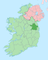
Knightsbrook is a village and townland in County Meath, Ireland. It is located on the R158 road, close to the junction with the R159. to the south of Trim.[1][2]
Knightsbrook | |
|---|---|
Village | |
 Knightsbrook Location in Ireland | |
| Coordinates: 53°31′55″N 6°47′13″W | |
| Country | Ireland |
| Province | Leinster |
| County | County Meath |
| Time zone | UTC+0 (WET) |
| • Summer (DST) | UTC-1 (IST (WEST)) |
The town is located in the civil parish of Laracor. Knightsbrook Hotel and Golf Club stands to the north, and the Knightsbrook River flows through the south of the townland.[3]
See also
- List of towns and villages in Ireland
References
- "Knightsbrook Townland, Co. Meath". www.townlands.ie. Retrieved 8 July 2020.
- "Knightsbrook". Logainm.ie. Retrieved 8 July 2020.
- "Relation: Knightsbrook (4551683)". OpenStreetMap. Retrieved 8 July 2020.
Текст в блоке "Читать" взят с сайта "Википедия" и доступен по лицензии Creative Commons Attribution-ShareAlike; в отдельных случаях могут действовать дополнительные условия.
Другой контент может иметь иную лицензию. Перед использованием материалов сайта WikiSort.org внимательно изучите правила лицензирования конкретных элементов наполнения сайта.
Другой контент может иметь иную лицензию. Перед использованием материалов сайта WikiSort.org внимательно изучите правила лицензирования конкретных элементов наполнения сайта.
2019-2025
WikiSort.org - проект по пересортировке и дополнению контента Википедии
WikiSort.org - проект по пересортировке и дополнению контента Википедии
