world.wikisort.org - Ireland
Cloondara (Irish: Cluain Dá Ráth, meaning 'pasture of two ringforts')[1][2] is a small village in County Longford, Ireland. It is situated just off the N5 road near Termonbarry, where the Royal Canal terminates at the River Shannon. It lies 7 km (4.3 mi) west of Longford Town. The Royal Canal is being upgraded so that canal boats can once again travel along it. The village of Termonbarry lies to the west of the village, on the opposite bank of the River Shannon. Many residential properties are being built, due to the tax incentives available in the area.[citation needed]
Cloondara
Cluain Dá Ráth | |
|---|---|
Village | |
 Cloondara Harbour on the Royal Canal | |
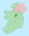
 Cloondara Location in Ireland | |
| Coordinates: 53°44′00″N 7°54′30″W | |
| Country | Ireland |
| Province | Leinster |
| County | County Longford |
| Time zone | UTC+0 (WET) |
| • Summer (DST) | UTC-1 (IST (WEST)) |
| Irish Grid Reference | N 061 760 |
See also
- List of towns and villages in Ireland
References
- A. D. Mills (2003). A Dictionary of British Place-Names. Oxford University Press.
- "Cluain Dá Ráth / Cloondara". logainm.ie. Placenames Database of Ireland. Retrieved 1 February 2020.
Places in County Longford | ||
|---|---|---|
County town: Longford | ||
| Towns |
|  |
| Villages and Townlands |
| |
| ||
На других языках
- [en] Cloondara
[ru] Клундара
Клундара[1] (англ. Cloondara; ирл. Cluain Da Rath, «выпас у двух фортов»[2])[3] — деревня в Ирландии, находится в графстве Лонгфорд (провинция Ленстер).Текст в блоке "Читать" взят с сайта "Википедия" и доступен по лицензии Creative Commons Attribution-ShareAlike; в отдельных случаях могут действовать дополнительные условия.
Другой контент может иметь иную лицензию. Перед использованием материалов сайта WikiSort.org внимательно изучите правила лицензирования конкретных элементов наполнения сайта.
Другой контент может иметь иную лицензию. Перед использованием материалов сайта WikiSort.org внимательно изучите правила лицензирования конкретных элементов наполнения сайта.
2019-2026
WikiSort.org - проект по пересортировке и дополнению контента Википедии
WikiSort.org - проект по пересортировке и дополнению контента Википедии