world.wikisort.org - Ireland
Ballyda (Irish: Baile Dháith)[1] is a small townland in the civil parish of Danesfort in County Kilkenny, Ireland. The townland has an area of approximately 0.5 square miles (1.3 km2),[2] and had a population of 70 people as of the 2011 census.[3]
Ballyda
Baile Dháith | |
|---|---|
Townland | |
 Tilled field in Ballyda townland | |
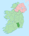
 Ballyda Location in Ireland | |
| Coordinates: 52°34′40″N 7°15′34″W | |
| Country | Ireland |
| Province | Leinster |
| County | County Kilkenny |
| Time zone | UTC+0 (WET) |
| • Summer (DST) | UTC-1 (IST (WEST)) |
See also
- List of townlands in County Kilkenny
References
- "Baile Dháith / Ballyda". logainm.ie. Irish Placenames Database. Retrieved 1 November 2020.
- "Ballyda Townland, Co. Kilkenny". townlands.ie. Retrieved 1 November 2020.
- "CD158 - Kilkenny Population by Private Households, Occupied and Vacancy Rate by Townlands, CensusYear and Statistic". Census 2011. Central Statistics Office. April 2011. Retrieved 1 November 2020 – via data.gov.ie.
Ballyda, Danesfort, Co. Kilkenny [..] 70
Places in County Kilkenny | ||
|---|---|---|
County town: Kilkenny | ||
| Towns |
|  |
| Villages |
| |
| Townlands |
| |
| ||
This article related to the geography of County Kilkenny, Ireland is a stub. You can help Wikipedia by expanding it. |
Текст в блоке "Читать" взят с сайта "Википедия" и доступен по лицензии Creative Commons Attribution-ShareAlike; в отдельных случаях могут действовать дополнительные условия.
Другой контент может иметь иную лицензию. Перед использованием материалов сайта WikiSort.org внимательно изучите правила лицензирования конкретных элементов наполнения сайта.
Другой контент может иметь иную лицензию. Перед использованием материалов сайта WikiSort.org внимательно изучите правила лицензирования конкретных элементов наполнения сайта.
2019-2026
WikiSort.org - проект по пересортировке и дополнению контента Википедии
WikiSort.org - проект по пересортировке и дополнению контента Википедии