world.wikisort.org - Ireland
Clerihan or Ballyclerahan (Irish: Baile Uí Chléireacháin, meaning 'the town of Ó Cléireacháin')[2] is a village in County Tipperary, Ireland. It is also a civil parish in the barony of Iffa and Offa East. It is approximately 8.5 kilometres north of Clonmel. Its name comes from the Irish meaning O'Clerahan's town. Locally, the "Bally" prefix is usually dropped and the village is almost always referred to simply as "Clerahan" which is most often spelled "Clerihan".[3][4][5]
Clerihan
Baile Uí Chléireacháin Ballyclerahan | |
|---|---|
Village | |
 Ryans of Clerihan public house | |
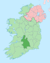
 Clerihan Location in Ireland | |
| Coordinates: 52°24′43″N 7°47′24″W | |
| Country | Ireland |
| Province | Munster |
| County | Tipperary |
| Elevation | 100 m (300 ft) |
| Population (2016)[1] | 862 |
| Time zone | UTC+0 (WET) |
| • Summer (DST) | UTC-1 (IST (WEST)) |
| Irish grid reference | S142290 |
Location and transport
The village is situated along the R688 regional road from Cashel to Clonmel. Clerihan is 8 kilometres north of the N24 road which leads to Waterford the closest city to Clerihan which is approximately 56 kilometres from the village. The closest airport to Clerihan is Waterford Airport located 65 kilometres south of the village, and the Port of Waterford is the closest port.
See also
- List of civil parishes of County Tipperary
- List of towns and villages in Ireland
References
- "Sapmap Area - Settlements - Ballyclerahan". Census 2016. CSO. April 2016. Retrieved 20 October 2019.
- "Baile Uí Chléireacháin / Ballyclerahan (Clerihan)". logainm.ie. Irish Placenames Commission. Retrieved 20 October 2019.
- "Clerihan.ie - Community website for Clerihan". clerihan.ie. Retrieved 20 October 2019.
- "Shock at sad death of Clerihan school principal - Tipperary Live". nationalist.ie. Retrieved 20 October 2019.
- "St. Michael's N.S." Archived from the original on 29 November 2014. Retrieved 20 November 2014.
Places in County Tipperary | ||
|---|---|---|
County town: Nenagh | ||
| Towns |
|  |
| Villages |
| |
| Baronies |
| |
| ||
Authority control | |
|---|---|
| General |
|
| National libraries | |
This article related to the geography of County Tipperary, Ireland is a stub. You can help Wikipedia by expanding it. |
Другой контент может иметь иную лицензию. Перед использованием материалов сайта WikiSort.org внимательно изучите правила лицензирования конкретных элементов наполнения сайта.
WikiSort.org - проект по пересортировке и дополнению контента Википедии