world.wikisort.org - Ireland
Ballintubber, officially Ballintober (Irish: Baile an Tobair, meaning 'settlement of the well'),[1] is a village in County Mayo, Ireland, known for Ballintubber Abbey which was founded in 1216. The countryside of Ballintubber is set against the against the backdrop of the Partry Mountains.
This article needs additional citations for verification. (November 2007) |
Ballintober
Baile an Tobair | |
|---|---|
Village | |
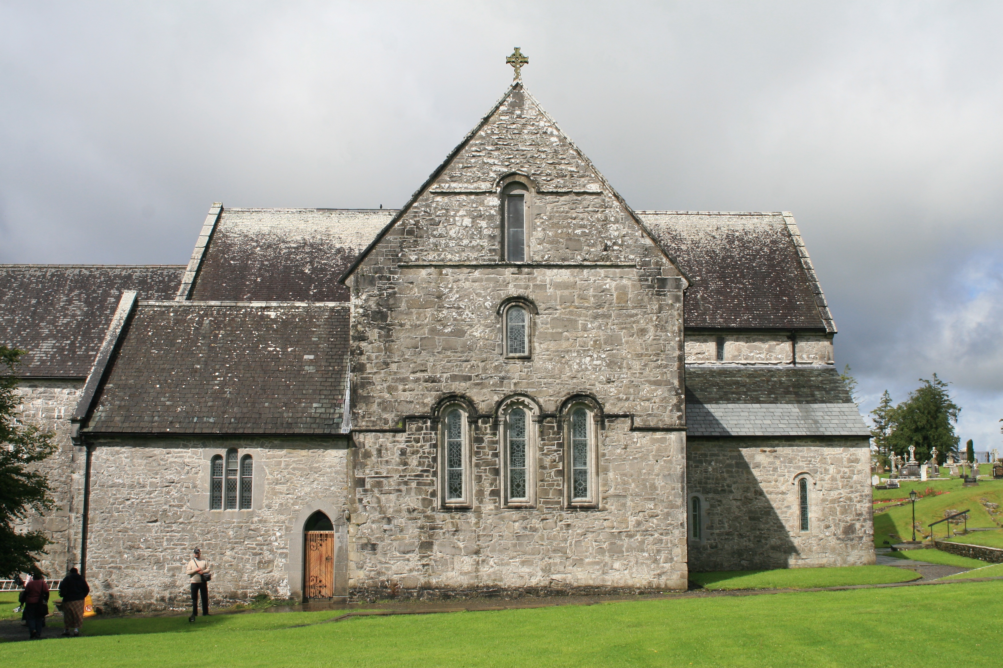 Ballintober Abbey | |
 Ballintober Location in Ireland | |
| Coordinates: 53°44′42″N 9°17′54″W | |
| Country | Ireland |
| Province | Connacht |
| County | County Mayo |
| Elevation | 64 m (210 ft) |
| Time zone | UTC+0 (WET) |
| • Summer (DST) | UTC-1 (IST (WEST)) |
| Irish Grid Reference | M142767 |
History
The long history of Ballintubber dates back to pre-Christian times, when people came from the east, through Ballintubber, on the way to a druidic site now called Croagh Patrick. When Saint Patrick brought Christianity to the west of Ireland after 461 A.D., he founded a church at Ballintubber.[citation needed] The present Ballintubber Abbey was founded in 1216 by Cathal Crobhdearg, Chief of the Name of Clan O'Conor and King of Connacht.[citation needed] Church records for Ballintubber and Burriscarra parish commenced in 1839 and are held at the South Mayo Family Research Centre in Ballinrobe.[citation needed]
People
- Alan Dillon
- Cillian O'Connor
- Diarmuid O'Connor
- Sean na Sagart
See also
- List of towns and villages in Ireland
References
External links
Places in County Mayo | ||
|---|---|---|
County town: Castlebar | ||
| Towns |
|  |
| Villages and townlands |
| |
| Baronies | ||
| Landforms | ||
| ||
This article related to the geography of County Mayo, Ireland is a stub. You can help Wikipedia by expanding it. |
На других языках
- [en] Ballintubber
[ru] Баллинтобер
Баллинтобер[1] (англ. Ballintubber; ирл. Baile an Tobair, «город колодца») — деревня в Ирландии, находится в графстве Мейо (провинция Коннахт). Население — 345 человек (по переписи 2002 года).Другой контент может иметь иную лицензию. Перед использованием материалов сайта WikiSort.org внимательно изучите правила лицензирования конкретных элементов наполнения сайта.
WikiSort.org - проект по пересортировке и дополнению контента Википедии