world.wikisort.org - Iran
Mehran (Persian: مهران, also Romanized as Mehrān; formerly, Mansurabad (Persian: منصورآباد), also Romanized as Mansūrābād)[2] is a city in and the capital of Mehran County, Ilam Province, Iran. At the 2006 census, its population was 13,118, in 2,958 families.[3]
Mehran
مهران | |
|---|---|
City | |
 Mehran | |
| Coordinates: 33°07′20″N 46°09′53″E | |
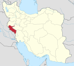
| Country | Iran |
| Province | Ilam |
| County | Mehran |
| Bakhsh | Central |
| Population (2016 Census) | |
| • Total | 17,435 [1] |
| Time zone | UTC+3:30 (IRST) |
| • Summer (DST) | UTC+4:30 (IRDT) |
Mehran is located near Iran's western border with Iraq. Because of its strategic proximity - only two hours' drive from Baghdad - the city has played a continuing role in dealings between Iran and Iraq.
In May 1986, during the Iran–Iraq War, Iraqi forces captured Mehran, on the western plain of the Zagros Mountains in Ilam Province, and pushed eastward to the mountain base.[4]
Demographics
The city is mostly populated by Kurds with a small Luri minority.[5]
Climate
Mehran has a hot semi-arid climate (Köppen BSh).
| Climate data for Mehran | |||||||||||||
|---|---|---|---|---|---|---|---|---|---|---|---|---|---|
| Month | Jan | Feb | Mar | Apr | May | Jun | Jul | Aug | Sep | Oct | Nov | Dec | Year |
| Average high °C (°F) | 15.1 (59.2) |
17.5 (63.5) |
23.5 (74.3) |
29.4 (84.9) |
36.5 (97.7) |
41.8 (107.2) |
44.1 (111.4) |
44.3 (111.7) |
40.0 (104.0) |
33.3 (91.9) |
22.6 (72.7) |
17.0 (62.6) |
30.4 (86.8) |
| Daily mean °C (°F) | 10.2 (50.4) |
12.2 (54.0) |
17.6 (63.7) |
23.4 (74.1) |
30.2 (86.4) |
35.4 (95.7) |
37.8 (100.0) |
37.8 (100.0) |
33.2 (91.8) |
27.0 (80.6) |
17.1 (62.8) |
12.0 (53.6) |
24.5 (76.1) |
| Average low °C (°F) | 5.3 (41.5) |
6.6 (43.9) |
10.8 (51.4) |
16.0 (60.8) |
22.0 (71.6) |
27.3 (81.1) |
30.0 (86.0) |
29.7 (85.5) |
25.3 (77.5) |
20.1 (68.2) |
11.7 (53.1) |
7.2 (45.0) |
17.7 (63.8) |
| Average precipitation mm (inches) | 52 (2.0) |
39 (1.5) |
38 (1.5) |
24 (0.9) |
6 (0.2) |
0 (0) |
0 (0) |
0 (0) |
0 (0) |
9 (0.4) |
42 (1.7) |
46 (1.8) |
256 (10) |
| Average precipitation days (≥ 1.0 mm) | 5 | 4 | 4 | 3 | 1 | 0 | 0 | 0 | 0 | 1 | 3 | 4 | 25 |
| Average relative humidity (%) | 64 | 58 | 37 | 29 | 17 | 12 | 12 | 12 | 15 | 22 | 46 | 60 | 32 |
| Source: https://en.climate-data.org/asia/iran/ilam/mehran-50574/ | |||||||||||||
References
- "Statistical Center of Iran > Home".
- Mehran, Ilam can be found at GEOnet Names Server, at this link, by opening the Advanced Search box, entering "-3074669" in the "Unique Feature Id" form, and clicking on "Search Database".
- "Census of the Islamic Republic of Iran, 1385 (2006)" (Excel). Statistical Center of Iran. Archived from the original on 2011-11-11.
- Iran–Iraq War history.
- "Language distribution: Ilam Province - Mērān". Iran Atlas. Retrieved 27 December 2020.
{{cite web}}: CS1 maint: url-status (link)
External links
- Iran–Iraq War
- People's militia
- News site
- Investigations about population movements
- News about immigration
- News site
Capital: Ilam | ||||||||||||||||||||||||
| Counties and cities |
|  | ||||||||||||||||||||||
| Sights |
| |||||||||||||||||||||||
| Populated places |
| |||||||||||||||||||||||
| Capital | |||||||||||||||||
|---|---|---|---|---|---|---|---|---|---|---|---|---|---|---|---|---|---|
| Districts |
| ||||||||||||||||
На других языках
[de] Mehrān
Mehrān (persisch مهران) ist eine kleine Grenzstadt im Westen Irans gegenüber der irakischen Grenzstadt Zurbatiyah (bei Badrah). Mehran gehört zur iranischen Provinz Ilam und ist der Hauptort des Bezirks (Schahrestan) Mehran, zu welchem auch Salehabad gehört.- [en] Mehran, Ilam
[ru] Мехран (город)
Мехра́н (перс. مهران) — приграничный город на западе Ирана, в провинции Илам. Административный центр шахрестана Мехран. На 2006 год население составляло 13 118 человек[1]; в национальном составе преобладают курды.Другой контент может иметь иную лицензию. Перед использованием материалов сайта WikiSort.org внимательно изучите правила лицензирования конкретных элементов наполнения сайта.
WikiSort.org - проект по пересортировке и дополнению контента Википедии