world.wikisort.org - Indonesia
Tolitoli Regency is a regency of Central Sulawesi Province of Indonesia. It covers an area of 4,079.77 km2 and had a population of 211,296 at the 2010 Census[2] and 225,154 at the 2020 Census;[3] the official estimate as at mid 2021 was 226,796, comprising 115,735 male and 111,061 female inhabitants.[4] It was previously part of another regency together with the current Buol Regency, named Buol Tolitoli Regency, but this was split in early 2000 after rapid decentralization of the Indonesian government. Its regency seat is located at Tolitoli (in Baolan District), which is a port town and where its population is concentrated.
Tolitoli Regency
Kabupaten Tolitoli | |
|---|---|
Regency | |
 Coat of arms | |
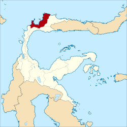 Location within Central Sulawesi | |
 Tolitoli Regency Location in Sulawesi and Indonesia  Tolitoli Regency Tolitoli Regency (Indonesia) | |
| Coordinates: 1°02′19″N 120°49′04″E | |
| Country | Indonesia |
| Province | Central Sulawesi |
| Capital | Tolitoli |
| Government | |
| • Regent | Mohammad Saleh Bantilan |
| • Vice Regent | Abdul Rahman |
| Area | |
| • Total | 4,079.77 km2 (1,575.21 sq mi) |
| Population (mid 2021 estimate)[1] | |
| • Total | 226,796 |
| • Density | 56/km2 (140/sq mi) |
| Time zone | UTC+8 (ICST) |
| Area code | (+62) 453 |
| Website | tolitolikab |
Administrative districts
The Tolitoli Regency was divided in 2020 into ten districts (kecamatan), which are tabulated below with their areas and their populations at the 2010 Census[5] and the 2020 Census,[6] together with the official estimates as at mid 2021.[7] The table also includes the location of the district administrative centres, the number of administrative villages in each district (103 rural desa and 6 urban kelurahan in total), and its post code.
| Name | Area in km2 | Pop'n Census 2010 | Pop'n Census 2020 | Pop'n Estimate mid 2021 | Administrative centre | No. of villages | Post code |
|---|---|---|---|---|---|---|---|
| Dampal Selatan (South Dampal) | 392.67 | 21,394 | 21,620 | 21,657 | Bangkir | 13 | 94554 |
| Dampal Utara (a) (North Dampal) | 182.88 | 14,390 | 13,900 | 13,908 | Ogotua | 12 | 94553 |
| Dondo | 542.50 | 21,358 | 22,650 | 22,798 | Tinabogan | 16 | 94551 |
| Ogodeide (b) | 412.13 | 11,682 | 12,270 | 12,339 | Bib | 11 | 94516 |
| Basidondo | 441.30 | 10,458 | 10,750 | 10,785 | Kayulompa | 10 | 94552 |
| Baolan | 258.03 | 63,072 | 67,600 | 68,114 | Baru | (c) 10 | 94511 - 94517 |
| Lampasio | 626.00 | 11,875 | 12,850 | 12,956 | Sibea | 9 | 94517 & 94518 |
| Galang | 597.76 | 31,701 | 35,720 | 36,159 | Lalos | 14 | 94561 |
| Tolitoli Utara (North Toli-Toli) | 405.50 | 16,940 | 18,180 | 18,320 | Laulalang | 10 | 94560 |
| Dako Pamean | 221.00 | 8,426 | 9,630 | 9,760 | Galumpang | 4 | 94562 |
| Totals | 4,079.77 | 211,296 | 225,154 | 226,796 | Tolitoli | 109 |
Notes: (a) including 7 offshore islands, the largest being Pulau Simatang off the north coast of the district.
(b) including 29 offshore islands, the largest being Pulau Kabetan off the northwest coast of the district.
(c) including all six kelurahan (urban villages).
Climate
Tolitoli has a tropical rainforest climate (Af) with moderate rainfall in March and April and heavy rainfall in the remaining months.
| Climate data for Tolitoli | |||||||||||||
|---|---|---|---|---|---|---|---|---|---|---|---|---|---|
| Month | Jan | Feb | Mar | Apr | May | Jun | Jul | Aug | Sep | Oct | Nov | Dec | Year |
| Average high °C (°F) | 30.5 (86.9) |
30.6 (87.1) |
30.9 (87.6) |
31.2 (88.2) |
31.4 (88.5) |
30.8 (87.4) |
30.4 (86.7) |
31.3 (88.3) |
31.5 (88.7) |
32.2 (90.0) |
31.6 (88.9) |
31.1 (88.0) |
31.1 (88.0) |
| Daily mean °C (°F) | 26.6 (79.9) |
26.7 (80.1) |
26.9 (80.4) |
27.0 (80.6) |
27.4 (81.3) |
26.8 (80.2) |
26.4 (79.5) |
27.0 (80.6) |
26.9 (80.4) |
27.5 (81.5) |
27.2 (81.0) |
27.1 (80.8) |
27.0 (80.5) |
| Average low °C (°F) | 22.7 (72.9) |
22.8 (73.0) |
22.9 (73.2) |
22.9 (73.2) |
23.4 (74.1) |
22.9 (73.2) |
22.4 (72.3) |
22.7 (72.9) |
22.4 (72.3) |
22.8 (73.0) |
22.9 (73.2) |
23.1 (73.6) |
22.8 (73.1) |
| Average rainfall mm (inches) | 256 (10.1) |
169 (6.7) |
108 (4.3) |
117 (4.6) |
174 (6.9) |
194 (7.6) |
274 (10.8) |
166 (6.5) |
154 (6.1) |
164 (6.5) |
194 (7.6) |
177 (7.0) |
2,147 (84.7) |
| Source: Climate-Data.org[8] | |||||||||||||
References
- Badan Pusat Statistik, Jakarta, 2022.
- Biro Pusat Statistik, Jakarta, 2011.
- Badan Pusat Statistik, Jakarta, 2021.
- Badan Pusat Statistik, Jakarta, 2022.
- Biro Pusat Statistik, Jakarta, 2011.
- Badan Pusat Statistik, Jakarta, 2021.
- Badan Pusat Statistik, Jakarta, 2022.
- "Climate: Tolitoli". Climate-Data.org. Retrieved 21 November 2020.
External links
- (in Indonesian) Local Government of Tolitoli Regency
Regencies and cities of Central Sulawesi | ||
|---|---|---|
Capital: Palu | ||
| Regencies |
| |
| Cities | ||
Authority control | |
|---|---|
| General |
|
| National libraries | |
Другой контент может иметь иную лицензию. Перед использованием материалов сайта WikiSort.org внимательно изучите правила лицензирования конкретных элементов наполнения сайта.
WikiSort.org - проект по пересортировке и дополнению контента Википедии