world.wikisort.org - Indonesia
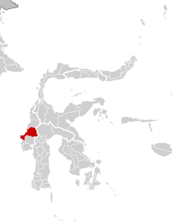
Mamuju Regency is a regency (Indonesian: kabupaten Mamuju) of West Sulawesi province, Indonesia. The regency capital is at Karema, while Mamuju town is the capital of West Sulawesi. The population of the regency was 336,879 at the 2010 Census, but it was substantially reduced by the creation of the new Central Mamuju Regency which was cut out of it in 2012. The reduced Mamuju Regency covers an area of 4,954.57 km2[2] and had a population of 278,764 at the 2020 Census.[3] The official estimate as at mid 2021 was 281,854.[4]
Mamuju Regency | |
|---|---|
Regency | |
 Coat of arms | |
 | |
| Country | Indonesia |
| Region | Sulawesi |
| Province | West Sulawesi |
| Regency | Mamuju |
| Government | |
| • Regent | Siti Sutina Suhardi |
| Area | |
| • Total | 1,912.97 sq mi (4,954.57 km2) |
| Population (mid 2021 estimate)[1] | |
| • Total | 281,854 |
| • Density | 150/sq mi (57/km2) |
| Time zone | UTC+8 (Indonesia Central Time) |
| Website | mamujukab |
Uranium sites
Mamuju Regency has high potential uranium sites with radioactivity of ~250 nsv per year as same as at Pocos de Caldas, Brazil. The highest potential uranium site at hill of Takandeang village about 40 kilometers from Mamuju City has radioactivity 2,000-3,000 nsw per hour.[5]
Administration
The regency is divided into eleven districts (kecamatan), tabulated below with their areas and their populations at the 2010 Census[6] and 2020 Census,[7] together with the official estimates for mid 2021.[8] The table also includes the locations of the district administrative centres, the number of administrative villages (rural desa and urban kelurahan) in each district, and its post code.
| Name | Area in km2 | Population Census 2010 | Population Census 2020 | Population Estimate mid 2021 | Administrative centre | No. of villages | Post code |
|---|---|---|---|---|---|---|---|
| Tapalang | 271.63 | 18,083 | 20,820 | 20,995 | Galung | 10 | 91551 |
| Tapalang Barat (West Tapalang) | 111.06 | 9,129 | 11,373 | 11,467 | Dungkait | 7 | 91552 |
| Mamuju (a) | 246.22 | 55,105 | 64,696 | 65,445 | Binanga | 8 | 91511 - 91515 |
| Simboro dan Kepulauan | 132.06 | 23,200 | 36,063 | 36,851 | Rangas | 8 | 91512 - 91513 |
| Kepulauan Balabalakang (b) (Balabalakang Islands) | 1.47 | 2,347 | 2,201 | 2,209 | Pulau Salissingan (Salissingan Island) | 2 | 91512 |
| Kulukku (c) | 452.65 | 49,250 | 59,108 | 59,763 | Kalukku | 14 | 91561 |
| Papalang | 200.89 | 21,395 | 23,942 | 24,107 | Topore | 9 | 91565 |
| Sampaga | 110.27 | 13,986 | 15,925 | 16,079 | Bunde | 7 | 91563 |
| Tommo | 765.75 | 19,407 | 23,381 | 23,582 | Campaloga | 14 | 91564 |
| Kalumpang | 1,792.55 | 10,800 | 11,763 | 11,814 | Kalumpang | 13 | 91560 |
| Bonehau | 870.02 | 8,622 | 9,492 | 9,542 | Bonehau | 9 | 91562 |
| Totals | 4,954.57 | (d) 231,324 | 278,764 | 281,854 | Karema | 101 |
Notes: (a) including offshore island of Pulau Karampuang to the north of the town. (b) the Balabalakang Islands are a small group lying between West Sulawesi and East Kalimantan, and closer to the latter.
(c) including 4 offshore islands. (d) excluding the 2010 population of those regencies split off in 2012 to form the new Central Mamuju Regency.
References

- Badan Pusat Statistik, Jakarta, 2022.
- This figure is the area published by BPS Mamuju Regency; the figure published by BP|S West Sulawesi Province is 4,999.69 km2.
- Badan Pusat Statistik, Jakarta, 2021.
- Badan Pusat Statistik, Jakarta, 2022.
- "Ada Uranium di Sulawesi Barat". March 17, 2012. Archived from the original on September 6, 2012. Retrieved March 17, 2012.
- Biro Pusat Statistik, Jakarta, 2011.
- Badan Pusat Statistik, Jakarta, 2021.
- Badan Pusat Statistik, Jakarta, 2022.
External links
- Official website (in Indonesian)
Regencies and cities of West Sulawesi | ||
|---|---|---|
Capital: Mamuju | ||
| Regencies |
| |
See also: List of regencies and cities of Indonesia | ||
This West Sulawesi location article is a stub. You can help Wikipedia by expanding it. |
На других языках
- [en] Mamuju Regency
[ru] Мамуджу (округ)
Мамуджу (индон. Mamuju) — округ в провинции Западный Сулавеси, Индонезия. Административный центр — город Мамуджу. Население — 349 571 чел. (2011)[2].Другой контент может иметь иную лицензию. Перед использованием материалов сайта WikiSort.org внимательно изучите правила лицензирования конкретных элементов наполнения сайта.
WikiSort.org - проект по пересортировке и дополнению контента Википедии