world.wikisort.org - Indonesia
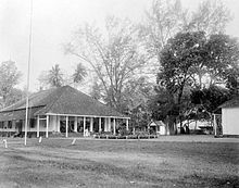
Benteng is an administrative district in the Selayar Islands Regency, South Sulawesi, Indonesia. It is the administrative capital of the Selayar Islands Regency and is located on the seafront where the means of transport from outside the closest is Benteng Pier. The nearest airport and is the only airport H. Aroeppala Airport located in Padang few miles south of Benteng Bontosunggu precisely in the village, Bontoharu District, Selayar Islands Regency. Capital city is the administrative district Benteng Citadel.
Benteng | |
|---|---|
Town | |
 Map of Benteng | |
 Benteng Location in Selayar Islands Regency, Sulawesi and Indonesia  Benteng Benteng (Sulawesi)  Benteng Benteng (Indonesia) | |
| Coordinates: 6°7′10.73″S 120°27′59.88″E | |
| Country | Indonesia |
| Province | South Sulawesi |
| Regency | Selayar Islands Regency |
| Area | |
| • Total | 7.12 km2 (2.75 sq mi) |
| Population (2010[1]) | |
| • Total | 21,344 |
| • Density | 3,000/km2 (7,800/sq mi) |
| Time zone | UTC+8 (ICST) |
| Postcode | 92812 |
| Area code | (+62) 414 |
| Vehicle registration | DD |
Demographics
| Population growth charts Benteng District |
|---|
 |


References
- Census of 2010 - Biro Pusat Statistik, Jakarta, 2011.
External links
- (in Indonesian) wikisource/Pariwisata selayar tahun 2010
- (in Indonesian) wikisource/Penduduk & ketenagakerjaan selayar tahun 2010
Текст в блоке "Читать" взят с сайта "Википедия" и доступен по лицензии Creative Commons Attribution-ShareAlike; в отдельных случаях могут действовать дополнительные условия.
Другой контент может иметь иную лицензию. Перед использованием материалов сайта WikiSort.org внимательно изучите правила лицензирования конкретных элементов наполнения сайта.
Другой контент может иметь иную лицензию. Перед использованием материалов сайта WikiSort.org внимательно изучите правила лицензирования конкретных элементов наполнения сайта.
2019-2025
WikiSort.org - проект по пересортировке и дополнению контента Википедии
WikiSort.org - проект по пересортировке и дополнению контента Википедии
